The history of Oklahoma didn’t begin with statehood in 1907 or even with the Land Run of 1889. Early inhabitants left plenty of archaeological evidence of their presence, but except for the well known Spiro Mounds Historic Site, you can’t get to those places and even if you could there might be nothing to see. But here are a few historical sites dating from the 1820s to the 1870s. They’re definitely off the beaten path but are otherwise accessible. Take a road trip and make some discoveries!
Doaksville
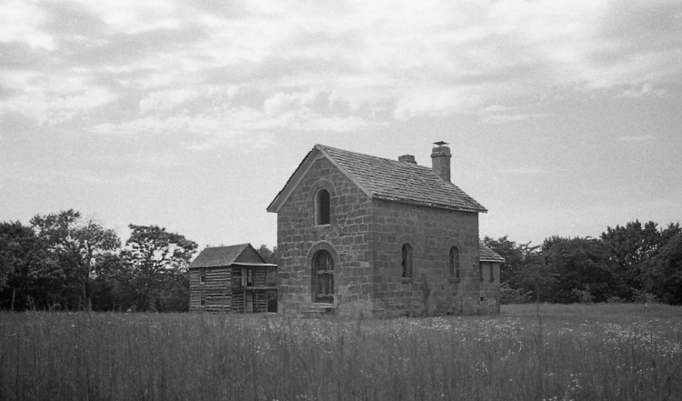
You’ll walk through an old cemetery and climb over a wall to reach this well-hidden spot, the remains of the once important and prosperous community of Doaksville. Archaeological investigations in the 1990s uncovered the limestone foundations of multiple structures at this townsite founded in the early 1820s with the establishment a trading post by Josiah Doak. By the 1850s it was the largest town in Indian Territory, with more than thirty buildings, including stores, a jail, school, hotel, and two newspapers.
Doaksville become the political center of the Choctaw Nation after 1850, but began to decline with the abandonment of nearby Fort Towson in 1854. The Civil War in Indian Territory devastated the region’s plantation-based economy. On June 23, 1865, the last Confederate general, Stand Watie, surrendered his Indian Brigade to Union forces near Doaksville. The final blow came in 1870 when the railroad was built one mile south. The town moved to the railroad and Fort Towson took the place of Doaksville.
The site is maintained by the Oklahoma Historical Society, with a walking trail around the ruins, and signage interpreting the history of Doaksville.
Location: Behind Fort Towson/Doaksville Cemetery, Fort Towson, OK
Sources and More Information:
http://www.okhistory.org/sites/ftdoaksville.php
http://www.ou.edu/cas/archsur/counties/choctaw.htm
While you’re in the area, visit the nearby Fort Towson Historical Site: http://www.okhistory.org/sites/forttowson
Edwards Store
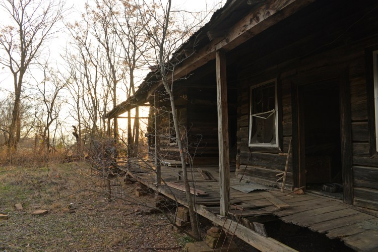
The Butterfield Overland Mail Co. operated from 1858 to 1861 under contract with the U.S. Postal Department, providing transportation of U.S. mail between St. Louis, Missouri, and San Francisco, California. Nearly 200 miles of the route cut a diagonal through what would become southeastern Oklahoma and along that route still stands Edwards Store, which served as an unofficial stop on the stagecoach route. The only such original structure in Oklahoma, Edwards Store is eight miles northeast of Red Oak in Latimer County. Built in 1858, the establishment served meals and offered a place to safely rest horses. Although in poor condition, the structure is easy to access off Norris Road. It was listed in the National Register of Historic Places in 1972.
More information: http://www.civilwaralbum.com/indian/butterfield1.htm
Bill and I have been retracing the Butterfield in Oklahoma. Here are a couple of posts on that subject:
https://susandragoo.com/2017/01/30/retracing-the-butterfield-overland-mail-route/
https://susandragoo.com/2017/02/02/more-from-the-butterfield/
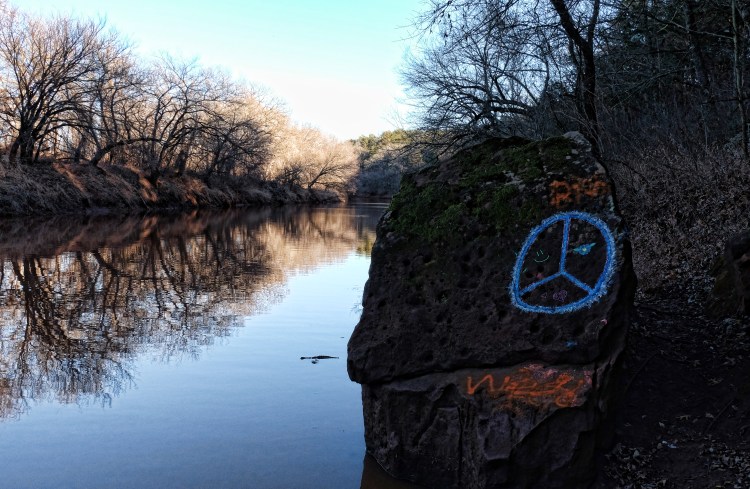
Wilson’s Rock
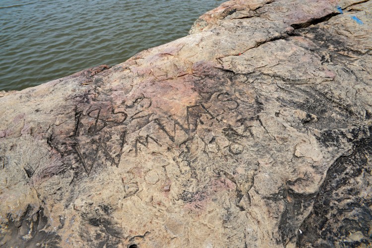
If you drive a few miles south out of Muldrow on Wilson Rock Road, you’ll end up on the banks of the Arkansas River, at a recreation area of sorts. On my last visit a few years ago this “park” was awfully dilapidated, but you can find a parking spot on the roadside, climb over a guard rail, and walk out onto a broad stone landing. Here in the mid 1800s, William Wilson operated a trading post and ferry and the site served as a steamboat landing. Go fishing, have a picnic, or just admire the view of the river, but don’t miss Wilson’s inscription in the rock, and the handprint beside it. Wilson’s grave is in the cemetery up the hill. Sam Houston’s Cherokee second wife, Tiana/Talahina Rogers, was also buried there before her remains were removed to Fort Gibson in 1904.
While you’re in the area, visit the Spiro Mounds Archeological Site, which is just on the other side of the Arkansas River. But there’s no longer a ferry, you’ll have to find a highway bridge.
More information on Spiro Mounds: http://www.okhistory.org/sites/spiromounds?full

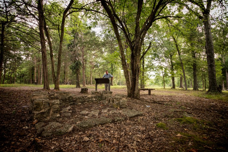
Sacred Heart Abbey
It’s pristine, easy to access, and historically important. It’s also remote and seems to be relatively unknown, and the fact that few people know about it is probably a good thing. The grounds of Sacred Heart Abbey, near Konawa, Oklahoma are a place of peace and calm and mystery. It’s a quiet place to walk, to explore, to meditate or pray, to ponder the work that went on here so many years ago, or to ponder nothing at all.
From the Encyclopedia of Oklahoma History and Culture:
A Roman Catholic institution founded May 13, 1877, by Father Isidore Robot, O.S.B., Sacred Heart Mission (later Sacred Heart Abbey) and its successor institution, St. Gregory’s Abbey and University, constitute Oklahoma’s oldest educational center in continuous operation. Robot, a Benedictine monk, had arrived in the Indian Territory in October 1875 with a lay brother companion. The two had left their home monastery in France when the Laic Laws threatened to close many Catholic institutions.
Other members of the French community soon joined Robot, and the Potawatomi Nation offered a section of land four miles north of the Canadian River in the southeast corner of what is now Pottawatomie County. By 1880 Robot had built a monastery, schools for Indian boys and girls, a technical institute, and a seminary. In 1892 he constructed a large church. Four years later Sacred Heart was raised to abbatial rank, and the monks elected their first abbot.
Fire destroyed the large complex of frame buildings during the night of January 14–15, 1901. The facilities were quickly rebuilt, but by that time the monks had realized that the nearest railroad would not be close enough to make a secondary school viable on the site. They therefore established St. Gregory’s College at Shawnee, thirty-five miles north. The new school opened in September 1915.
As other monastic operations thereafter gravitated to Shawnee, Sacred Heart reverted to priory status, with the seat of the abbey transferred to St. Gregory’s in 1929. Sacred Heart Priory closed in 1955 and most of its buildings were razed.
– James D. White, “Sacred Heart Abbey,” Encyclopedia of Oklahoma History and Culture, http://www.okhistory.org (accessed June 01, 2016).
More on Father Robot: Father Isidore Robot
For information on the location of Sacred Heart Abbey, see this link: Sacred Heart Abbey
Irving’s Castle
During his 1832 “Tour on the Prairie” through what would become Oklahoma, author Washington Irving made note of a rock formation in the prairie north of the Cimarron River, likening it to “the ruins of some Moorish castle, crowning a height in the midst of a lonely Spanish landscape.” Over the years the landmark became known as “Irving’s Castle,” and although cedars have grown up around it in the interim, making the rock less prominent from a distance, it is remarkable in this landscape nonetheless.
To reach the “castle” from Ripley, travel north on Highway 108 across the Cimarron River. On the north side of the river, beneath the bridge, you’ll see a road running east and west along the river bank. This is Ghost Hollow Road, another interesting side trip. Read more about it here:
https://billdragoo.files.wordpress.com/2015/01/oklahoma_ghost-hollow_roadrunner_oct12.pdf
Continue north to E. 56th Street and turn east. This looks like a private drive but it’s a public road, winding around to a north-south road, 3430. Turn north there and as you travel you will see to the northwest a hilltop with a dark mound of trees at the top, which is Irving’s Castle. It’s on private property but the owners keep a road mowed through the pasture to this historic site and it’s an easy to drive to the top.
I highly recommend reading Irving’s entertaining account of his adventure, available at public libraries or free on Kindle:
https://www.amazon.com/s/ref=nb_sb_noss_2?url=search-alias%3Dstripbooks&field-keywords=A+Tour+On+the+Prairies
More on Irving’s Castle: http://nr_shpo.okstate.edu/nhrpdfs/78002257.pdf