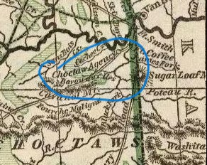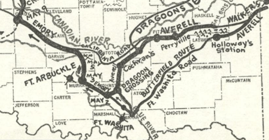
Map of Averell’s Ride in Indian Territory by Muriel H. Wright from “Lieutenant Averell’s Ride at the Outbreak of the Civil War,” Chronicles of Oklahoma, Spring 1961. Courtesy Oklahoma Historical Society.
Escape!
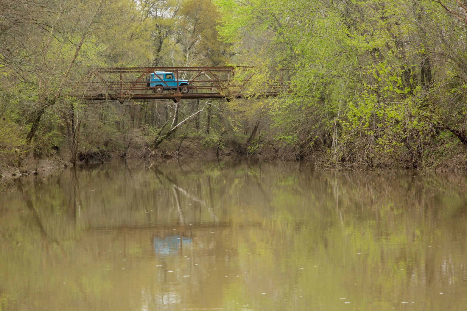
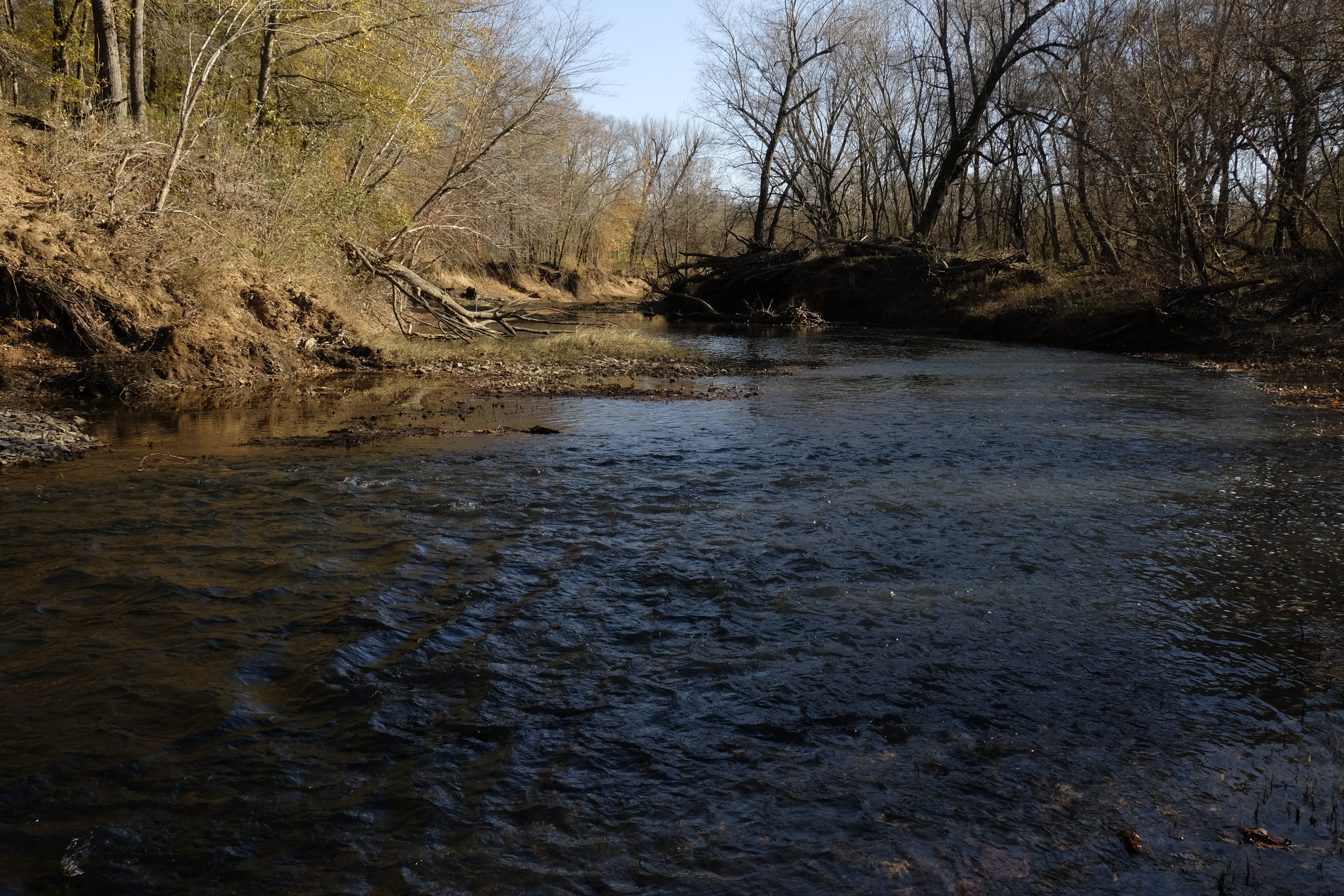
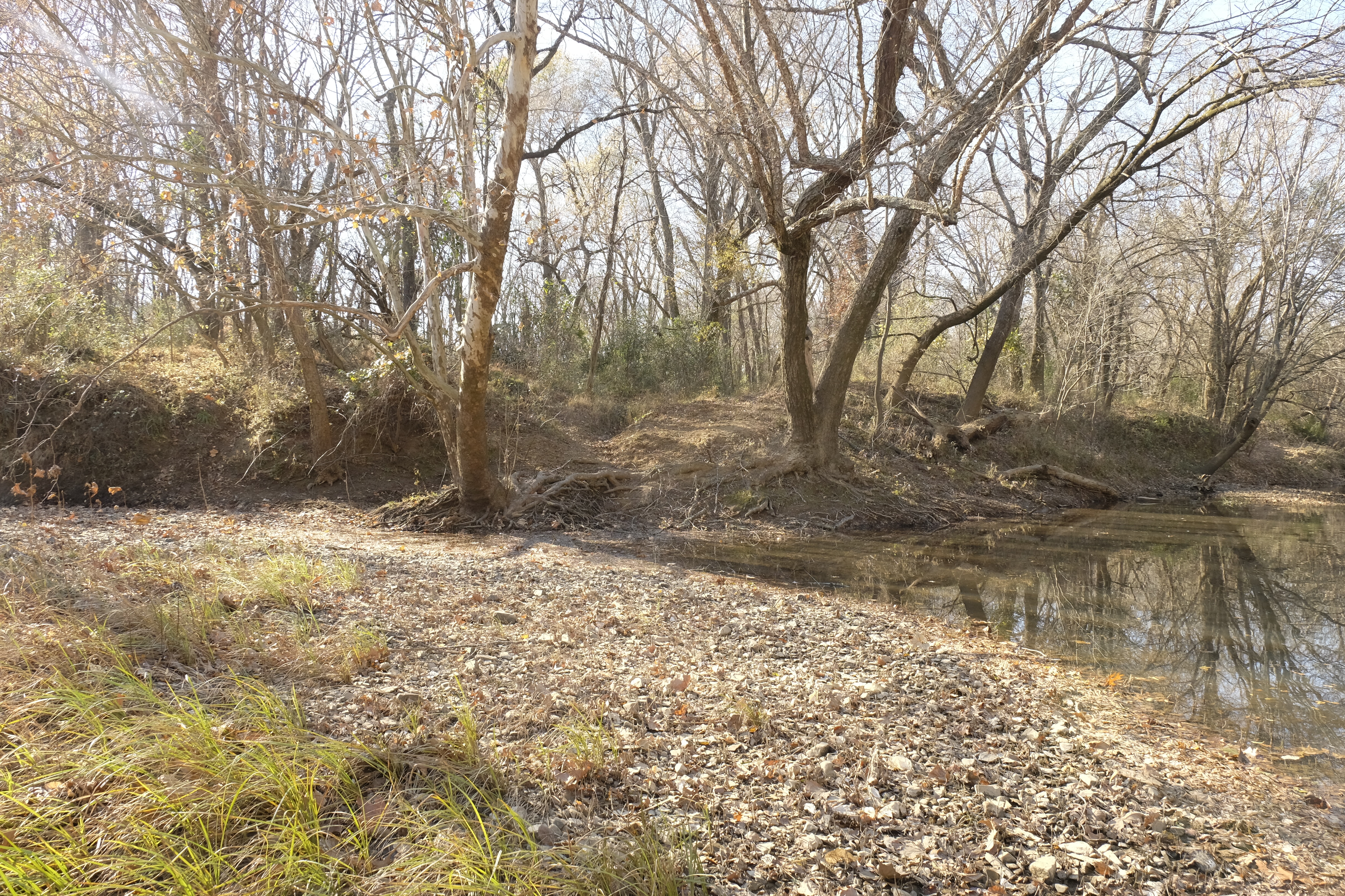
The lone horseman picks his way along faint forest paths, never holding a straight line for long. Only his butternut trousers catch the afternoon light filtering through the leaves, most of his body concealed by a black overcoat and slouch hat. Even in the shadows, the horse is clearly hard to control, the rider tense, moving with a mixture of haste and caution at the edge of the woods, trying to stay out of sight. Voices echo in the distance and the rider startles and pulls up, listens for a moment, then urges the horse forward through a clearing with more speed, quickly putting some distance between him and his pursuers. Soon he slips back amid the thick growth of trees, continuing to steal along game trails until he arrives on the banks of a river, swollen from recent rains. This is the Poteau, and he must cross it. A few days before, a stout iron bridge spanned it, built only a year before and well used, even by the stagecoaches carrying the Overland Mail. But now all that remains are stone abutments, charred timbers and flame-scarred trusses, left by federal troops as they fled Fort Smith for Indian Territory.
Finding the ruts of a ford used at low water, the rider removes his coat and throws it across the pommel of his saddle, then he and the colt plunge into the roiled and rushing current. The horse struggles, frantic, rearing and trying to return to the eastern shore as the rider battles to keep his own head above water. The overcoat is swept away by the current, but the hat is saved, just barely. From the lower side of the horse, the rider holds the animal’s head slightly upstream. Seeing the other shore, the colt swims steadily but the swift current carries the pair a quarter-mile downstream before they make land. Although the distance across is not more than a hundred yards, the frightened horse is exhausted and can barely climb up the bank. The rider’s condition is not much better. He lies upon his back, holding his feet in the air to drain the water from his boots, then remounts and rides off into Indian Territory, continuing his thousand-mile journey to deliver a secret message carried from Washington to the western frontier. Lieutenant William Woods Averell’s journey, as harrowing as it has already been, is about to become even more so.
An Unusual Assignment
Ten days earlier, on April 17, 1861, Averell stood in the office of the War Department in the city of Washington, receiving orders to proceed at once to Fort Arbuckle, deep in the Indian Territory. He carried urgent instructions for Lieutenant Colonel William H. Emory, commander of all the troops in Indian country west of Arkansas.
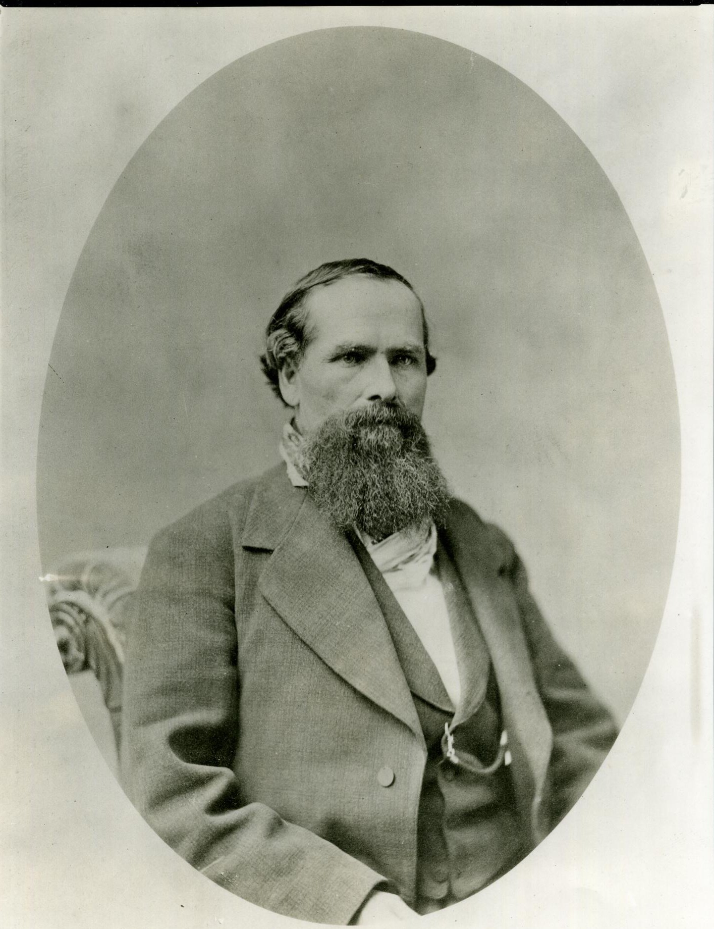
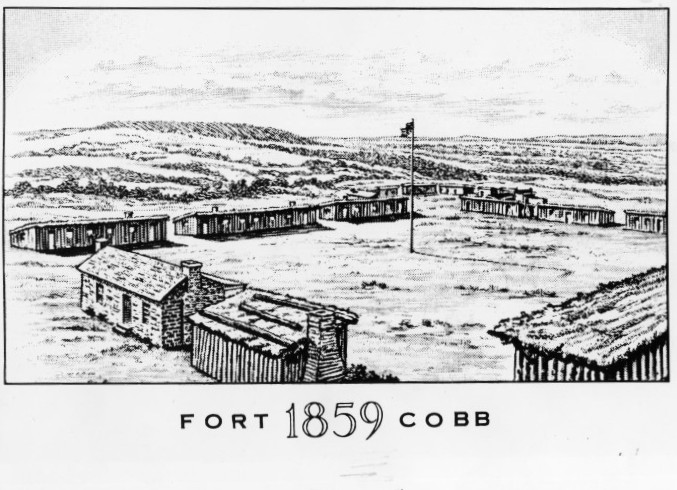
In 1858, Emory was assigned to Indian Territory to command the troops at Forts Arbuckle and Washita and directed to stop the Comanche, Kiowa, and Cheyenne from raiding the settlements in Texas and the Chickasaws and Choctaws in Indian Territory. In 1859, with establishment of the new Wichita Agency near present Anadarko, Emory established Fort Cobb nearby to protect the local Wichita Indians and several Texas tribes, recently removed from their Brazos River reservations to the Leased District, from raids by the Comanche, Kiowa, and Cheyenne.
In early 1861, Emory was in Washington on military business when, on March 13, he was ordered to return to Indian Territory. Before his departure, the Army received a report of secessionist Texans threatening attacks on Fort Washita, just twenty-two miles north of the Red River. Emory was instructed to proceed without delay to the post, where he was to concentrate his three garrisons, “unless the safety of the troops and the interests of the United States demand a different disposition.”
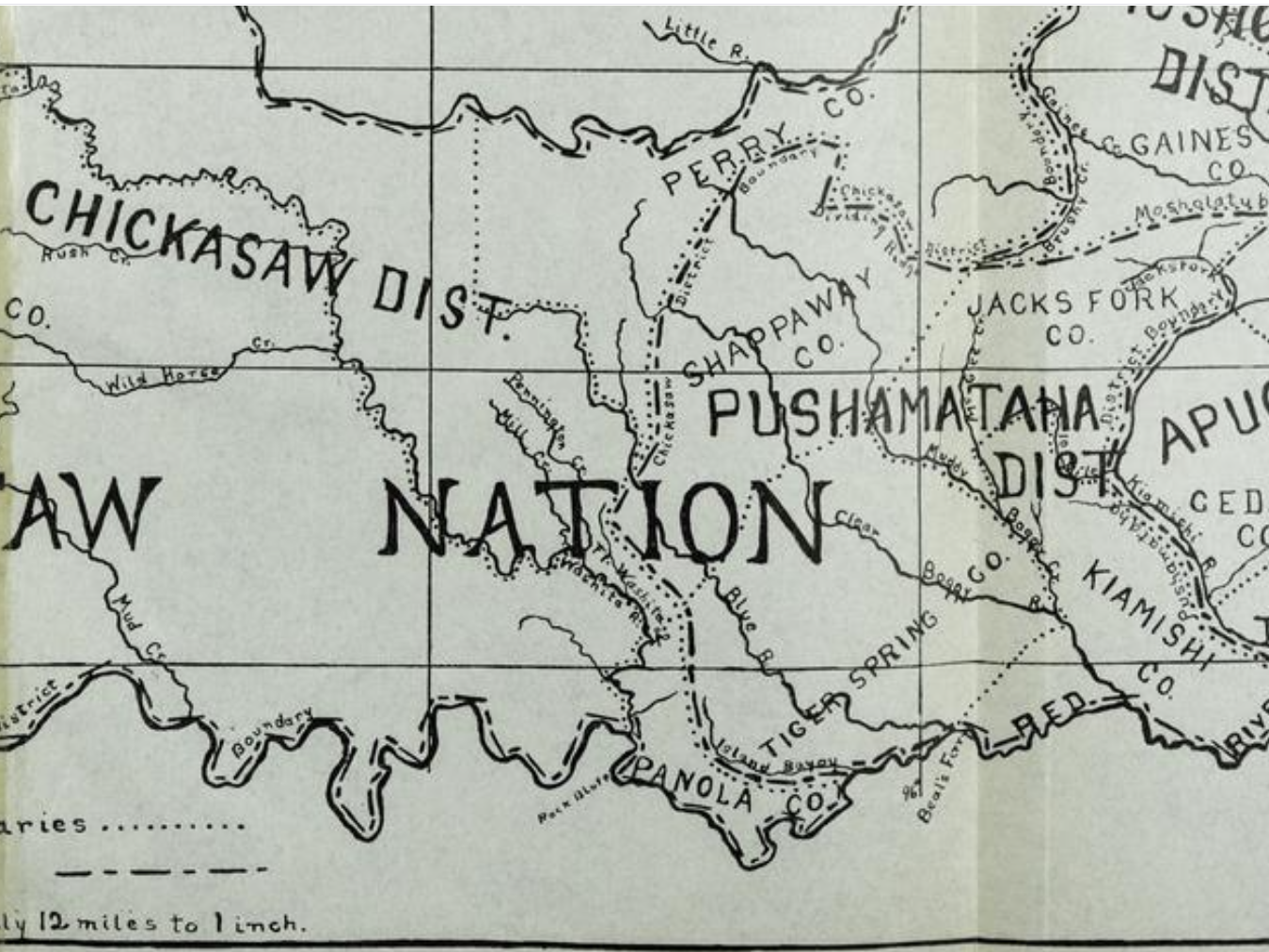
Low water in the Arkansas River prolonged Emory’s return trip to Indian Territory. In early April, as he reached Fort Smith, war was erupting back east and its impact was felt on the frontier. Secessionist forces threatened Fort Smith and had seized the supply of ammunition being shipped up the Arkansas River for Emory’s command and the federal troops at the fort. Tensions were high in Indian Territory as well. Texas had already seceded and Arkansas would soon follow. Caught between them, the Five Civilized Tribes, beholden to the Union under treaty and dependent on the U.S. Army for protection, faced increasing pressure to join the Confederacy. Between July and October, 1861, the Choctaws, Chickasaws, Cherokees, Creeks and Seminoles would all make formal treaties aligning with the Confederate States of America. Federal troops in Indian Territory felt the heat as secessionist aggressors closed in. A great distance from their base, they were now cut off from support by the U.S. government.
By this time, seven states had seceded from the Union and established the Confederate States of America, eventually to comprise eleven states. On April 12, Confederate forces fired upon Fort Sumter, which was surrendered the next day. Abraham Lincoln called for a federal militia and on April 13, Emory set out from Fort Smith for Indian Territory with some of his cavalry. En route, he learned that a large force of Texas Confederate troops was marching north toward Fort Washita.
Enter Lt. Averell
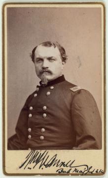
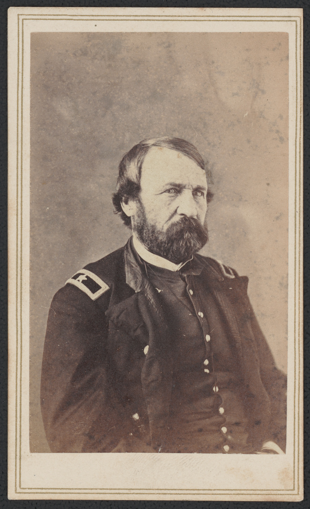
Into this boiling cauldron plunged Lieutenant Averell with a crucial message for Emory. The twenty-eight-year-old officer had graduated from West Point in 1855. In 1857, he was serving on the New Mexico frontier, where in 1859 he received a serious gunshot to the left leg and was sent back east to recover. By February 1861, having been on crutches for 18 months at his family home in Bath, New York, he finally recovered enough to walk with a cane. Bored with inactivity and anxious to be of service, Averell traveled to Washington. His leave was scheduled to end June 12 but with the firing on Fort Sumter, Averell could not stand by and do nothing. He presented himself for duty at the War Department on April 16.
The next day, he received his orders:
You will, by order of the General-in-Chief, proceed at once to Fort Arbuckle and deliver the accompanying letter to Lieut. Col. W.H. Emory, or the senior officer present, receive from him communications for the Government, and return to this city.
The orders he carried for Emory were:
On receipt of this communication, you will, by order of the General-in-chief, with all the troops in the Indian country west of Arkansas, march to Fort Leavenworth, Kans., taking such useful public property as your means of transportation will permit. The troops may or may not be replaced by Arkansas volunteers. The action of that State will not affect your movement.
Capt. A. Montgomery, A.Q.M., will be left at Fort Smith, to take charge of public property, and as staff officer of volunteers who may be mustered into the service of the United States.
Averell left Washington on a westbound train the same day. Disguised in civilian clothing, he intended to pass himself off as a Southern sympathizer hurrying to rescue his sister from Fort Smith, where her fictional Union soldier husband was stationed. Along his route, “the wildest excitement (over the war) prevailed.”
He arrived at St. Louis on the evening of April 19 and the next day took the first train to Rolla, Missouri, one hundred fifteen miles away. Rolla was the last stop on the railroad, and from that point Averell would have to travel by stagecoach to Fort Smith. He arrived at Rolla late on a Saturday, requiring him to wait until Monday for departure of the next stage. On Monday, April 22, he rode the stagecoach out of town with five other passengers, including “several prominent Southern gentlemen,” with three hundred miles of rough roads ahead. The towns he passed through were “wild with secession excitement and rumors of war,” and Averell was acutely conscious of the need to conceal his true identity for the sake both of his own safety and the security of the message he carried. He passed one night at Lebanon, Missouri, amid bed bugs and drunken secessionists, and in Springfield shared a bed with a Confederate officer. Continuing south, the stage also made overnight stops at Cassville and Fayetteville. At Evansville, just 40 miles shy of Fort Smith, Averell learned the military post had been captured by pro-Confederate Arkansas militia on April 23, just hours after Captain Samuel D. Sturgis, warned of the impending attack, evacuated his men.
At Van Buren, on the north bank of the Arkansas River across from Fort Smith, Averell tried to hire a horse and vehicle to detour through Tahlequah in the Cherokee Nation, thinking he could circumvent Fort Smith altogether. But all the horses there had been seized by the rebels. Having no other way to go but through, he crossed the Arkansas River on a ferry, reaching Fort Smith at 9 a.m. on April 27. The town was “boiling over with political frenzy and unlimited whiskey.” As he rode in, “Horsemen galloped alongside the stage and peered into the windows, making inquiries or shouting like bedlamites. That I got to the St. Charles Hotel without being shot or hanged seemed like a special providence.”
A Tough Spot
Averell was in a tough spot. Disembarking at the hotel across the street from the stagecoach office, he had no transportation, no supplies, and found himself in hostile territory. Montgomery, the post quartermaster who was to supply Averell, was detained in the guard house as a prisoner of war. Union troops were retreating westward, bridges had been burned and the streams were swollen from recent rains.
In the midst of men yelling, “women screeching and fluttering secession flags, and everybody in a sublime state of glorification,” Averell found the proprietor, whose demeanor suggested he might be at least partly trusted, and bought from him a horse, saddle and bridle for the price of his gold hunting watch and $20 cash. The horse, blind in one eye, also turned out to be unbroken to the saddle. Riding out of town through a crowd of troops having a training session and target practice, Averell put on quite the public spectacle. “After a gymnastic contest of ten or fifteen minutes’ duration, my colt took the bit in his teeth and started off at full run,” he wrote. Out of the saddle for two years because of his leg wound and weary from the jolting stagecoach journey, Averell was in poor condition for this struggle, but his expert horsemanship prevailed. “I kept my seat firmly and the roads being sloppy, muddy and heavy, at the end of about three miles my horse seemed to reach the conclusion that it didn’t pay and began to moderate his pace.”
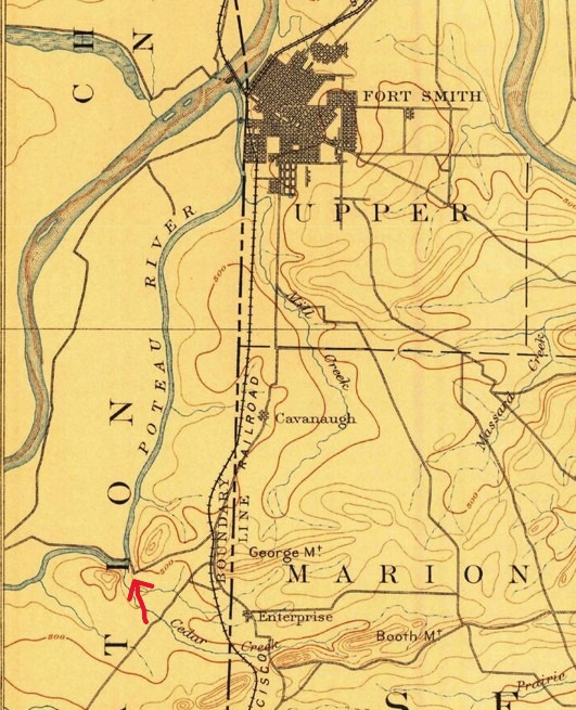
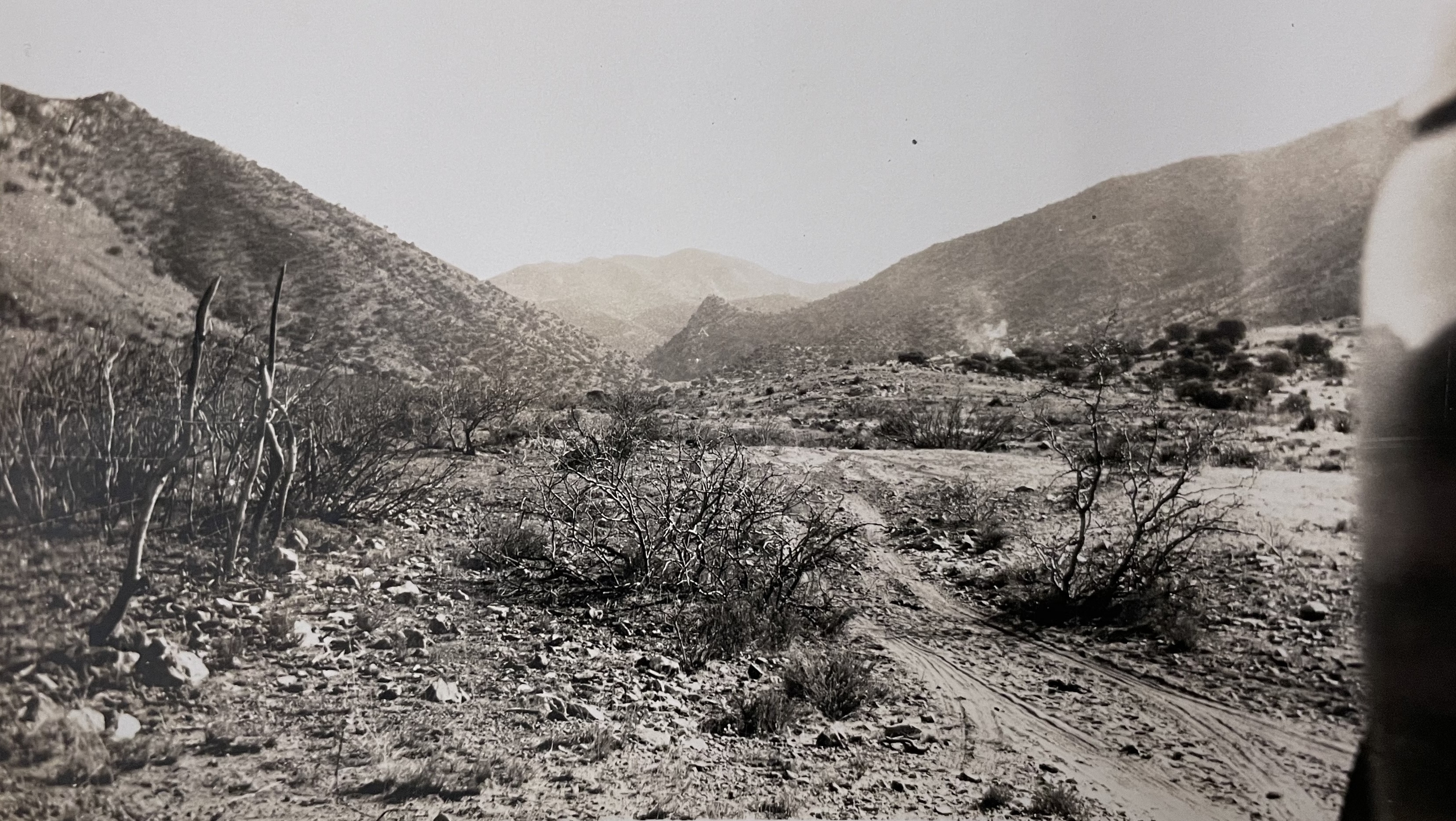
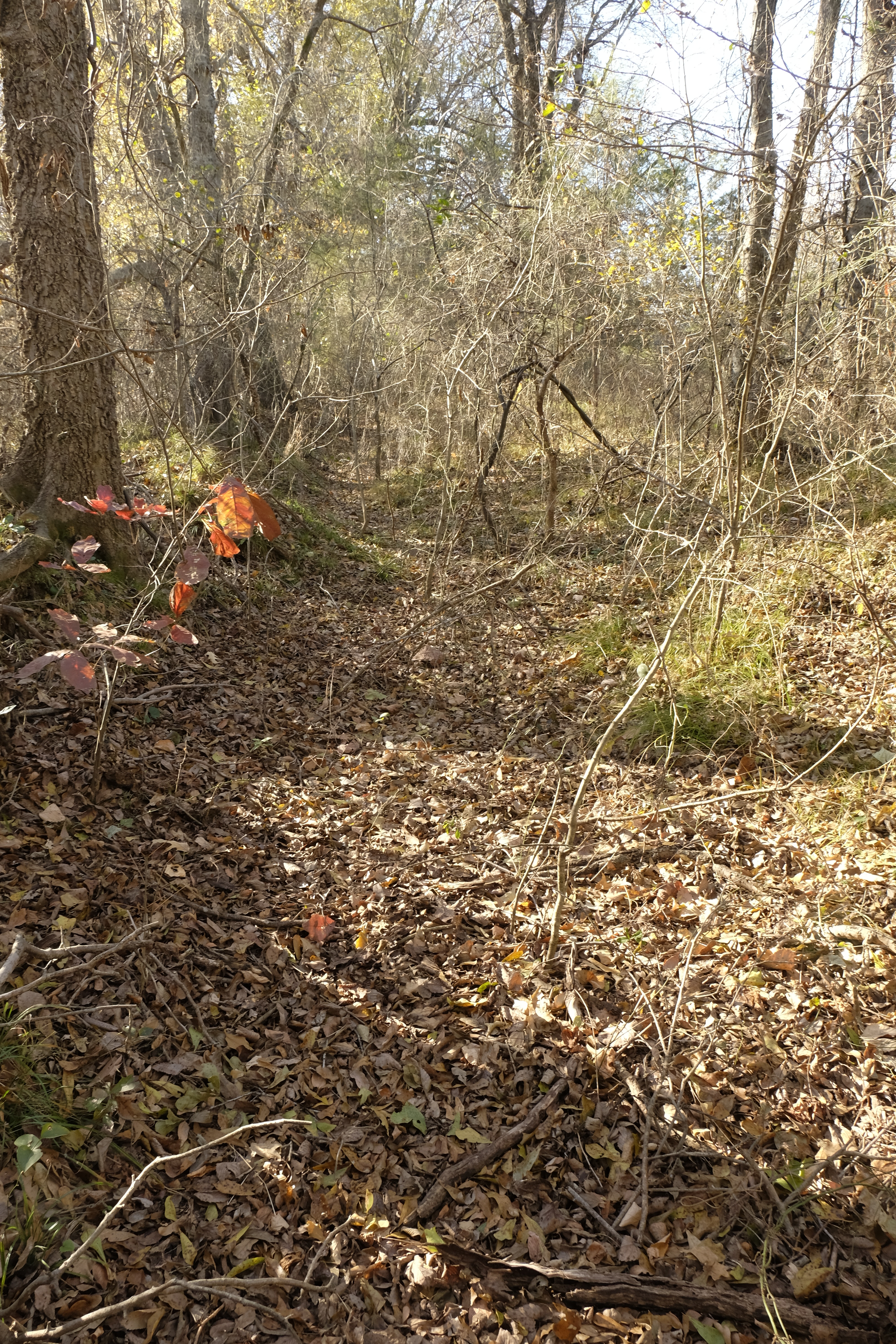
He cleared Fort Smith but knew that the “comedy of the runaway colt” had attracted attention and he would soon be pursued. Taking side paths and riding through open woods to avoid leaving a trail on the muddy highway, he lost the main road and wandered for a long time, soon forced to evade a group of horsemen, then, continuing southwesterly through the woods, he came to the remains of the burned bridge.

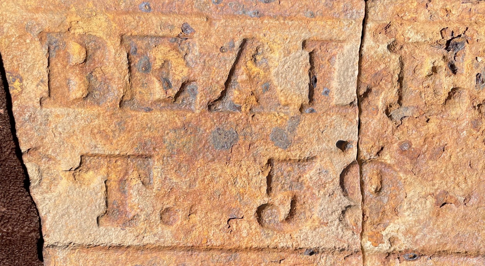
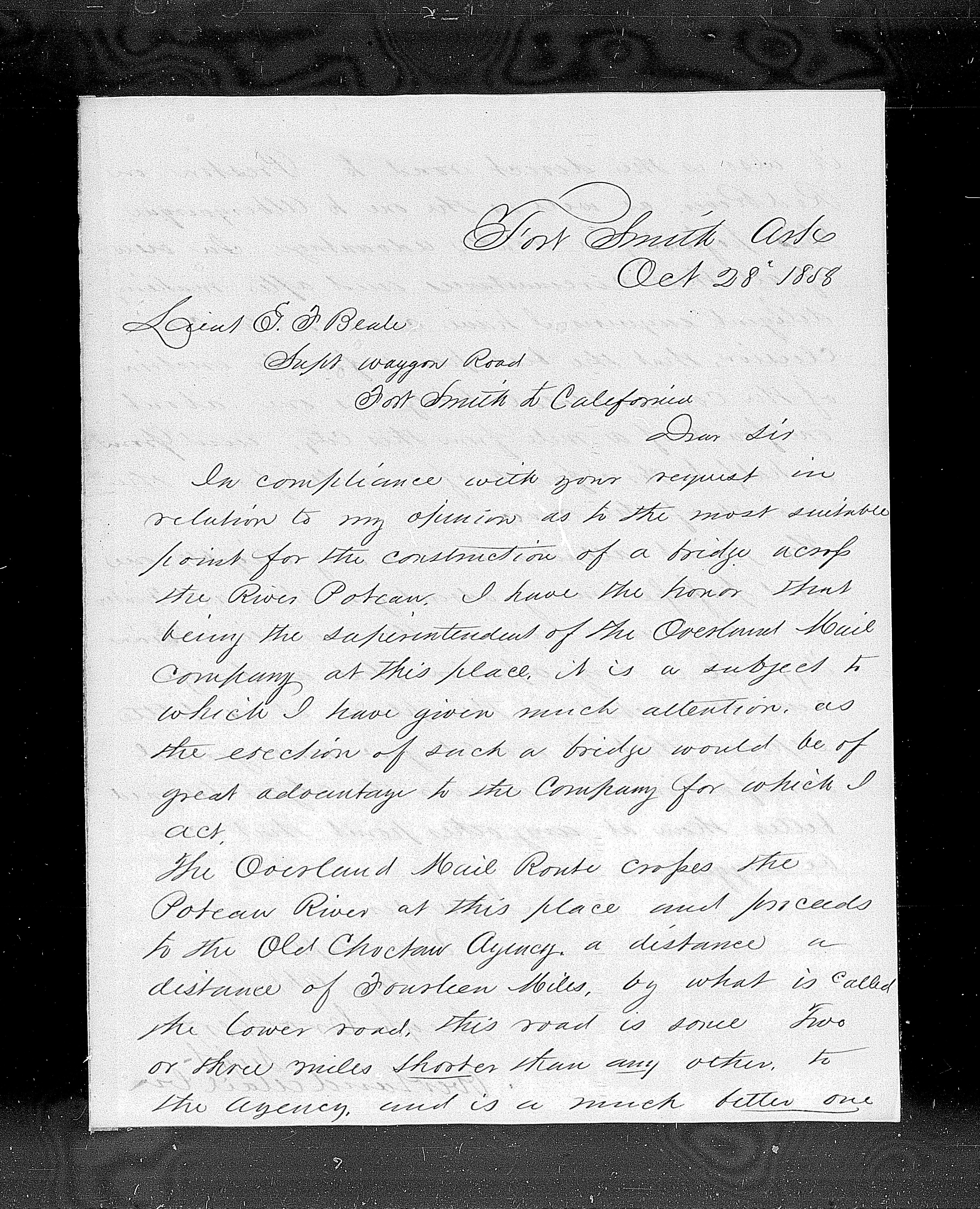
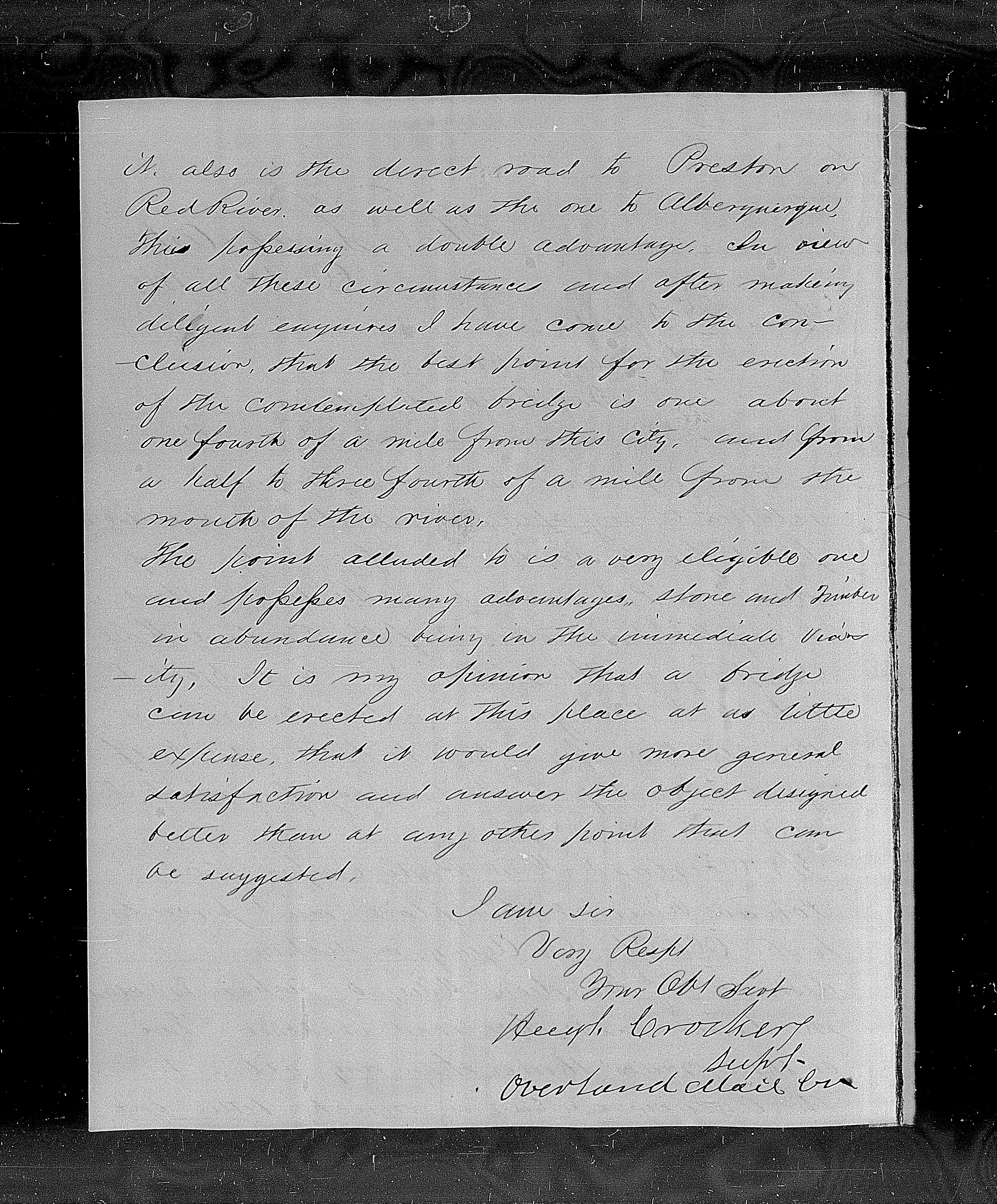
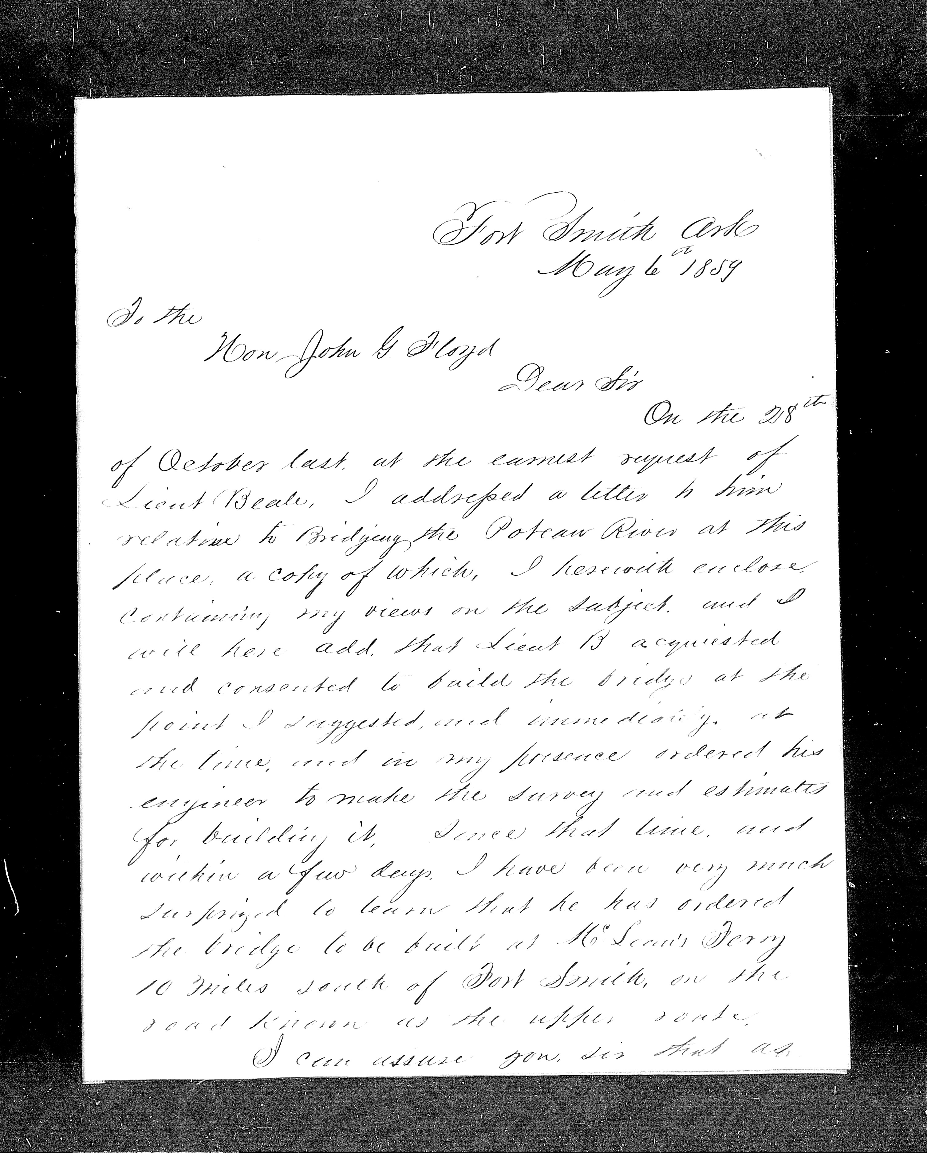
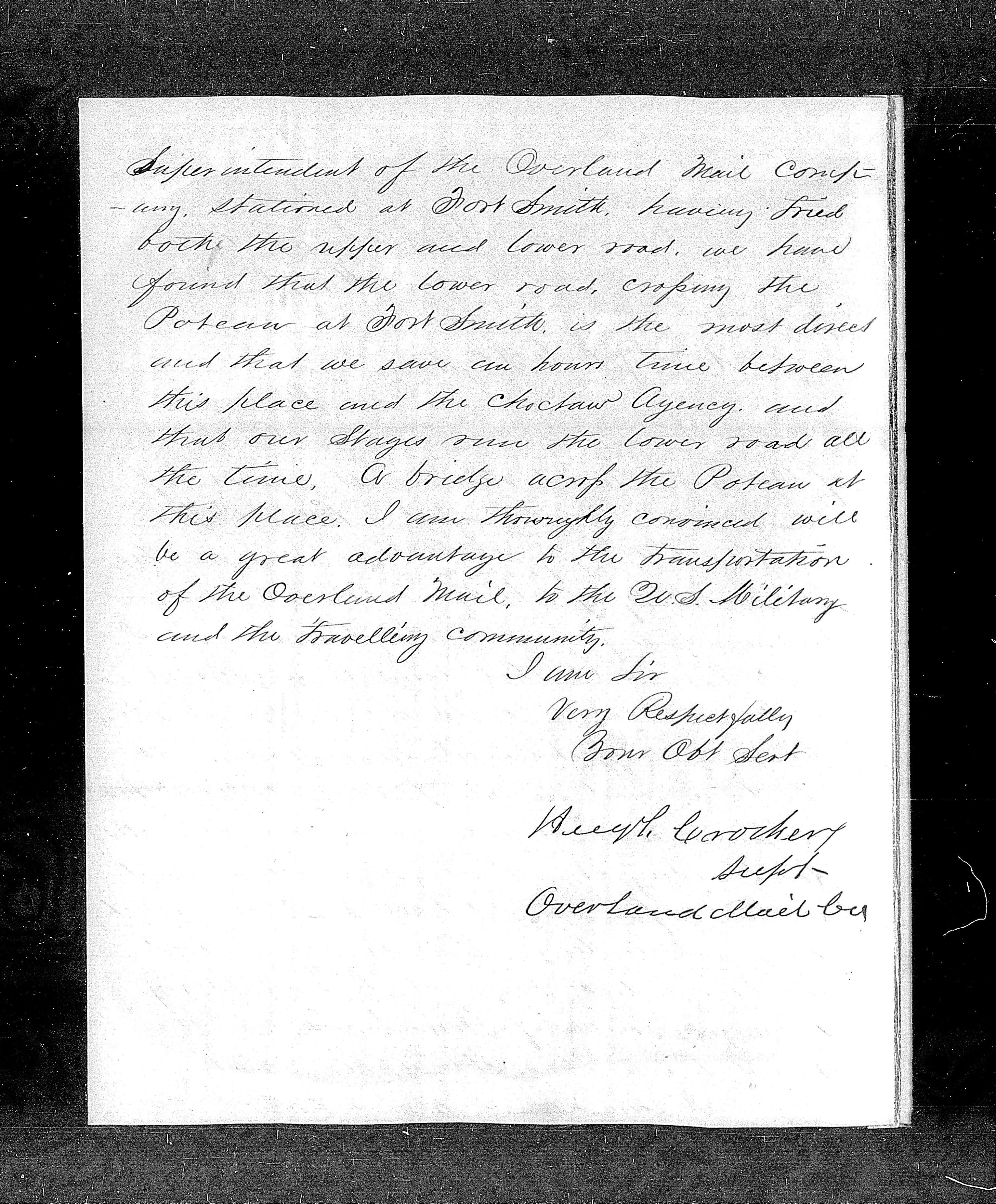
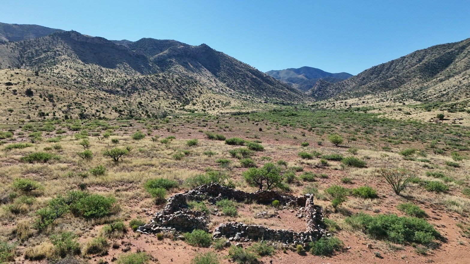
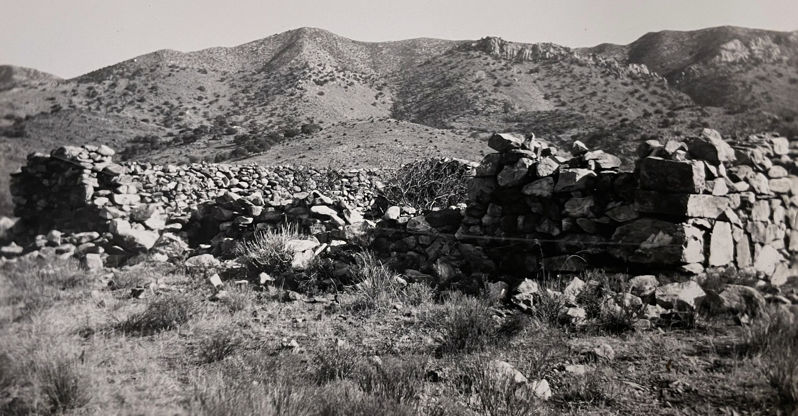
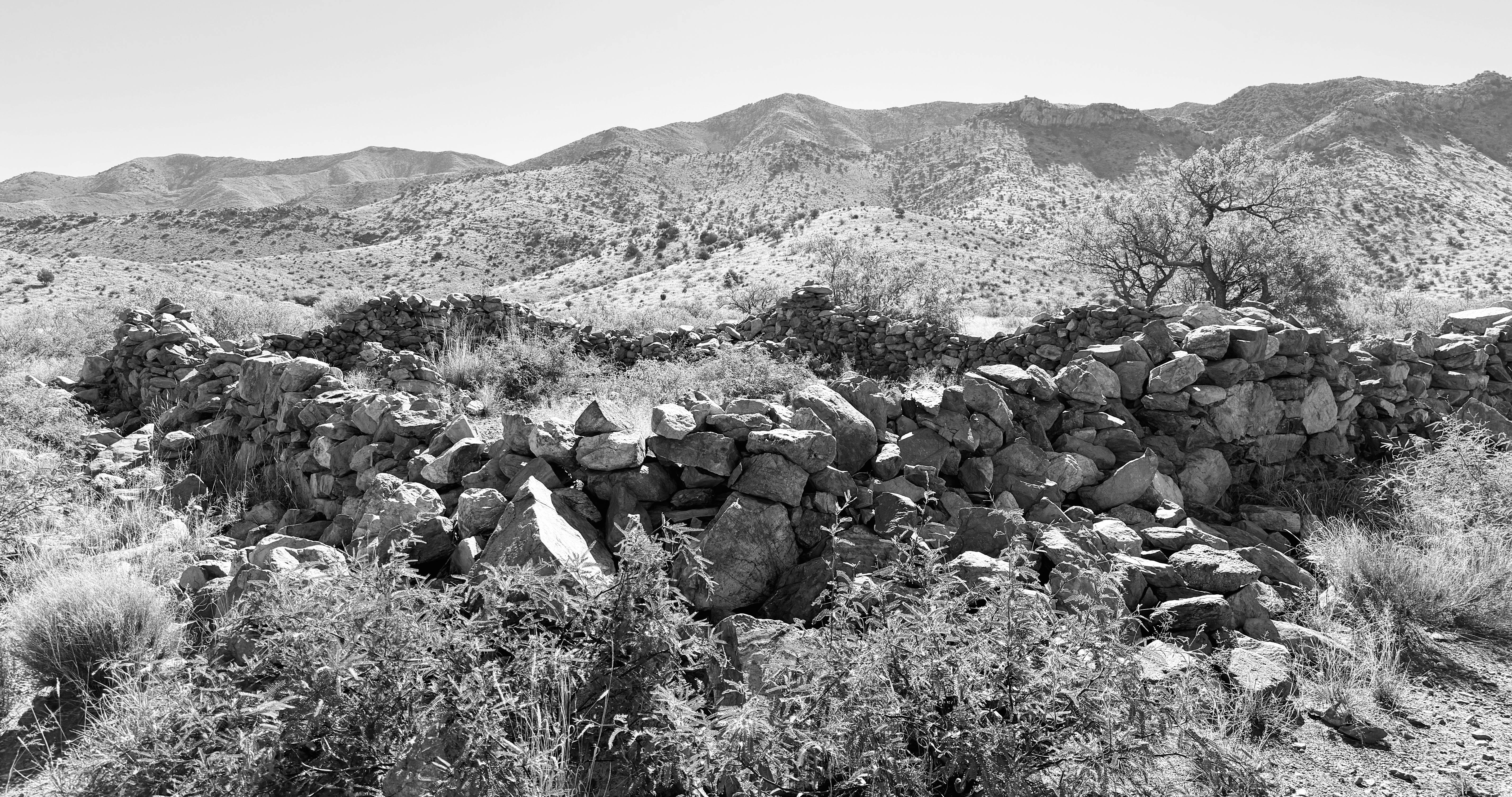
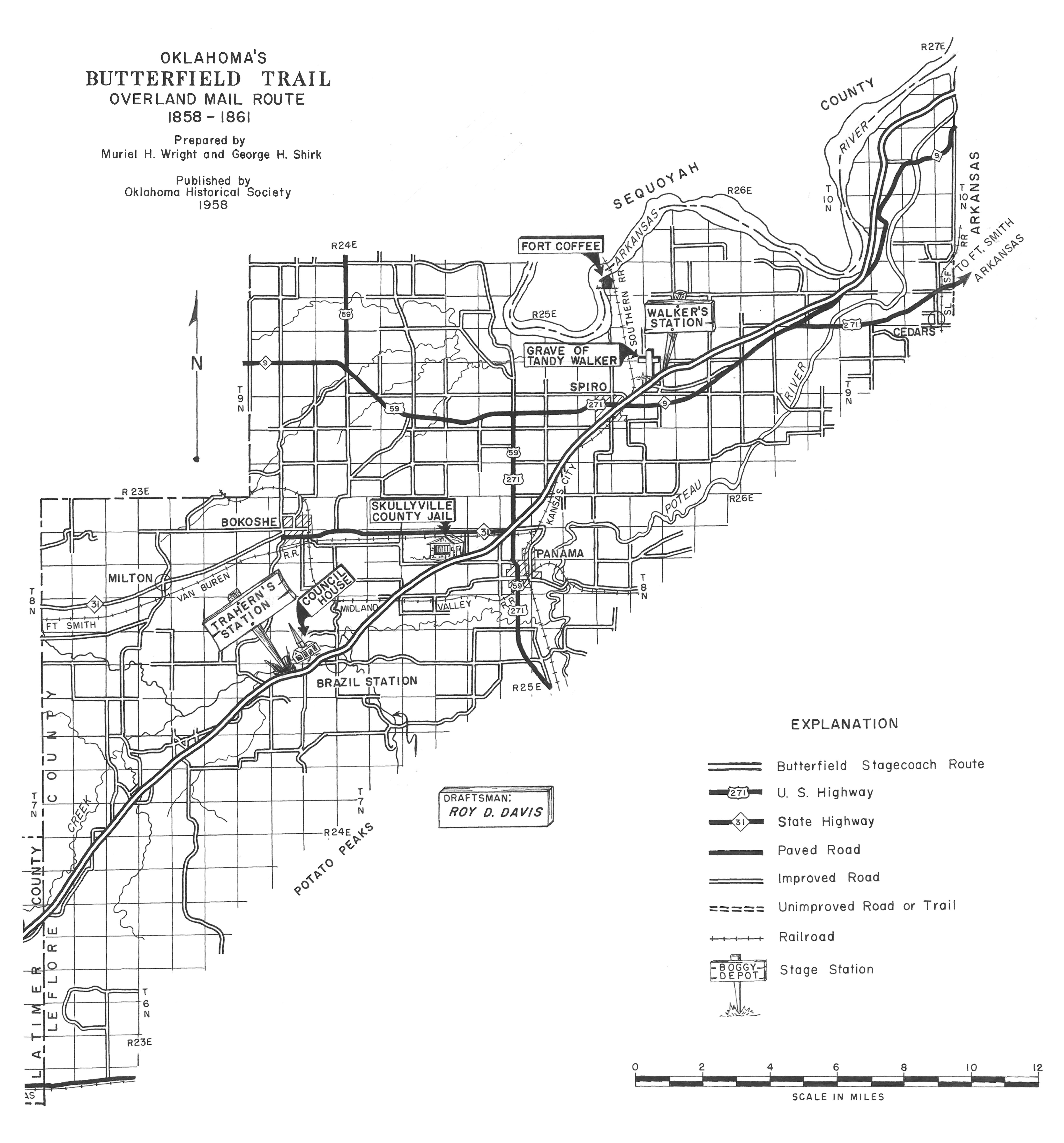
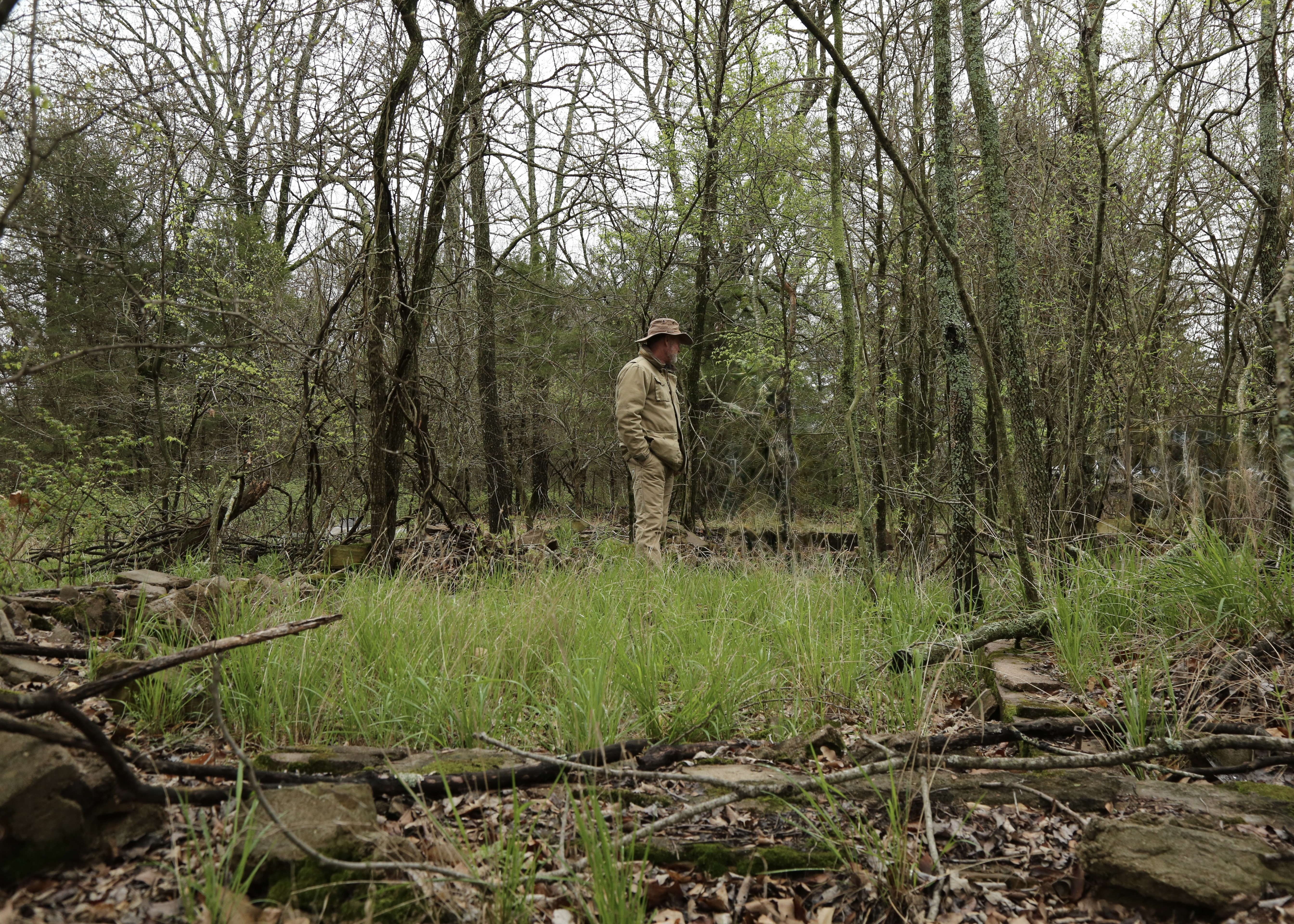
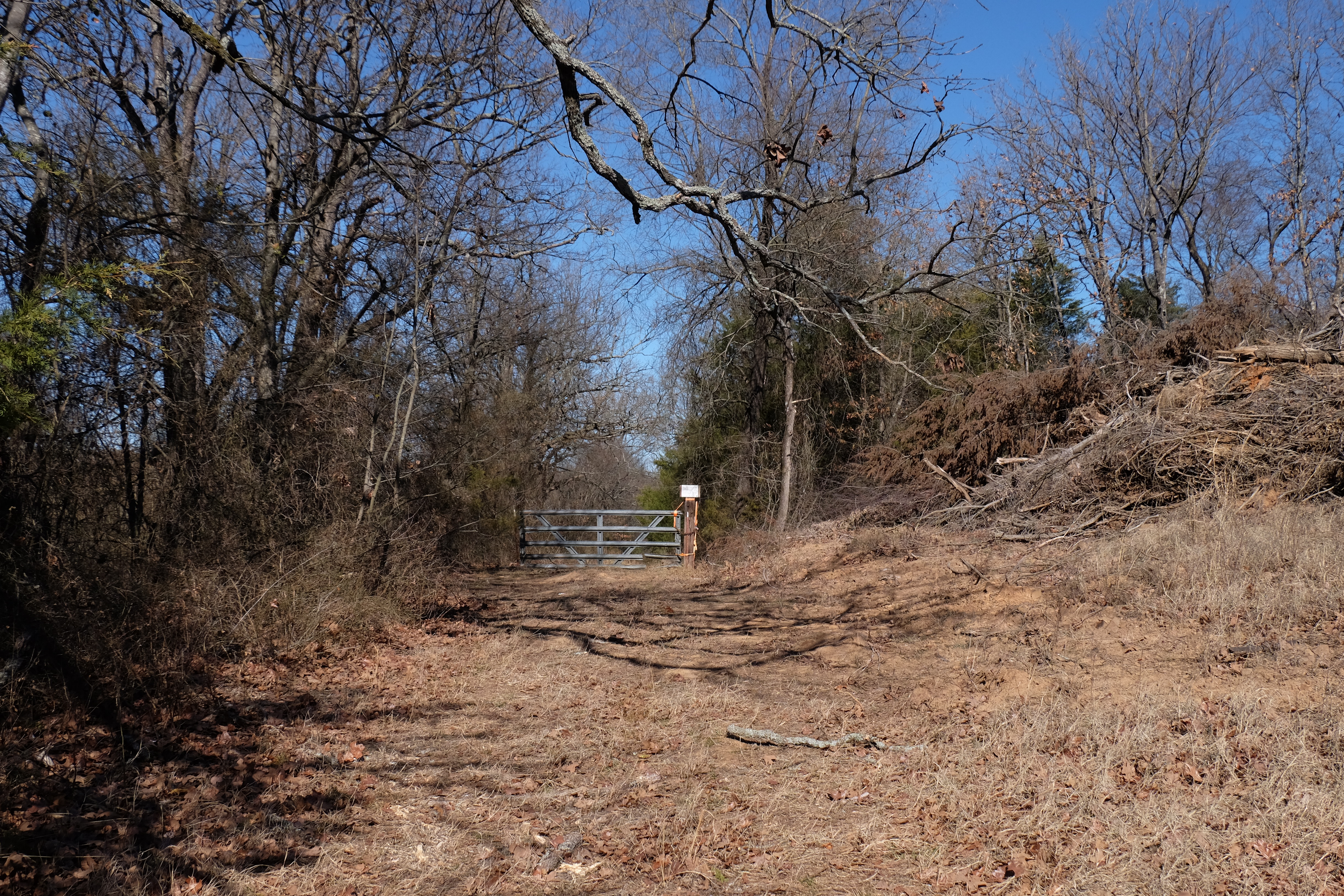
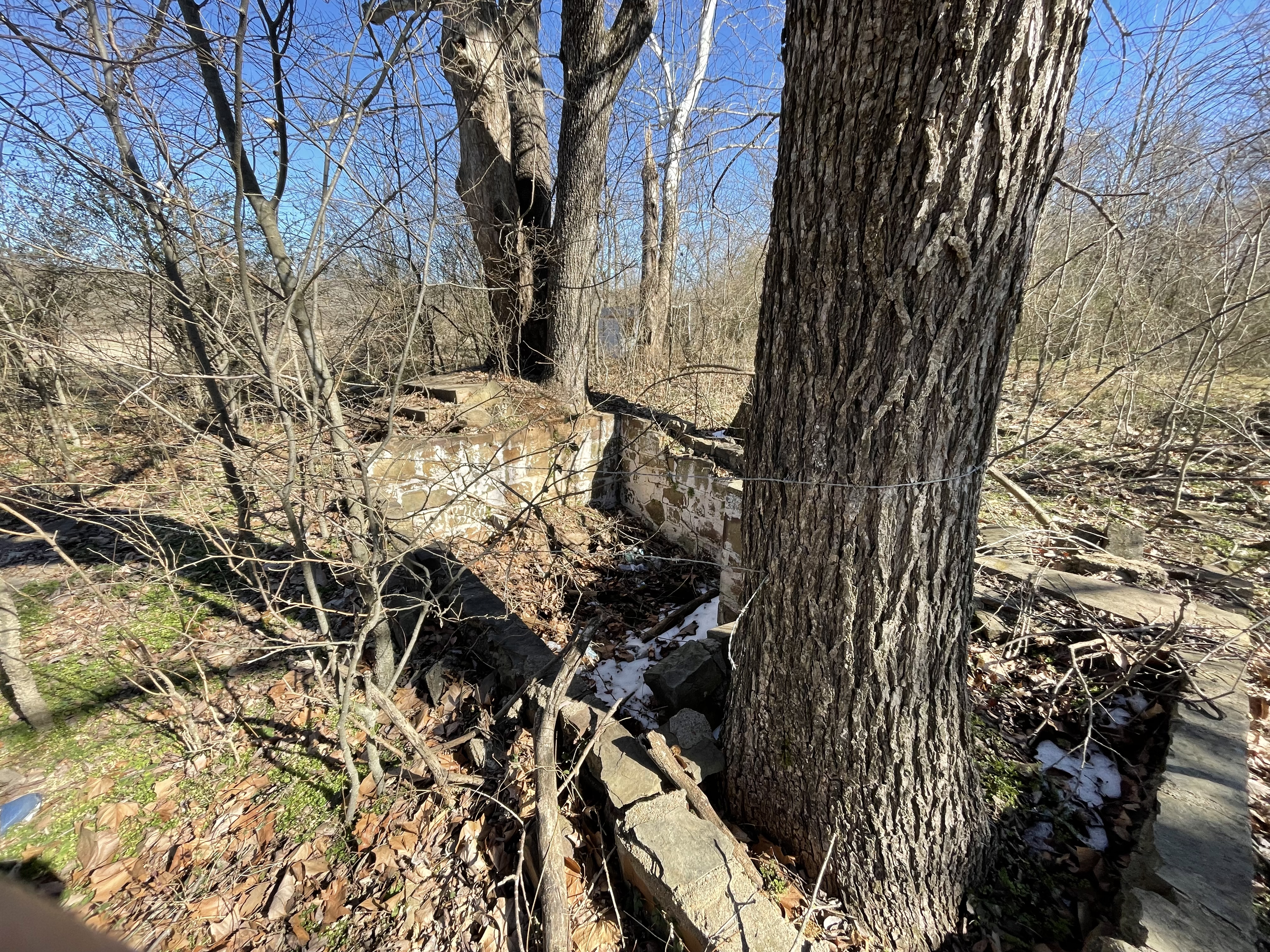
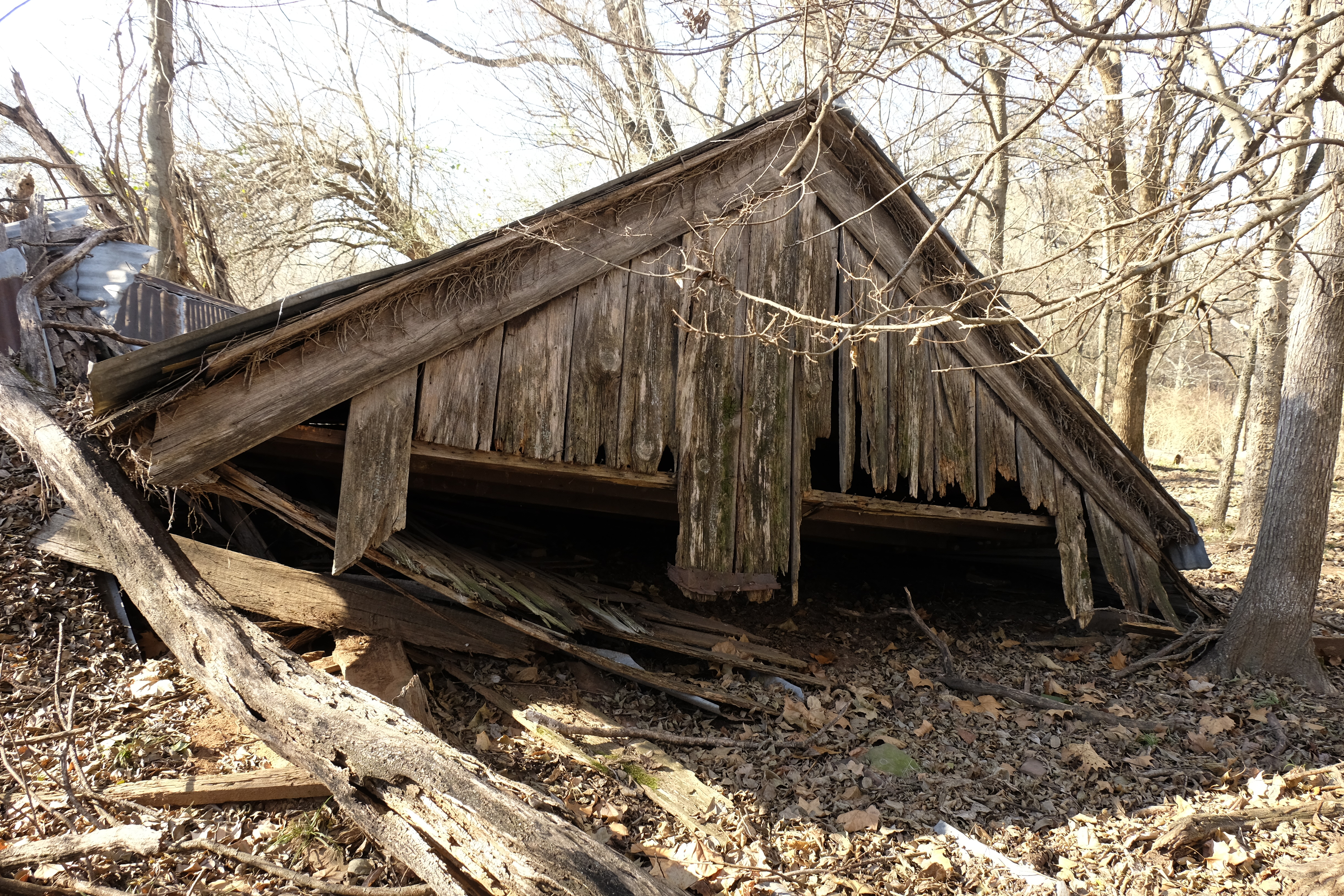
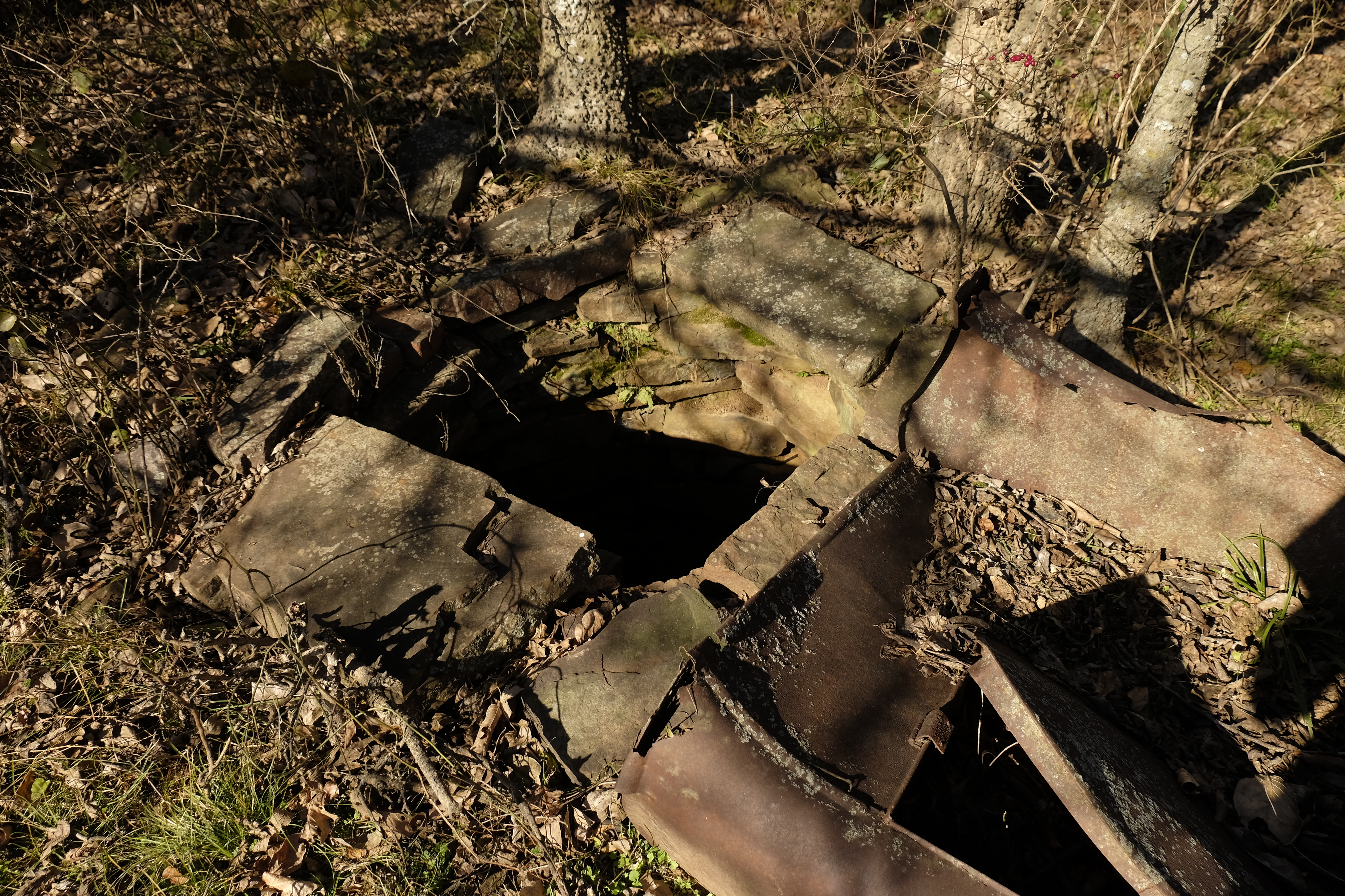
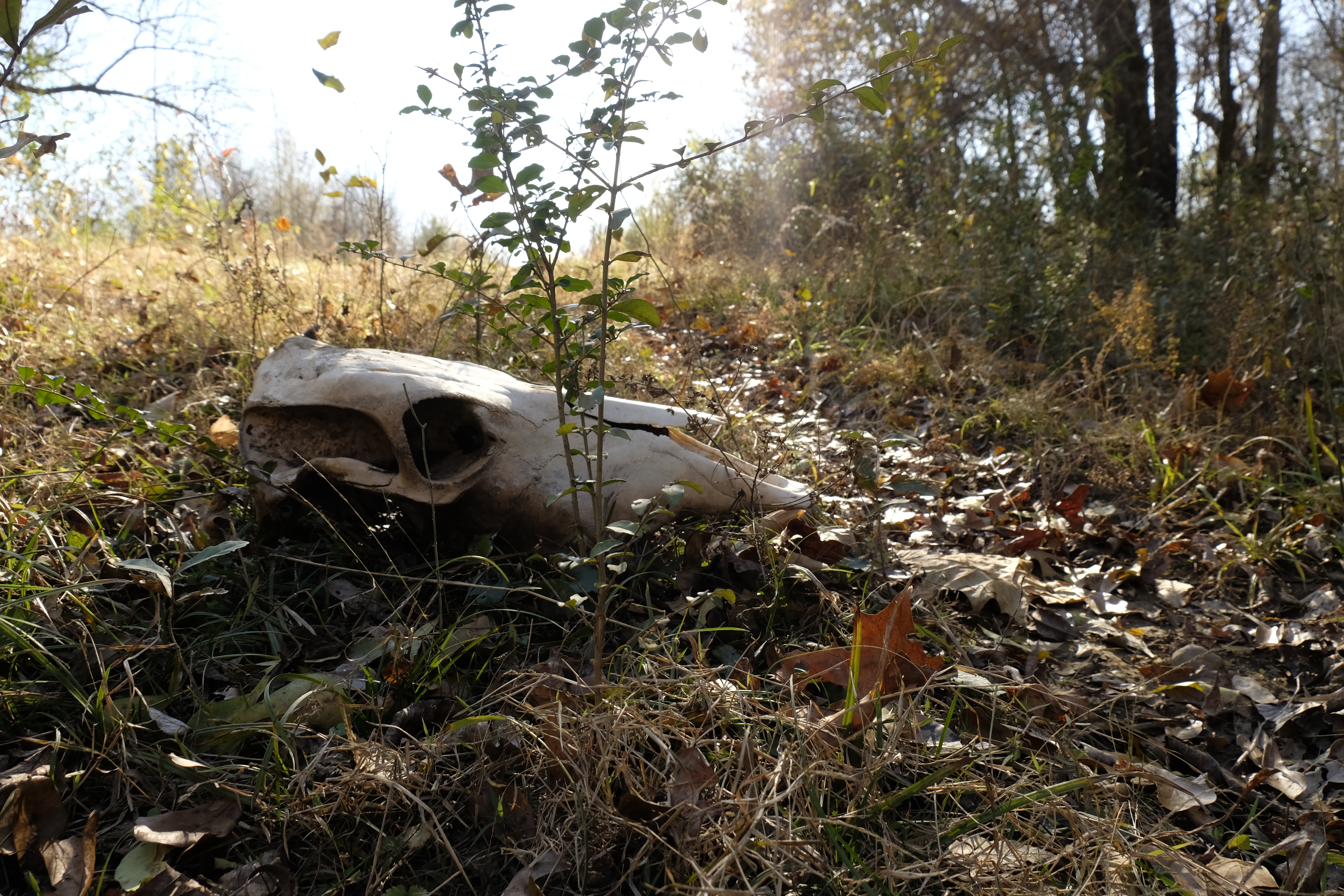
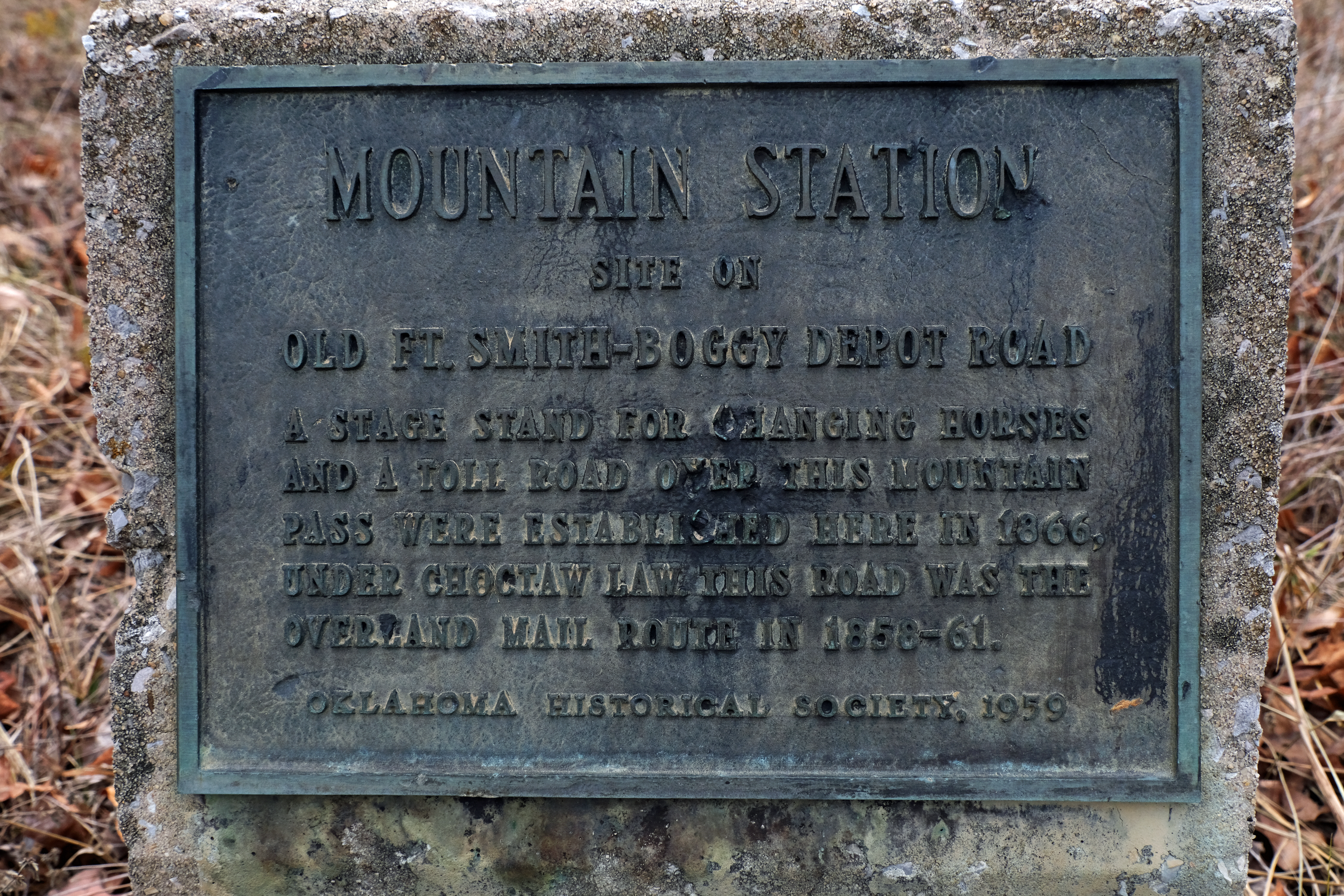
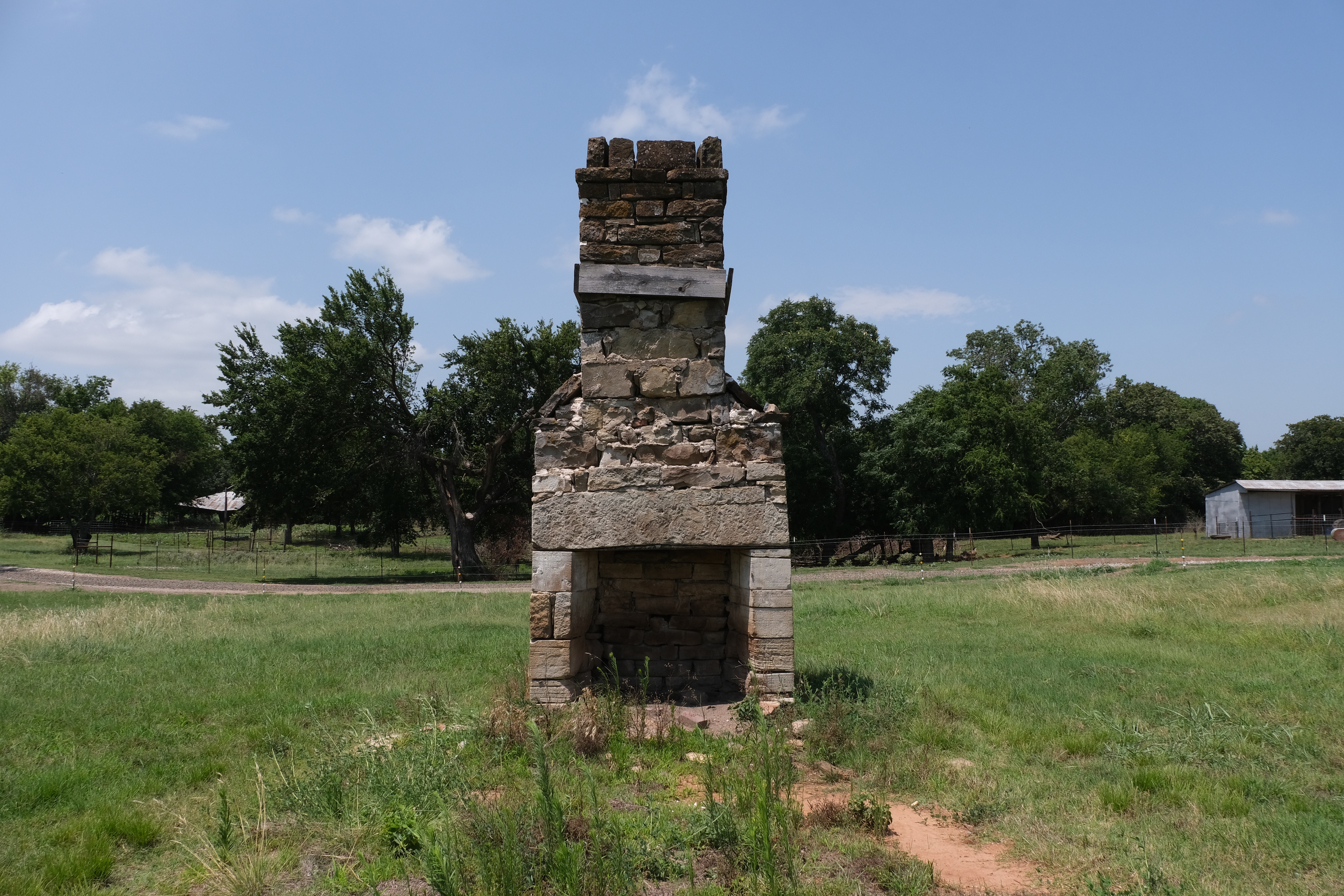
Averell would have been near present-day Pocola, Oklahoma, the site of the easternmost of Lieutenant Edward F. Beale’s iron bridges. In 1859, Beale was directed by the government to survey a westward route from Fort Smith along the Canadian River for a national wagon road to the Colorado River. Six iron bridges soon spanned several flood-prone streams in eastern Indian Territory as well as the Poteau River. All of them were destroyed during the Civil War, apparently by retreating federal troops. Artifacts from the next bridge west of the Poteau, at Redbank Creek west of present-day Spiro, have recently been discovered.
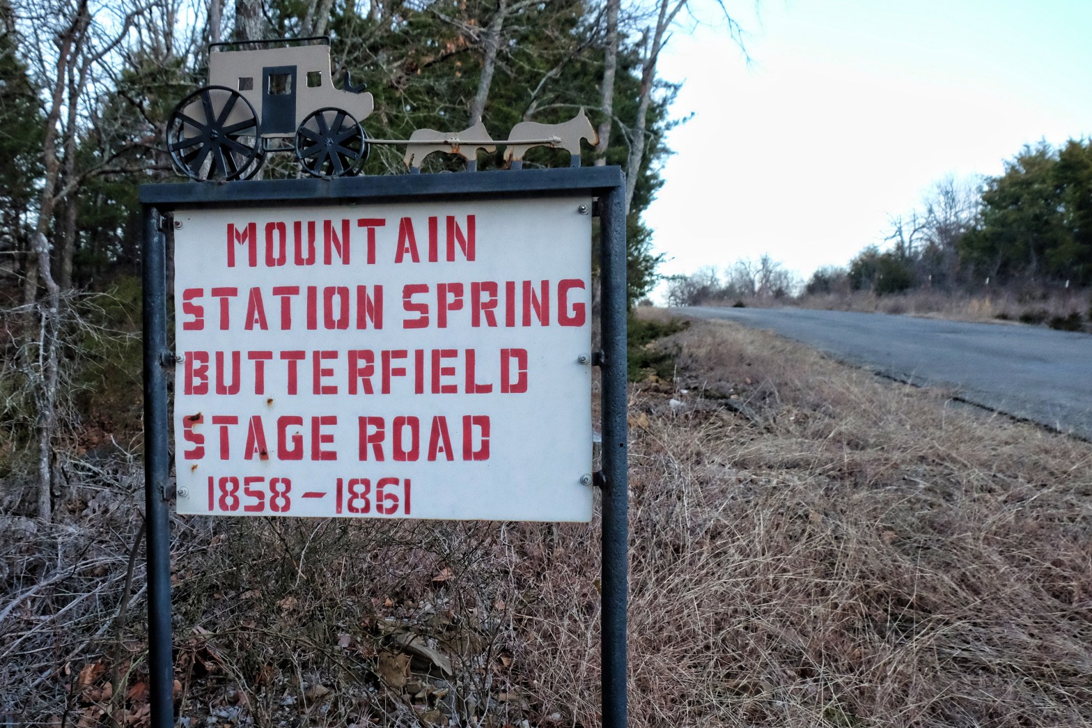
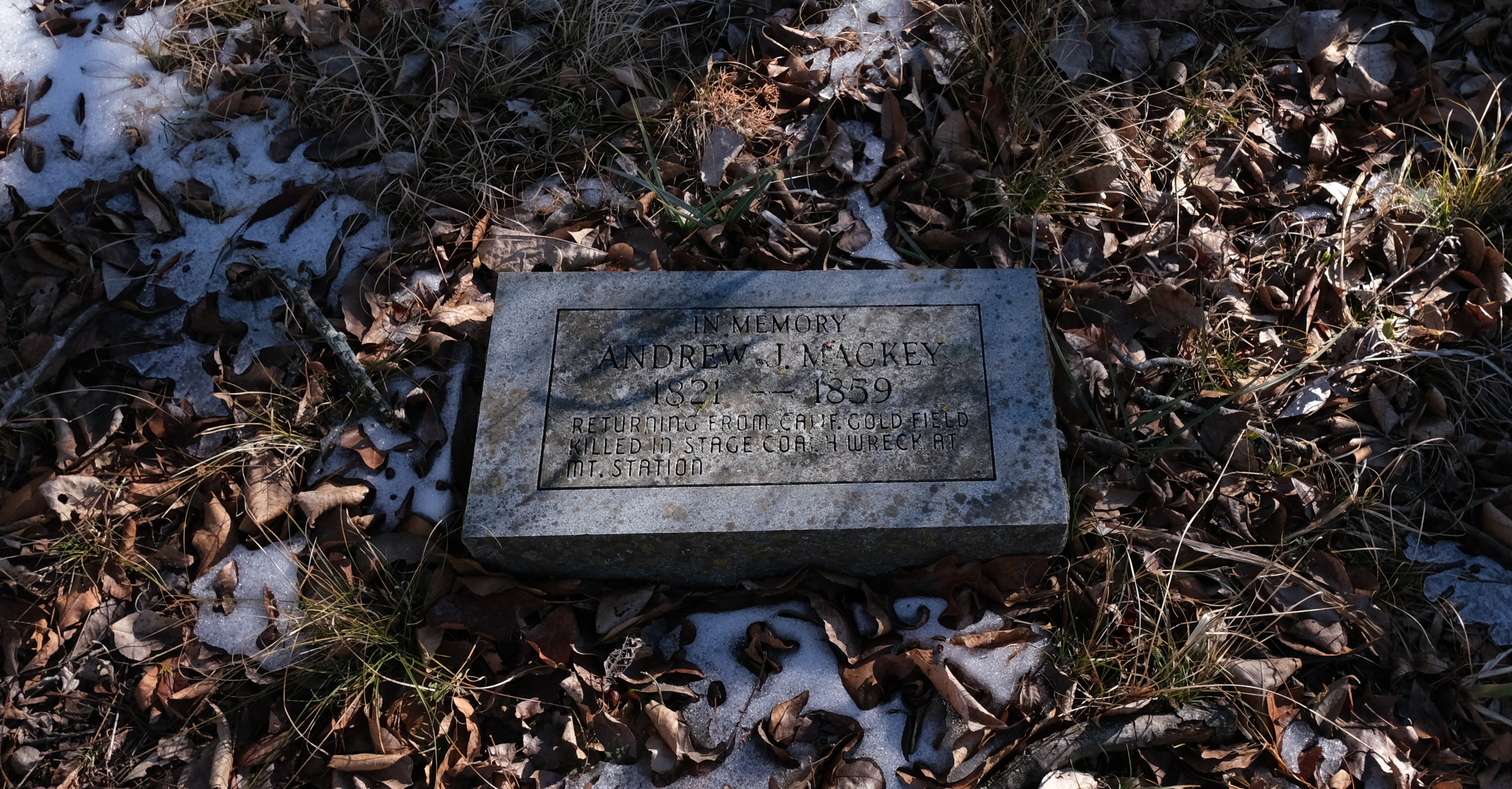
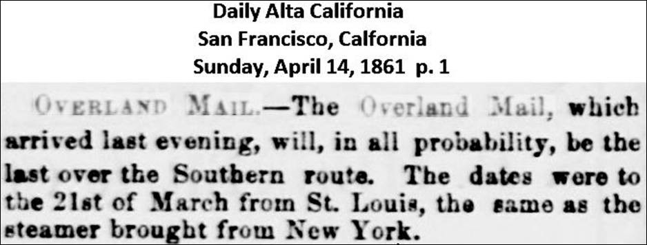
Barely more than a month before Averell’s arrival, the last Butterfield Overland Mail stagecoach would have crossed the same bridge on its final journey to California. Already concerned about the drain on postal service finances by the unprofitable mail line, harassment of mail stagecoaches by rebels in Texas ultimately prompted Congress on March 2, 1861 to move the Overland Mail route farther north. On March 21, 1861, the final westbound stage left for San Francisco, arriving at Fort Smith on March 24 and San Francisco on April 13.
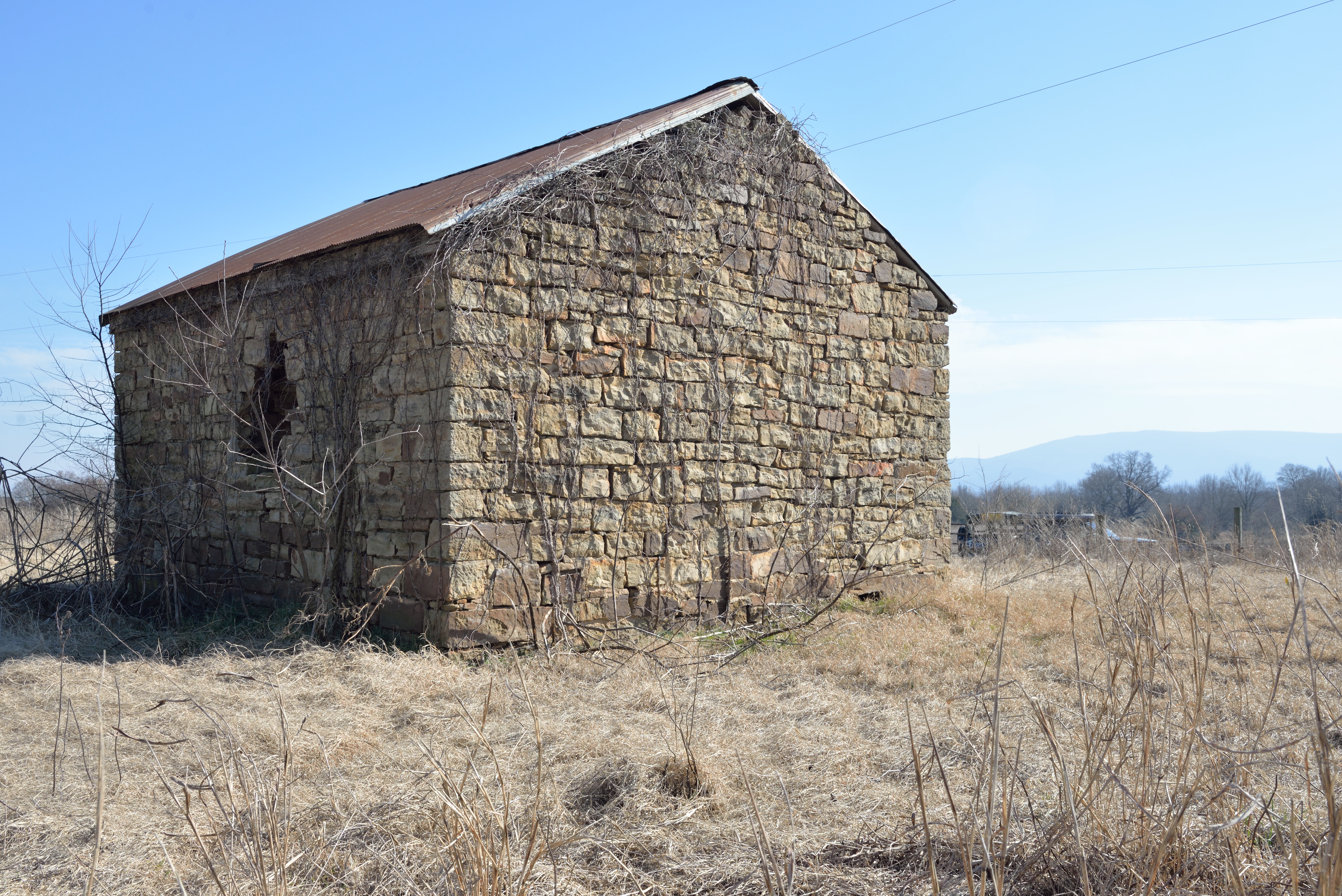
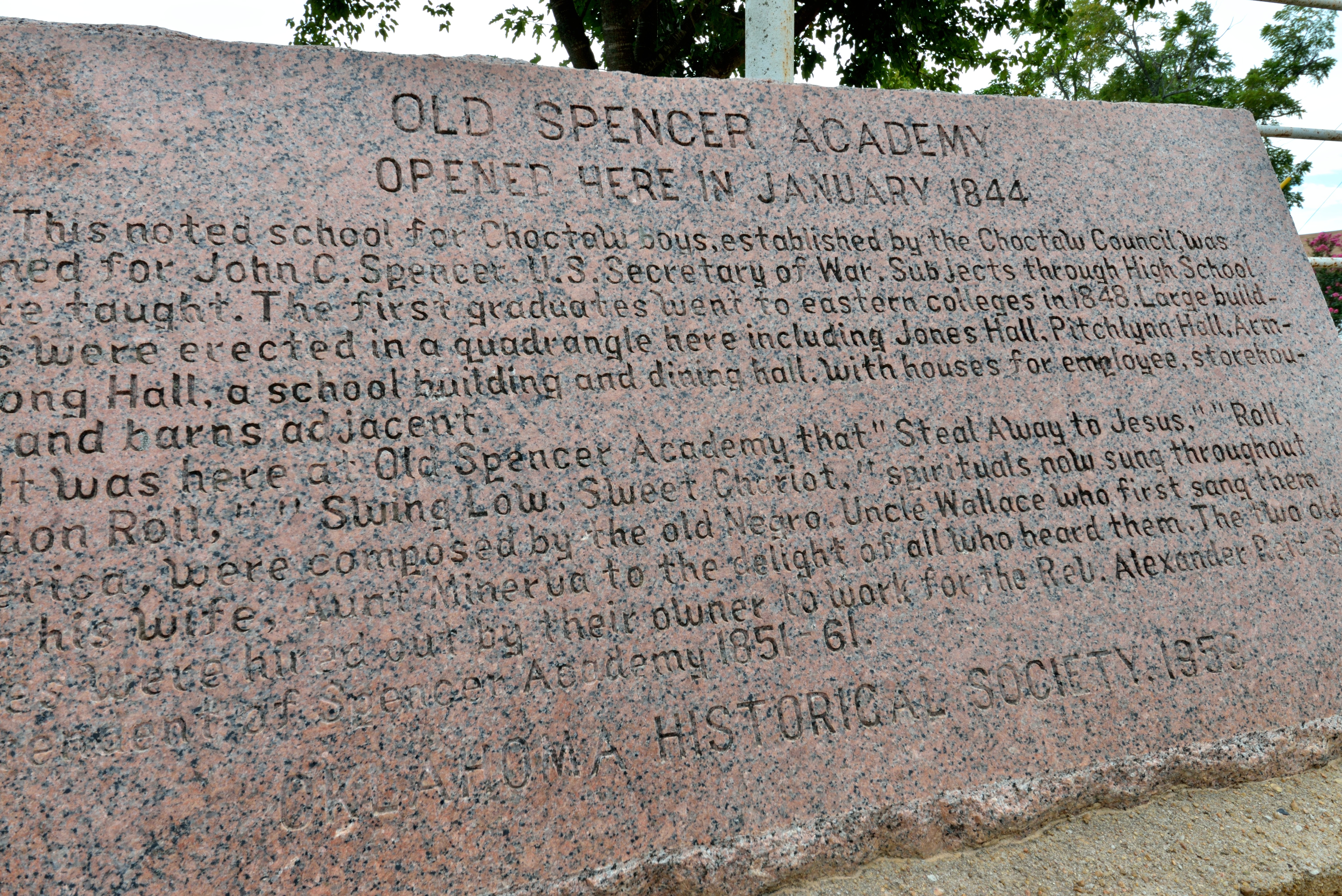
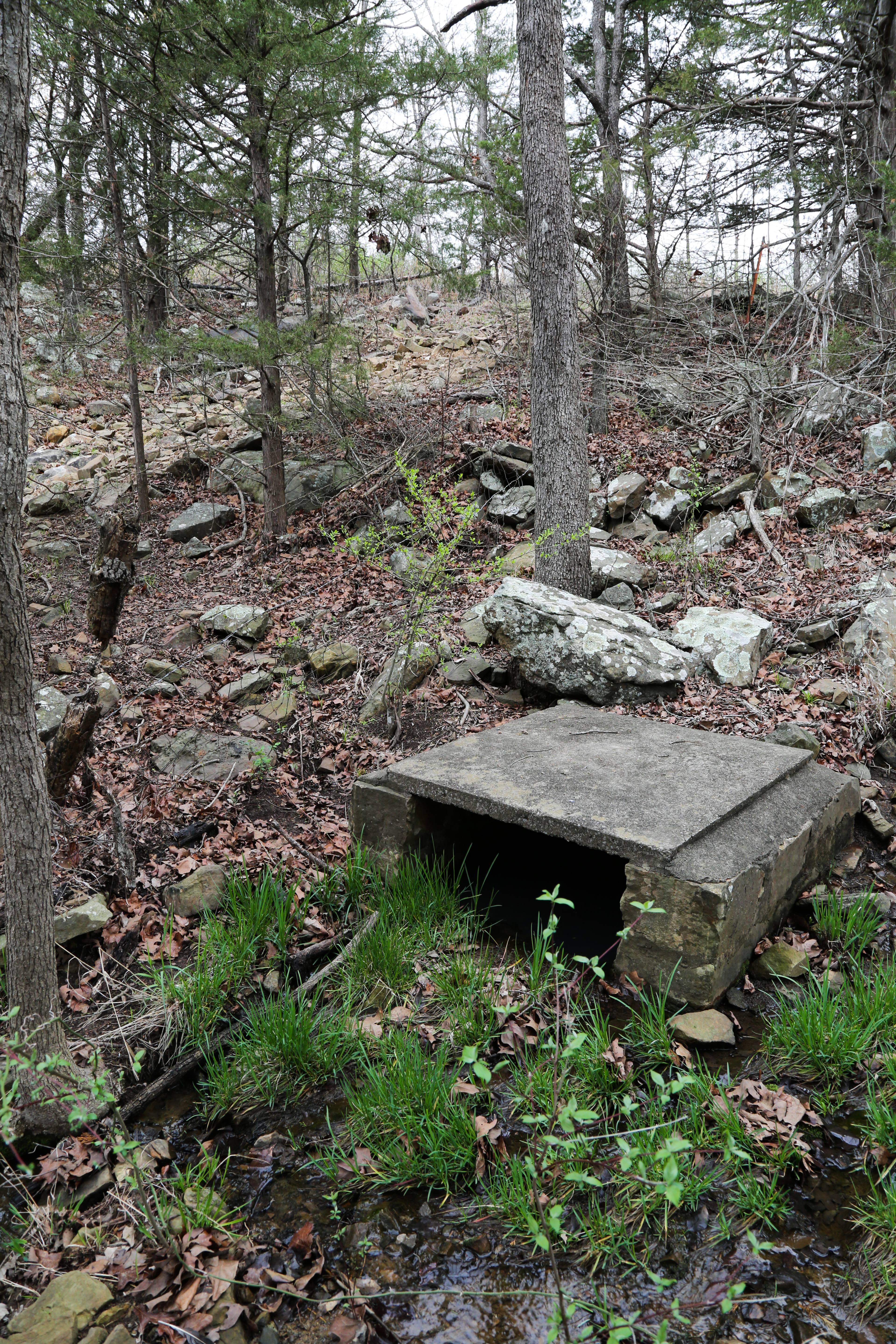
After his traumatic crossing of the Poteau, Averell rode about four miles to Skullyville. Walker’s Station, the easternmost Overland Mail station on the Indian Territory segment of the Butterfield Mail route, was located there, at the site of the former Choctaw Agency. Tandy Walker, governor of the Choctaw Nation, and soon-to-be commander of the First Regiment of Choctaw and Chickasaw Mounted Rifles for the Confederacy, was the station keeper for the Overland Mail Company.
Things were quiet at Skullyville and Averell continued unchallenged to a fork west of present-day Spiro, Oklahoma, where one branch runs nearly due west toward Fort Arbuckle. This is the same road Captain Randolph Barnes Marcy used for his escort of goldseekers to Santa Fe in the spring of 1849, running along approximately the same route as present-day Oklahoma Highway 31. The other branch, the Overland Mail route, led southwest to Fort Washita. Seeing that Sturgis and his retreating troops had taken the Fort Washita road, Averell took the other branch for a mile to make a false trail, then crossed over to follow Sturgis.
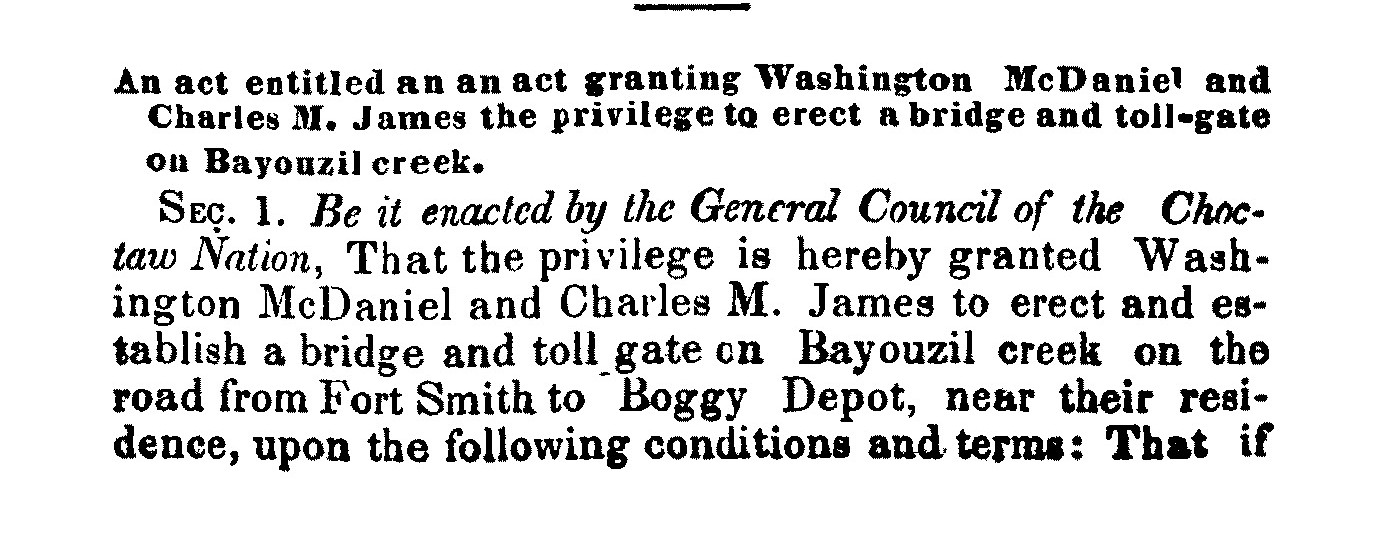
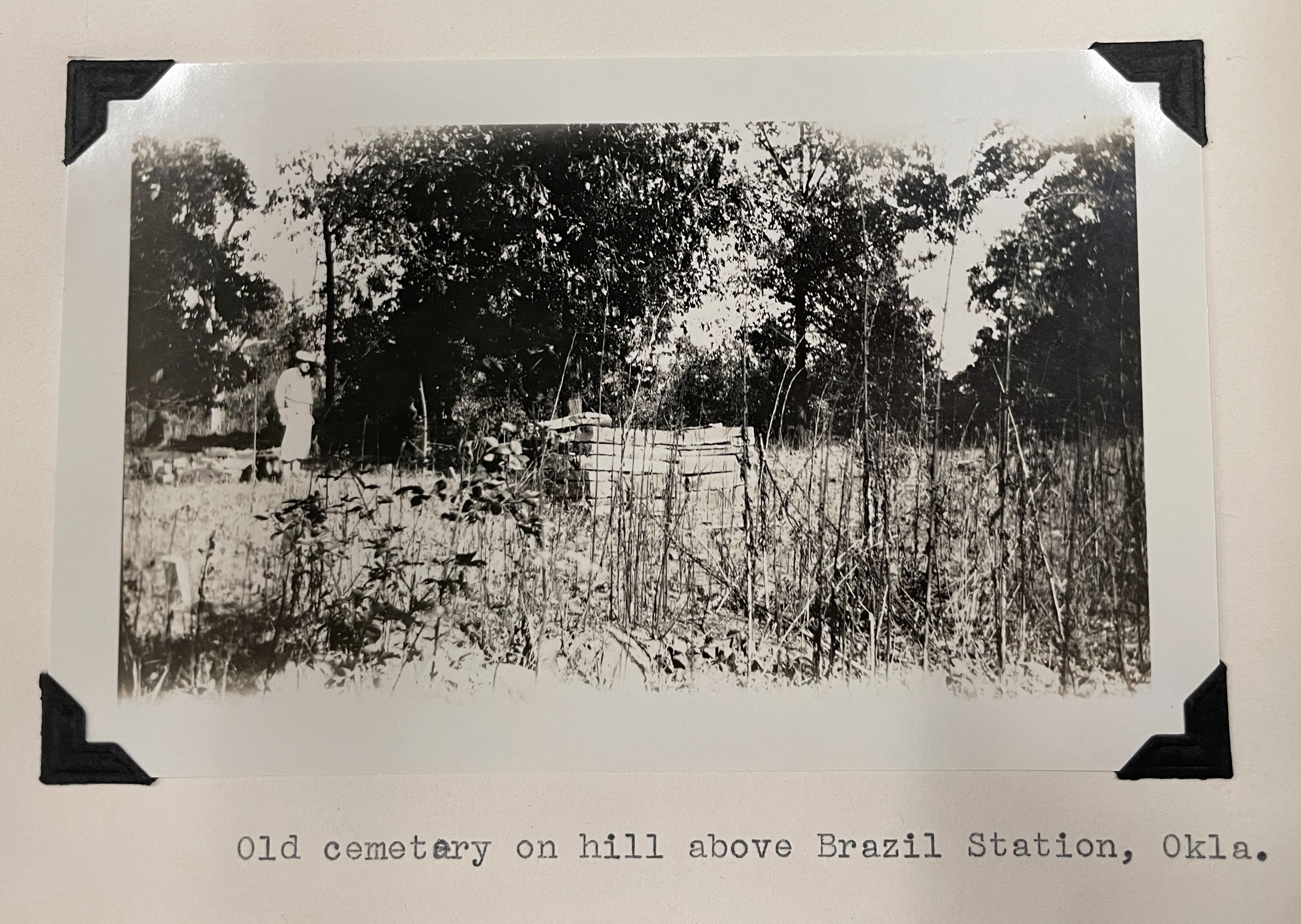
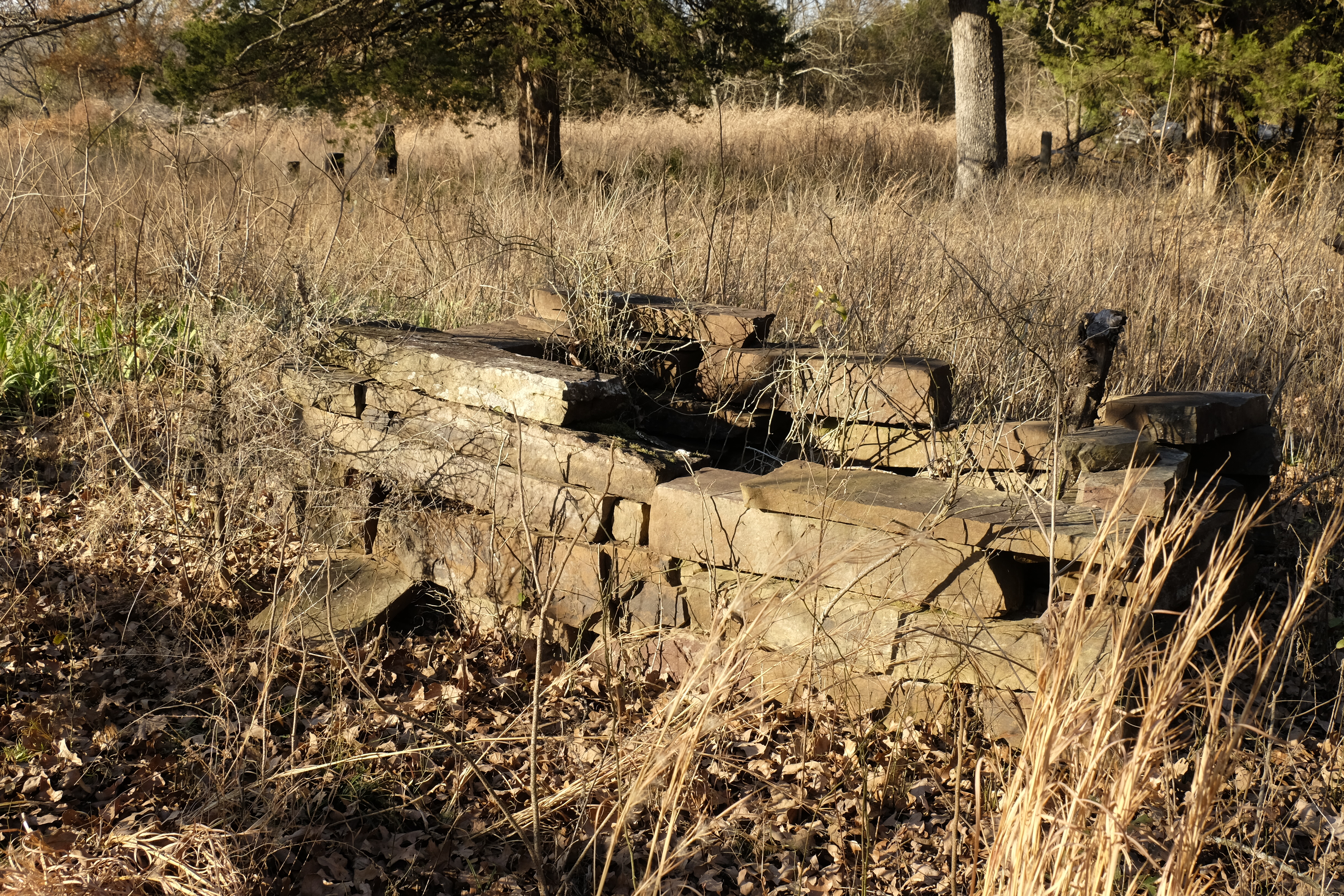
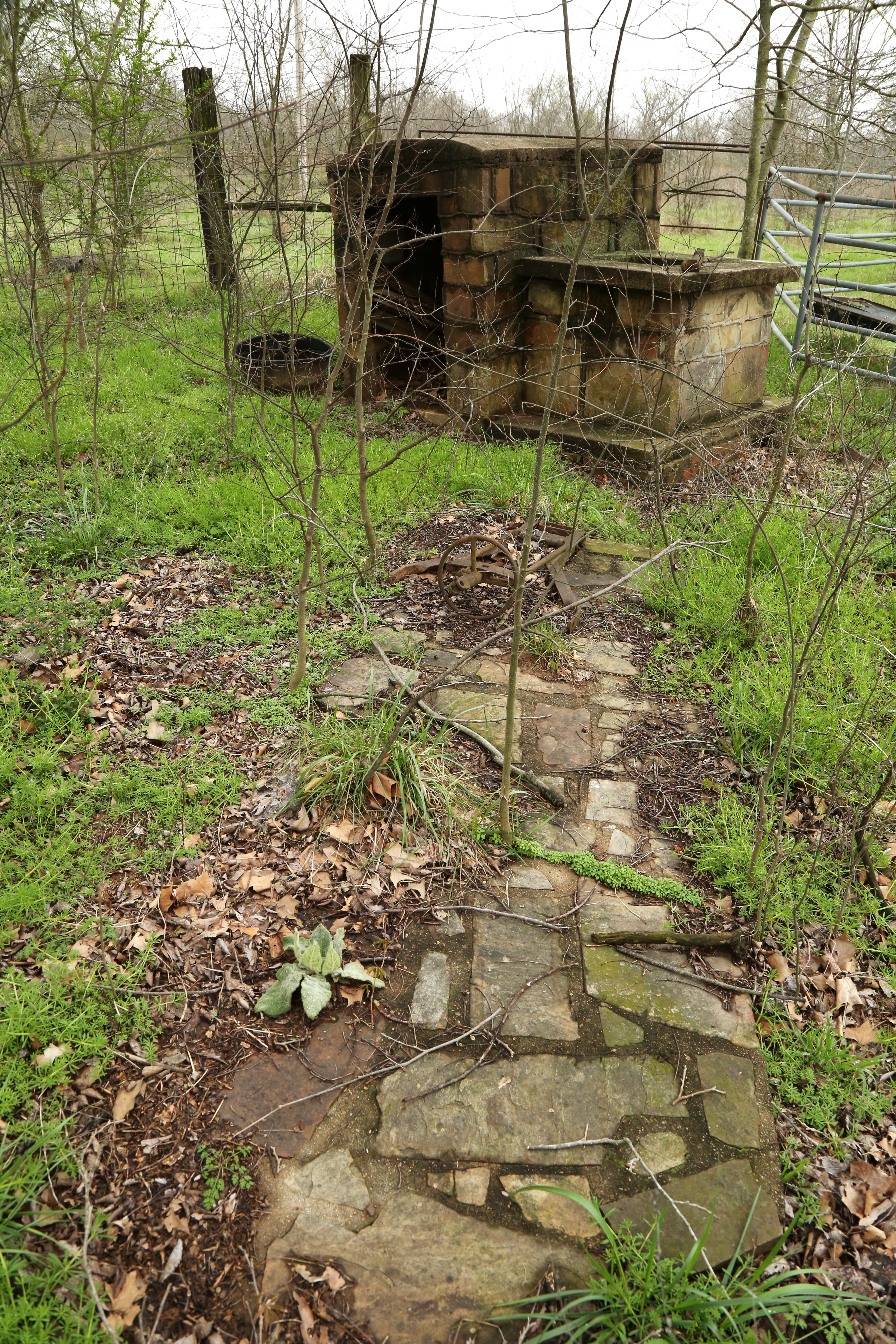
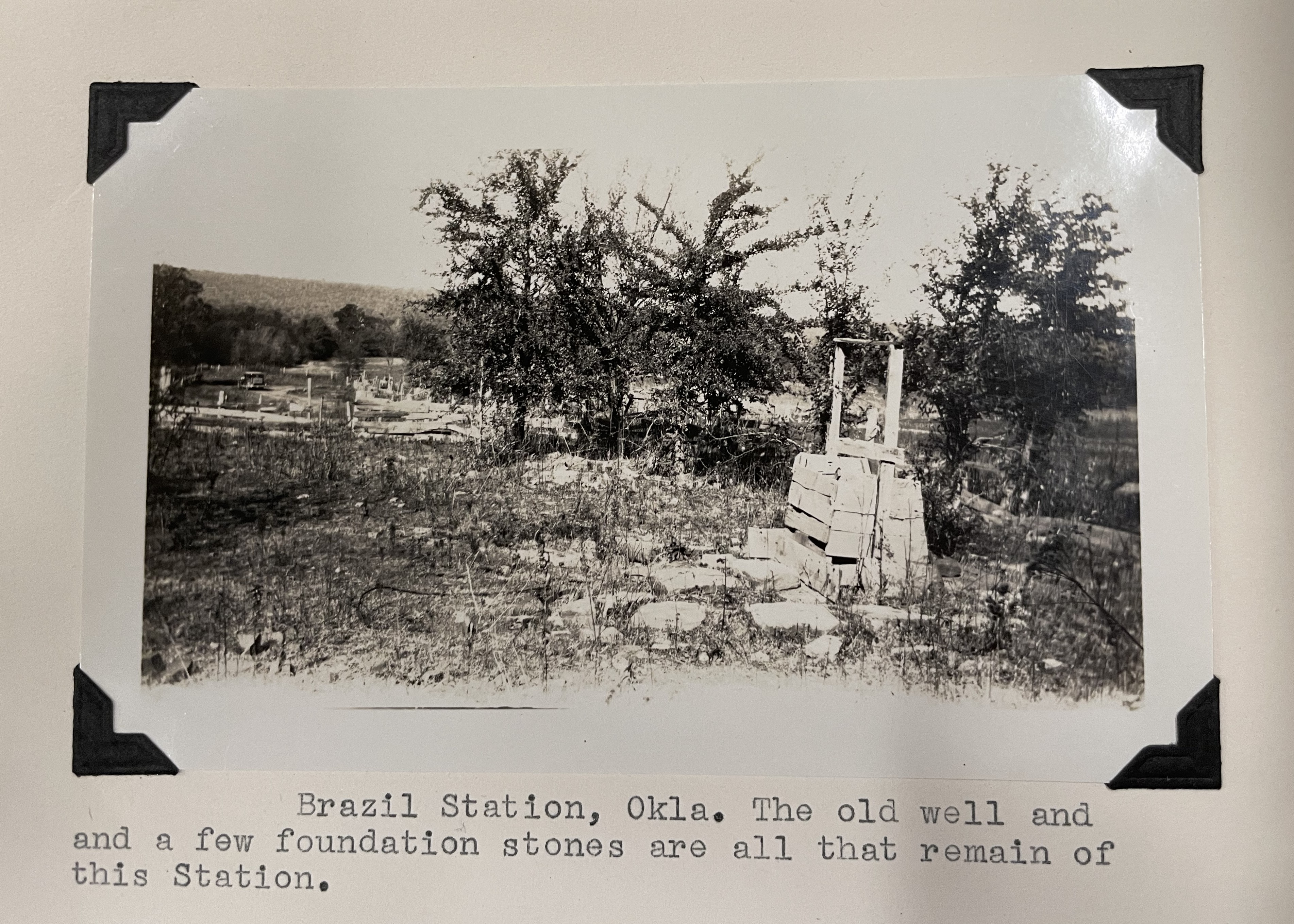
At sunset he stopped to rest at “Daniel’s Station.” This was likely Brazil Station, a settlement near a toll bridge across Brazil Creek operated by Washington McDaniel and Charles James. There Averell bought a soldier’s old blue overcoat for five dollars to replace the one swept away in the Poteau. After a supper of bacon, cornbread and coffee, he resumed his journey when the moon rose at 10 p.m.
“The overland route,” he wrote, “was so well defined that even the night traveler ran no risk of losing his way, but it was awfully lonesome. The Moon’s glimmering light over forest and prairie invested commonplace objects with strange and frightful shapes. Howling wolves responded to hooting owls on every side, while other night birds and beasts lent their strange voice to swell the wild chorus. . . .”
Holloway’s Station
About three in the morning Averell arrived at Holloway’s Station, an Overland Mail station at the Narrows about three miles northeast of present-day Red Oak. A double log cabin on one side of the Overland Mail Road and a corral on the other comprised the facility. He awoke the woman of the house and she directed him upstairs to a hay mattress and blanket on a bedstead of barrel staves laid across two poles. Next morning, Averell awoke from a deep sleep with the sun shining through the cracks in the roof and the sound of rough voices below. Two men “whose villainous countenances were shaded by Texan sombreros,” were asking the woman for Averell’s description, and whether he was armed.
Pulling on his boots, Averell slipped his small pistol into his trouser pocket and boldly joined the trio at breakfast in a lean-to behind the cabin. After breakfast the two men confronted him: “Stranger, where did you start from yesterday?” Assuming a casual tone, he named Fort Smith and told his fiction about the married sister, supposedly awaiting rescue this time at Fort Washita. Averell’s interrogators seemed convinced and asked if he had seen anyone on the road since he left Fort Smith.
“In an instant, the circumstance of my change of overcoats flashed upon me and I made use of it,” wrote Averell. He told them he saw, a few miles back, a horseman ahead of him in a black overcoat who disappeared in the woods as he approached. The rebels agreed this must be the “Yankee spy” they were after.
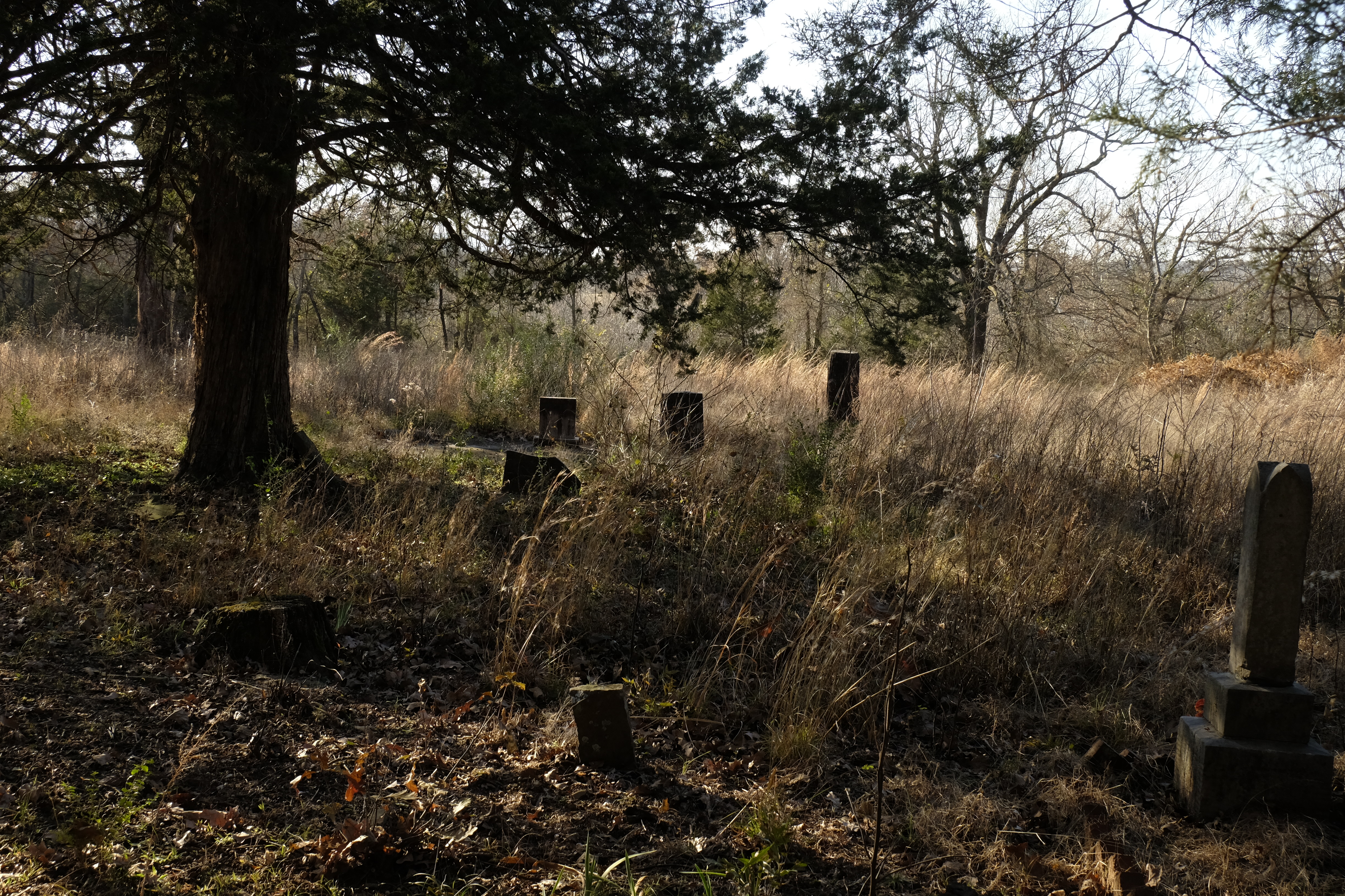
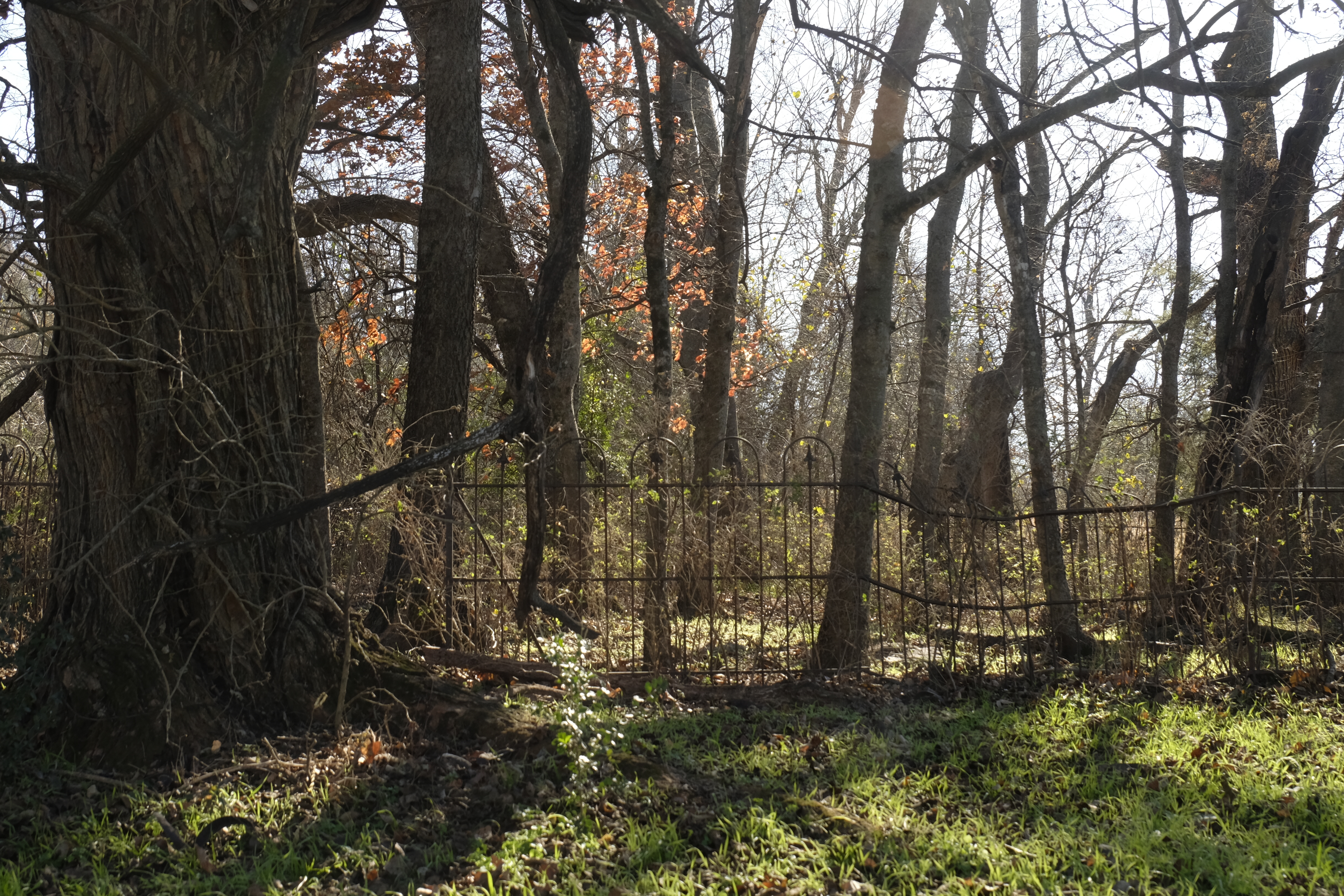
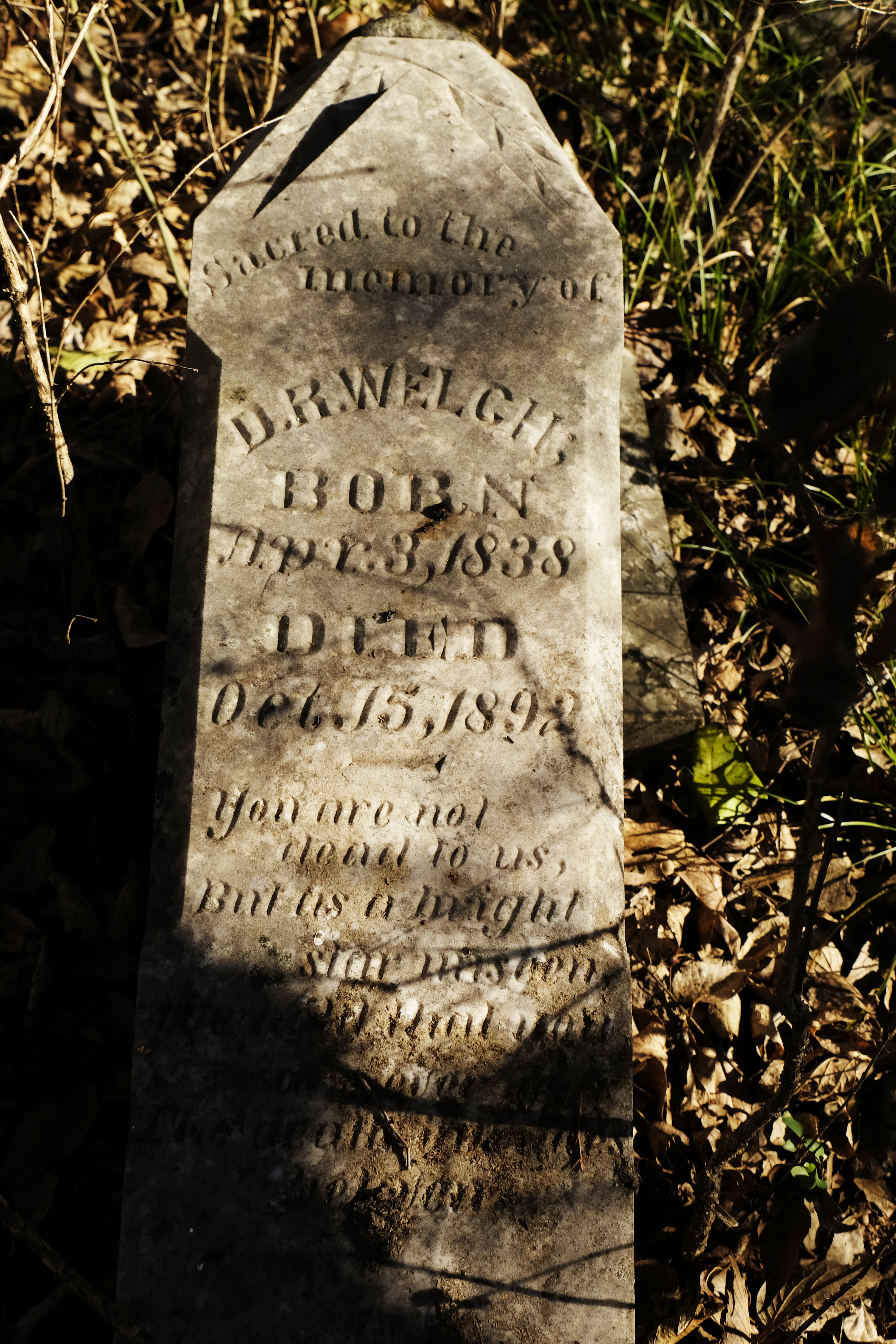
Averell’s pursuers actually numbered four although he had seen only two at this point. The third was still asleep in the cabin at Holloway’s and the fourth had gone on to Riddle’s Station about fourteen miles farther west, to keep watch. Promising to do all he could to help capture the “infernal Yankee,” Averell parted with the men, who gave him a confidential message for their comrade at Riddle’s, located on the eastern outskirts of present-day Wilburton, next to Lutie Cemetery.
For the next eight miles or so the road led through the woods, then entered a prairie about two miles across. On the far side of it, Averell spotted a cabin with smoke rising from the chimney. Staying out of sight, he skirted the prairie, intending to avoid the cabin. He soon saw three of the Texans dashing across the open space, following his intended route. They stopped at the cabin then pushed on, disappearing into the forest. Averell realized that once his pursuers met their fourth member coming back from Riddle’s, his deception would be exposed. He decided to follow their trail until in sight of Riddle’s, then circle around the station and make his escape.
Nearing Riddle’s, Averell encountered a man on foot who had passed the Texans. The friendly stranger warned Averell that the men planned to shoot him on sight. He was then about fifty miles southwest of Fort Smith on the road to Fort Washita and his escape routes were few. Between him and the road to Fort Arbuckle loomed the Sans Bois mountains. They were, and still are, rugged and rocky. Averell described,
. . . their rocky, serrated ridges, which as their name indicates were destitute of woods. The thick and luxuriant woodlands which skirted the northern and southern flanks of the range gradually dwindled into stunted and scattered bushes as the slopes were ascended until finally the bald rocky heights forbade further vegetal encroachment. Where the prairie joined the bottom slopes of the mountains there were frequent swamps and bogs where the wild, luxuriance of vines and undergrowth rendered the forest almost impenetrable, and frequent and deep winding arroyos were found which would bewilder the most intrepid hunter.
Across the Mountains
Near the western end of the mountains there was a cross road, but Averell could not hope to reach that without running into his pursuers. Two miles farther, he saw the horsemen approaching and turned into the woods as fast as he could. A deep ravine full of thickets blocked his way.
Dismounting, I leaped into the arroyo, dragging my horse after me, tearing my way through the vines and bushes to a crevice in the other side up which I climbed pulling out my horse, mounted and was off again. The feat was scarcely accomplished when I heard a demoniac yell that my pursuers had discovered my trail.
Finally, after riding six miles toward the mountains he could no longer hear their calls.
Now his greatest struggle began. Abandoning the Fort Washita Road somewhere between present-day Panola and Lutie, he started north across the mountains toward the Fort Arbuckle Road, a journey of about thirty-five miles according to Averell’s estimate. During that terrible journey across difficult country, he realized it might be “easier to die than to live.”
Climbing in zigzag lines and pulling my horse up steep and lofty ridges with the hope of seeing the prairie on the north when the summit should be reached, I was doomed many times to be disheartened by a view of another ravine and ridge, deeper and higher, yet to be crossed.
The sun was setting and he faced another ridge which it was hopeless to cross before dark but with a final effort he got his horse to the bottom of the valley, finding a small stream of good water and a patch of grass. Stopping there to rest he fell into a deep sleep. On awaking, he found his horse standing over him snorting with terror.
On sitting up and looking around, I perceived we were encircled by hundreds of wolves, gnashing their teeth and howling dismally. On realizing my position, I burst into a hysteric laugh and was startled by the echo of my own voice among the rocks and trees. The coyotes are cowardly wretches and were kept at a respectful distance by a few stones distributed among them occasionally. The dreadfully dismal opera of the night birds was opened and until the moon rose I was lonesome. Down in a deep, dark valley the voices of that night had me at their will. Every cry seemed a hint of horror, and all the shades of gloom were expressed in that howling, shrieking menagerie. The dread of the wolves kept my horse from feeding, and when the moon rose I saddled up and resumed my journey. With the stars for my guide I found it easier traveling than by daylight.
About two in the morning, Averell struck the Arbuckle Road and rode until daybreak. After a few hours’ rest, he resumed the journey, soon overtaking a man driving cattle, who informed Averell about the roads and gave him breakfast of cold corn bread and bacon. Learning that a party of men from Perryville, southwest of present-day McAlester, were out looking for him, he decided to avoid the town and continued cautiously. Perryville was a busy settlement situated along the Texas Road and Fort Arbuckle/California roads. Nearing the town, Averell saw three mounted men approaching. He tried to hide but eventually they saw him and gave chase. He managed to escape, went around Perryville, and turned back south toward the main road.
After another night in the wilderness among the owls and wolves, Averell heard the crowing of a rooster. Following the sound to its origin, he found to his great relief a Chickasaw cabin where he had the “best breakfast (he) ever enjoyed of bacon, corn bread and milk.” A boy then guided him to the Arbuckle Road. He struck it about ten miles west of Perryville, hoping he was now out of reach of his pursuers.
Drawing Near
Averell’s next objective was “Cochrane’s” ranch, a few miles west of present-day Stonewall, on Clear Boggy Creek. Robert Cochran was the sutler of Fort Arbuckle; his ranch was located about forty miles from the fort. Averell arrived at Cochran’s by noon, at first overshooting the ranch by fifteen miles. His horse was played out and the sutler outfitted him with dinner, a horse and an Indian guide. They left the ranch for Fort Arbuckle about two p.m. and rode until late afternoon, when a thunderstorm broke. In the darkness of the storm, “the Indian lost the way and (Averell) lost the Indian.” After wandering for some time he struck the Blue River, ten or twelve miles south and west of present-day Wapanucka. He forded the stream, “with a little swimming in the middle,” and slept on the wet grass on the western bank.
This was May 1. While Averell struggled to reach him with orders from a thousand miles away, Colonel Emory was in the field taking action. That same day, with news of the approach of Texas Confederate forces, Emory ordered the abandonment of Fort Washita. His command marched northwest toward Fort Arbuckle.
On the morning of May 2, Averell awoke with his guide sitting beside him, having rejoined him in the night. They rode on, soon learning that Fort Washita was in the hands of the Texans, and that Colonel Emory with his command was now encamped on the Arbuckle Road only six miles away.
“With my fleet steed and a good will, those six miles were soon accomplished, and it was with an exhultant (sic) heart that I saw my old comrades in arms just forming squadrons for the march . . . .” But his colleagues did not recognize him at first. Delivering his orders to Colonel Emory, who was in the saddle, “looking as grim as a grizzly bear,” Averell introduced himself. “The Colonel’s sour expression changed suddenly to astonishment and . . . lifting his arms, (he) said, ‘My God! Averell, how did you get here?’
Feeling faint, Averell collapsed and regained consciousness in the arms of a colleague, “the doctors giving me something to drink.”
“My mission,” he wrote, “with all its attendant dangers and sufferings, was accomplished. The excitement and sense of responsibility which had hitherto sustained my strength was over also, and for a few days I had to travel in an ambulance.”
Mission Accomplished
The next day, the command arrived at Fort Arbuckle. The day after, May 4, Emory ordered the flag lowered with military honors at Arbuckle and the troops marched north. Gathering the troops from Fort Cobb, they arrived at Fort Leavenworth, Kansas, on May 31. “Not a man, an animal, an arm, or wagon has been lost except two deserters,” reported Colonel Emory.
Returning to Washington, Averell was disappointed with the reception he received at the War Department when he delivered dispatches from the frontier, which were considered “of no consequence whatever.” Clearly, the U.S. Army had greater concerns elsewhere in June of 1861.
Averell did get some attention in the press, however. The Philadelphia Inquirer of June 3, 1861 announced Averell’s return from the Indian Nation with the news that Colonel Emory and all of his troops had arrived safely at Fort Leavenworth. Averell’s exploits in reaching Emory were reported in some detail there and on June 9 the Cincinnati Enquirer highlighted his “Daring Exploit” on page one. “One of the most arduous, skillful and gallant exploits, performed in this or any war, . . . was that achieved by Lieutenant Averell.”
Averell later served as a general in the Union Army during the Civil War and in postbellum life was a diplomat, inventor and entrepreneur. He died in Bath, New York, in February, 1900.
Read more about the Butterfield Overland Mail stagecoach route through Indian Territory here: https://susandragoo.com/butterfield-oklahoma/
Sources
This writer first discovered Lt. Averell’s story in Muriel H. Wright’s article in the Chronicles of Oklahoma, Lieutenant Averell’s Ride at the Outbreak of the Civil War, Spring 1961, Volume 39 No. 1, 2-14. https://gateway.okhistory.org/ark:/67531/metadc2123780/
I was then informed by my friend June Chubbuck of the existence of Averell’s memoir: William Woods Averell, Ten Years in the Saddle, The Memoir of William Woods Averell, 1851-1862. Edited by Edward K. Eckert and Nicholas J. Amato. This highly readable memoir is also highly dramatized, i.e. “hundreds of wolves, gnashing their teeth and howling dismally.” I have used it liberally for this article, embellishment and all, so keep in mind that a grain of salt may be warranted.
I subsequently located Averell’s official report to the War Department, also a major source for Muriel Wright. It is more straightforward than the memoir but upholds the harrowing nature of Averell’s journey. See his report below.
United States Congress. House, Publisher United States Government Publishing Office, Author United States Congress. House, and United States War Department. War of the Rebellion: A Compilation of the Official Records of the Union and Confederate Armies. Supplement; January – June 1865; Series 1, Vol. 53, Chapter 65. [Washington, D.C.: U.S. Government Printing Office, 1898] Pdf. https://www.loc.gov/item/2024854157/. Pp 493-496
Other sources (not intended to be a formal bibliography) are as follows:
Dragoo, Susan. “Notes and Documents: Beale’s Wagon Bridge Artifact Uncovered.” Chronicles of Oklahoma Vol. 101 No 3. Fall 2023, 342-345. https://susandragoo.com/wp-content/uploads/2023/12/beales-wagon-road-chronicles-1.pdf
Faber, Cody. “Abandonment of Fort Smith.” Encyclopedia of Arkansas. https://encyclopediaofarkansas.net/entries/abandonment-of-fort-smith-6640
Faulk, Odie B.; Franks, Kenny Arthur, & Lambert, Paul F. Early Military Forts and Posts in Oklahoma. https://gateway.okhistory.org/ark:/67531/metadc862897/.
Jon D. May, “Leased District,” The Encyclopedia of Oklahoma History and Culture. https://www.okhistory.org/publications/enc/entry?entry=LE002.
May, Jon D. “Perryville,” The Encyclopedia of Oklahoma History and Culture. https://www.okhistory.org/publications/enc/entry?entry=PE020.
Messer, Carroll J. “Beale Wagon Road to the Pacific Coast. Western Camel Road and Eastern Iron Bridge Road,” 2021. Texas A&M University, College Station. https://oaktrust.library.tamu.edu/handle/1969.1/194898
Milligan, James C. & Norris, L. David. “Keeping the Peace: William H. Emory and the Command at Fort Arbuckle.” Chronicles of Oklahoma Vol. 69 No. 3. Autumn 1991, 256-281. https://gateway.okhistory.org/ark:/67531/metadc2031662/.
Norris, L. David. “Emory, William Hemsley,” The Encyclopedia of Oklahoma History and Culture. https://www.okhistory.org/publications/enc/entry?entry=EM001.
Tinsley, Bill. “Remembering Stonewall, Pontotoc County, Chickasaw Nation.” Chronicles of Oklahoma Vol. 76 No. 4. Winter 1998-99, 436-449. https://gateway.okhistory.org/ark:/67531/metadc2031858/.
Trickett, Dean. “The Civil War in the Indian Territory, 1861.” Chronicles of Oklahoma Vol. 17 No. 3. September 1939, 315-327. https://gateway.okhistory.org/ark:/67531/metadc2192137/.