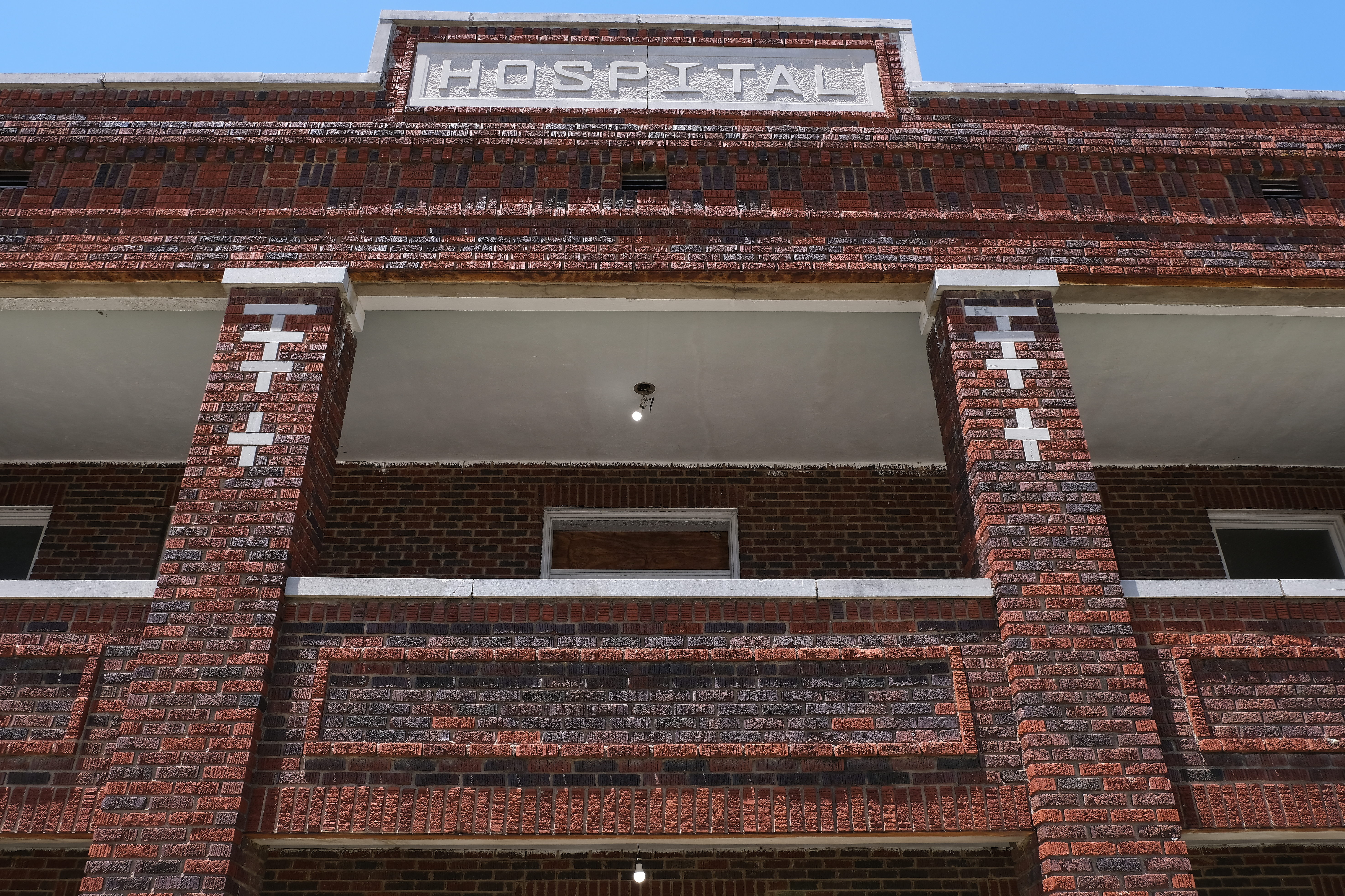
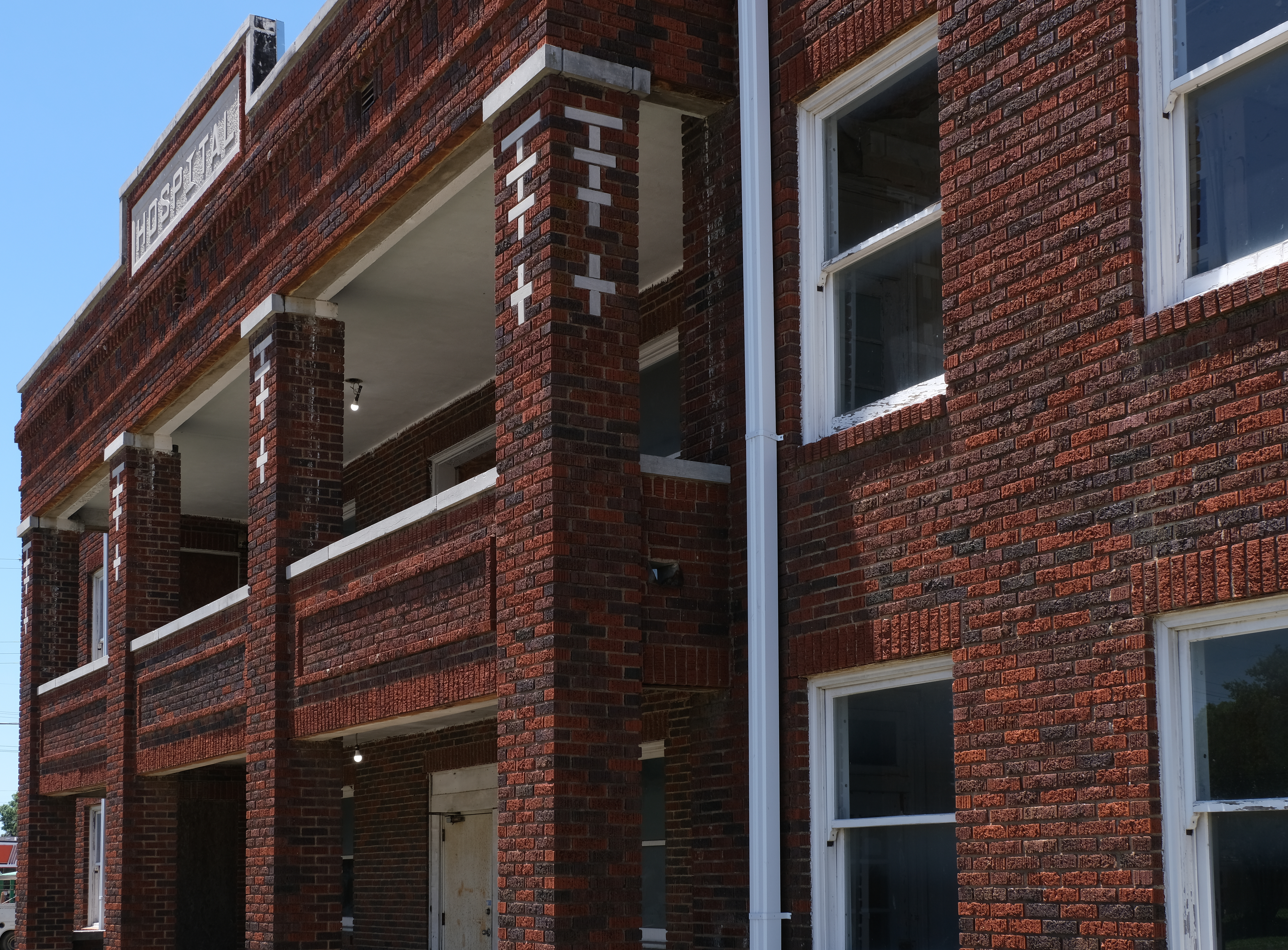
In the early twentieth century segregation touched every facet of life, including health care. Okmulgee’s African American community came together in the 1920s to build a hospital providing care to many who could not afford it. With the advent of integration the Okmulgee Colored Hospital closed its doors, but it has retained its historic integrity as the only Black hospital still standing in Oklahoma. Read my article on the history of the institution and its impact on the surrounding area, as well as the efforts of community leaders to rehabilitate the site for future use.in the latest issue of The Chronicles of Oklahoma (Volume XCIX, No. One, Spring 2021):
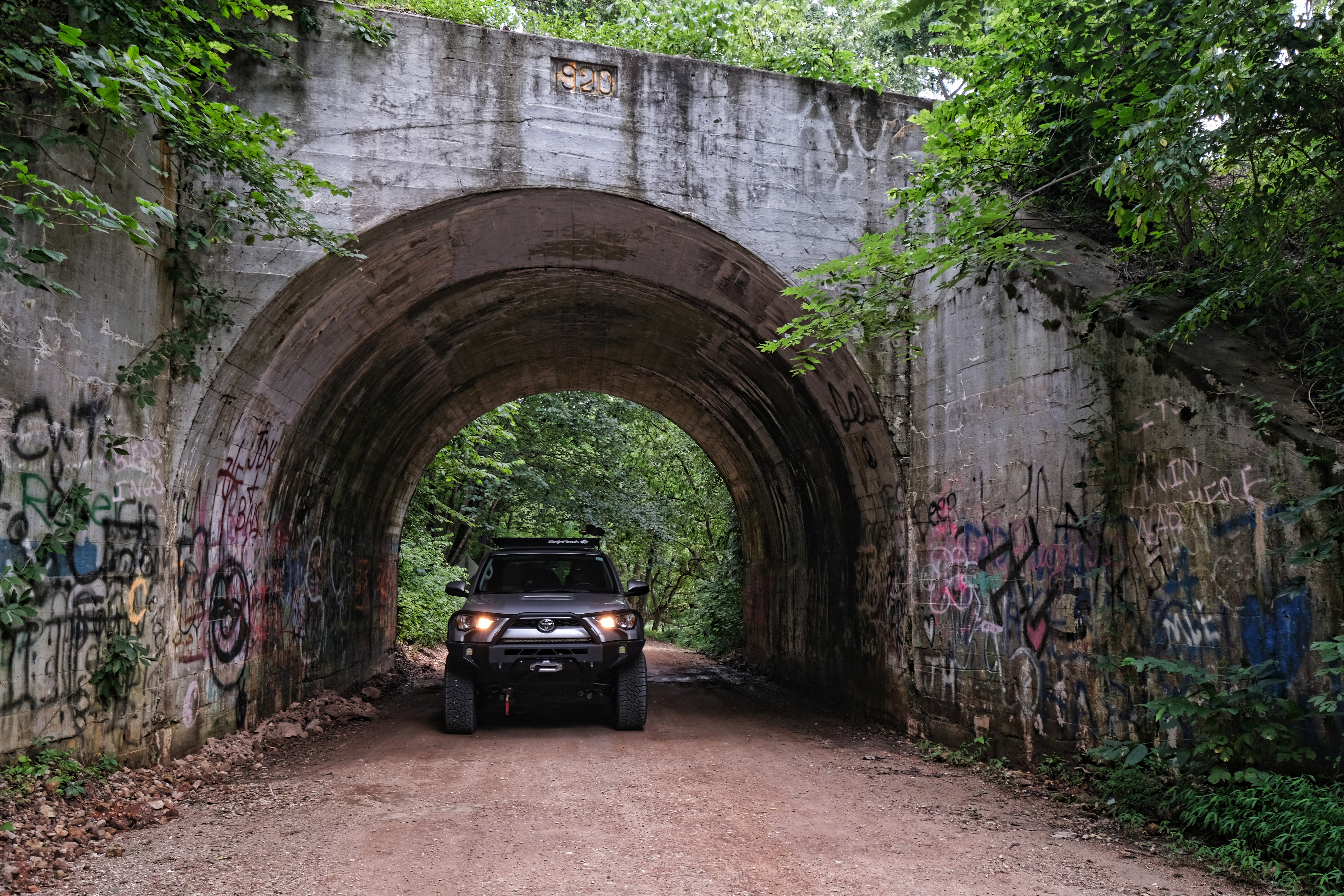
Nice work by author and photographer Travis Monroe, photographer Jake Dragoo, and of course Bill Dragoo, and a few of my photos too, in “The Long Road Home,” featured in OutdoorX4, Issue 38:
Two new OutdoorX4 articles are now available on my blog: A Day and a Night in Chaco Canyon, and a build article that Bill wrote and I photographed about our Toyota 4Runner, with images from our trip on the California Backcountry Discovery Route.
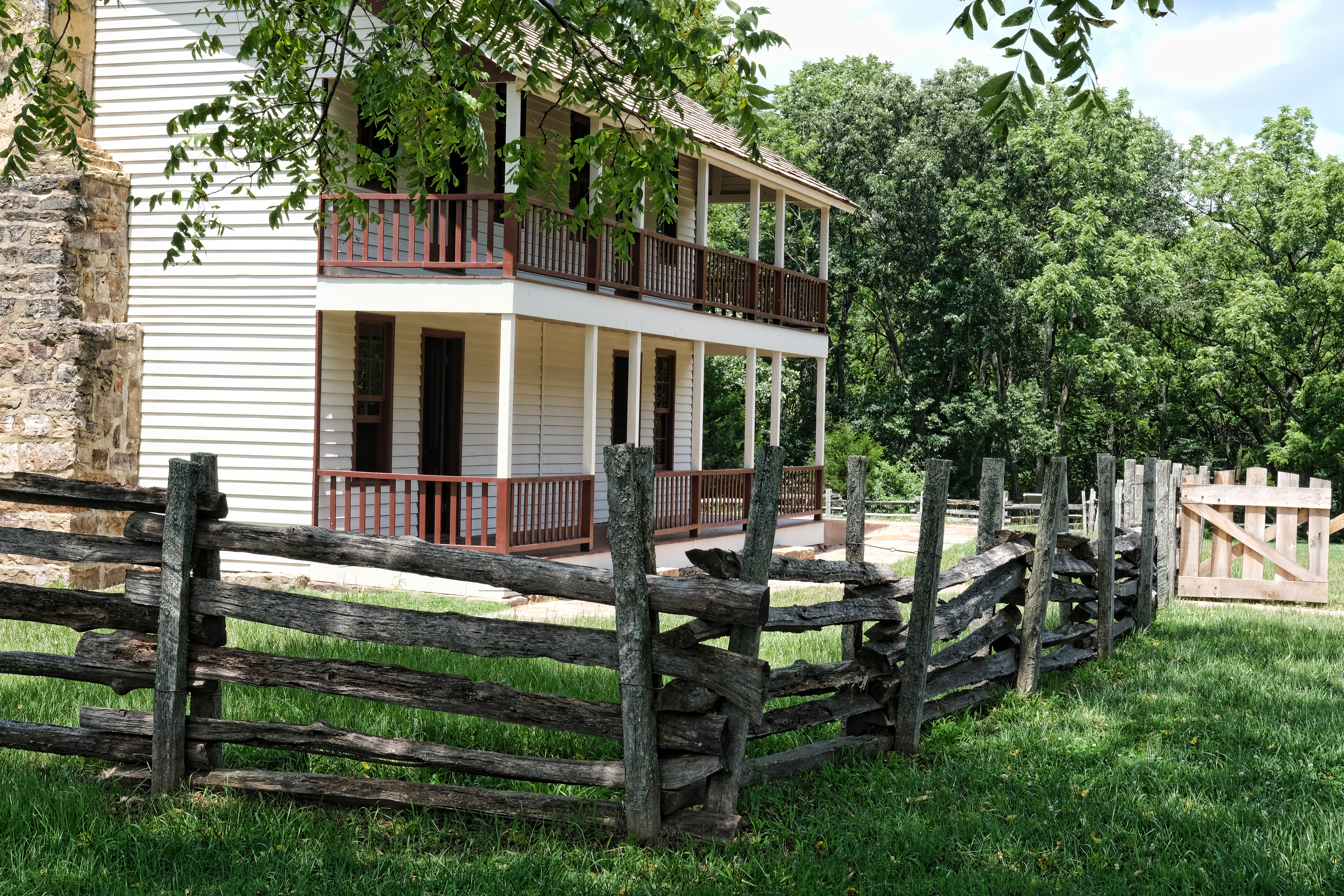
Above: Elkhart Tavern is situated on Old Wire Road in Pea Ridge National Military Park. Before Old Wire was associated with the telegraph, it was used by the Butterfield Overland Mail stagecoaches on their route.
Elkhorn Tavern sits along Old Wire Road in Pea Ridge National Military Park in northwest Arkansas. According to the National Park Service, the battle fought at Pea Ridge was the most pivotal Civil War battle west of the Mississippi River and Pea Ridge is one of the most intact Civil War battlefields in the United States.
According to Roscoe and Margaret Conkling, authors of The Butterfield Overland Mail, 1857-1869, the definitive work on retracing the Butterfield stagecoach road and published in 1947, Elkhorn Tavern was established directly on the old post road nearly two decades before the advent of the Butterfield. It was a popular stopping place for travelers and the stagecoaches would stop there to take on or discharge passengers, but the tavern was never reported as a Butterfield station.
The first log tavern was built by William Reddick around 1834 and he adorned it with an enormous pair of antlers from an elk killed by a neighbor. During the Civil War the tavern was burned, but was rebuilt soon after the war’s end. During the war the antlers had been removed and sent to New York City but were later recovered and, when the Conklings visited in the 1930s or 1940s, the elk horns adorned the gable of the tavern. After the acquisition of the site by the National Park Service (NPS) in 1960, the structure was restored to its approximate wartime appearance. According to the NPS, the present building is a reconstruction; elk horns still adorn its gable but whether they are original is unclear.
I first visited Pea Ridge and Elkhorn Tavern more than 40 years ago. At the time, I would have learned that prior to the Civil War and the extension of the telegraph line through the area, the road known as “Old Wire” was used for the Butterfield Overland Mail stagecoach road. But the information about the Butterfield didn’t mean much to me then. I was, however, fascinated with the history of the place and recall reading Douglas C. Jones’ historical novel, Elkhorn Tavern, with great enjoyment.
For the past 20 years, my parents have had a home on Beaver Lake just a few miles from Pea Ridge. I’ve been back to Pea Ridge several times for casual visits. In the past four years I’ve begun to make the Butterfield Overland Mail stagecoach road in Indian Territory a focus of my research and writing, but it hadn’t occurred to me before now that the Arkansas segment of the Butterfield was right in my own back yard. Our route back and forth from Oklahoma to visit my parents runs very close to the Butterfield trail and the northernmost segment of the stagecoach road is within minutes of their house near Garfield.
This year (2019), Bill and I were visiting the lake for July 4th and on our way we picked up a segment of the Butterfield on the north end of Rogers, where it is named Arkansas Street. As it runs north along the east side of the railroad tracks, it becomes Old Wire Road. We diverged from the Butterfield at Avoca, but later in the holiday I had a bit of extra time, so I took my mother, Jane Morgan, along with me to drive the segment north of Pea Ridge battlefield.
From Highway 62 in Garfield, we took Alvin Seamster Road north. This road runs along the eastern perimeter of Pea Ridge National Military Park and becomes an unpaved road as it turns west, then curves northwest to connect with Old Wire Road, which was the Butterfield road. The canopied dirt road provides a pleasant tunnel of time travel, and it was easy to imagine meeting a stagecoach coming up the hill as we dropped down into the hollow.
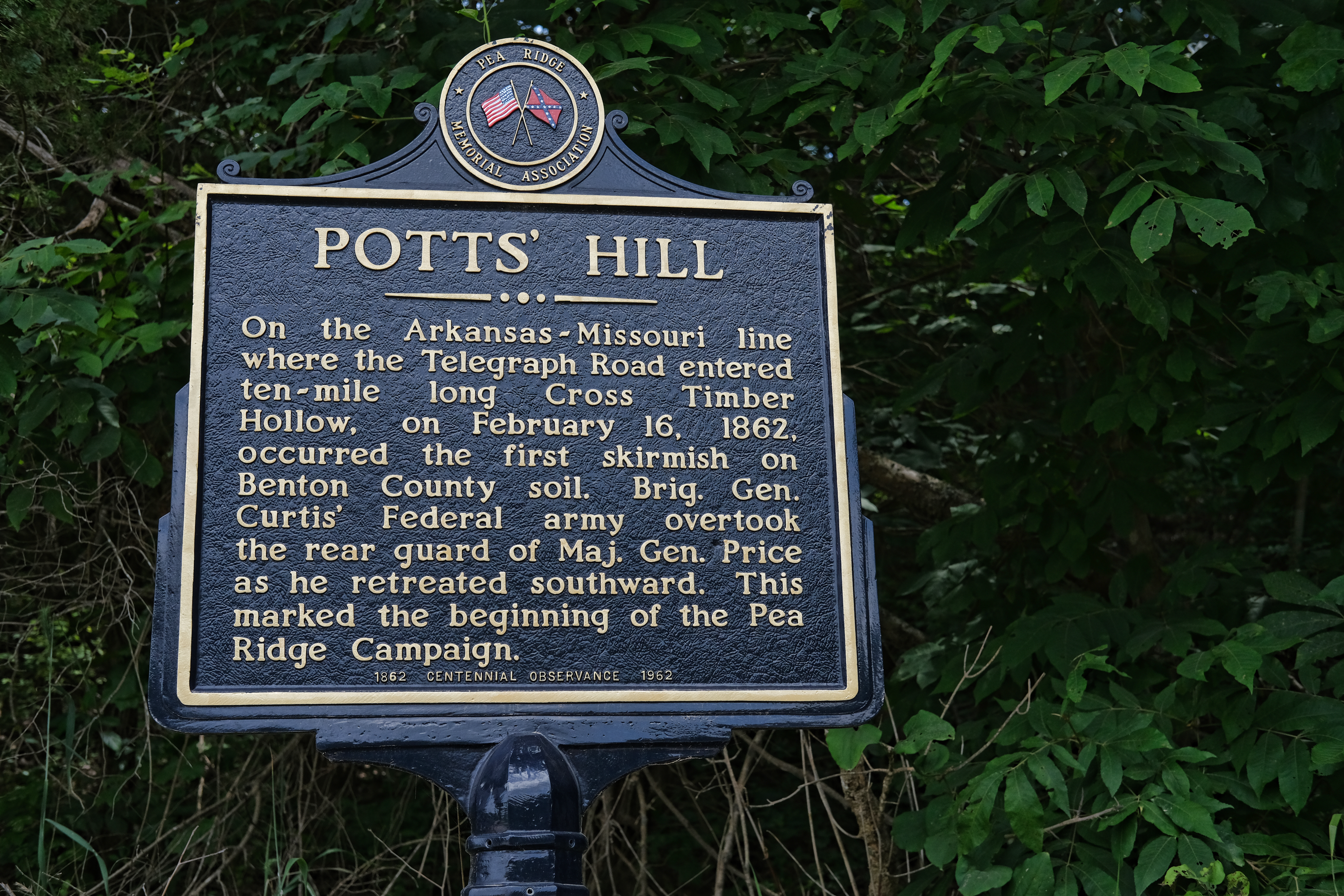
We soon reached the Missouri border (because it is just 3 1/2 miles from Elkhorn Tavern to the border) and found the marker for Potts’ Hill, where a skirmish on February 16, 1862 marked the beginning of the Pea Ridge campaign. We turned around and drove back toward Highway 62, now realizing we were in the ten-mile long Cross Timber Hollow mentioned on the marker, also referred to as the “narrow little valley of the south branch of Big Sugar creek” by the Conklings. This stream is now shown on maps as Little Sugar Creek.
Back at the Pea Ridge battlefield, we took the scenic loop around the park, part of which is on Telegraph/Old Wire Road. One stop marks the route of the Trail of Tears, which followed Old Wire Road here. The trace of the old path is still visible through the forest, but July is not the time to explore the woods of Arkansas. Chiggers, ticks, and poison ivy make that something a prudent person would likely avoid. And I am generally a prudent person (though some would argue the point).
Likewise, there is a hiking trail extending north from Elkhorn Tavern on the Butterfield road but exploring that must wait until fall or winter. Elkhorn Tavern itself has recently been refurbished and opened to the public. A historical interpreter named Vic told us about the building, including the fact that the fireplace on the south end is, he said, original. Fleur de lis on each corner of the stone fireplace indicate it was brought from Saint Louis, he added.
The next day as Bill and I left for home, we drove another segment of the Butterfield on Old Wire Road, starting just west of the national military park and turning south off Highway 62. There are a couple of places signed “Old Wire Road,” but one of them is a dead end. Highway 62 was recently re-located, creating some disconnects in the old road. The Old Wire Road west of Battlefield Road is the proper turn, and we drove southwest there, intersecting Sugar Creek Road briefly, where we came upon an impressive stone train trestle over Little Sugar Creek. Old Wire Road connects to Sugar Creek Road again just to the west, and continues to Avoca, going through another railroad bridge, this of 1920 vintage, on the way.
I’m eager to see more of Arkansas’ segment of the Butterfield Overland Mail road which, unlike Oklahoma’s segment, is actually on my way to somewhere. How convenient.
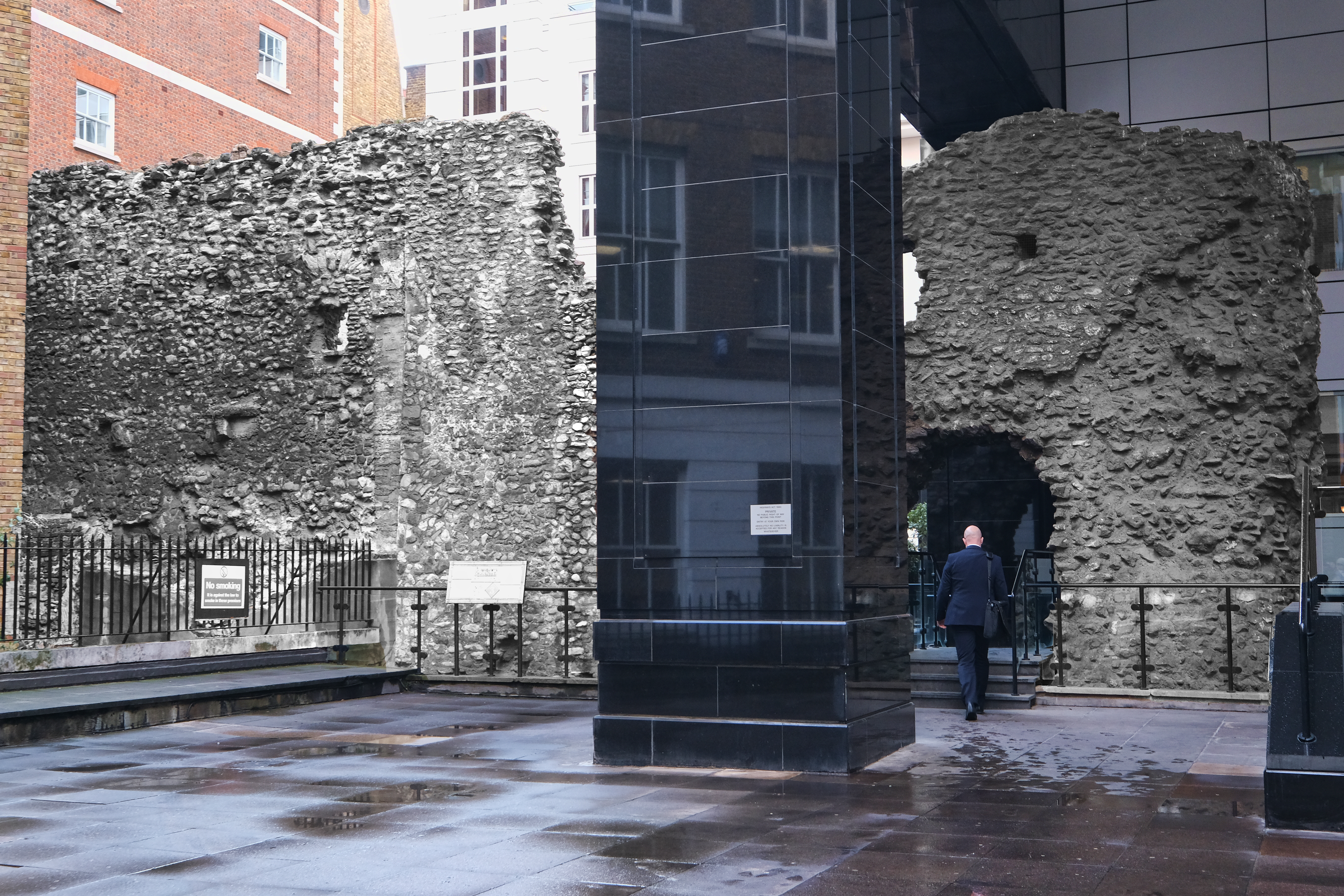
Photo Above: On Tower Hill, this section of the City Wall stands at a height of 35 feet, with the Roman work surviving to the level of 14 1/2 feet, and medieval stonework above. The Tower of London is visible in the distance.
With a week in London, one can barely scratch the surface of all there is to see. Bill and I were there in April of this year, and it was my first time in England. My priority was visiting prominent historical sites like the British Museum and the Tower of London, but also exploring some of London’s less-known ancient Roman sites, including the London City Wall and the London Mithraeum. Unlike the more popular tourist sites, these were uncrowded and we could explore in relative solitude.
London Wall Walk
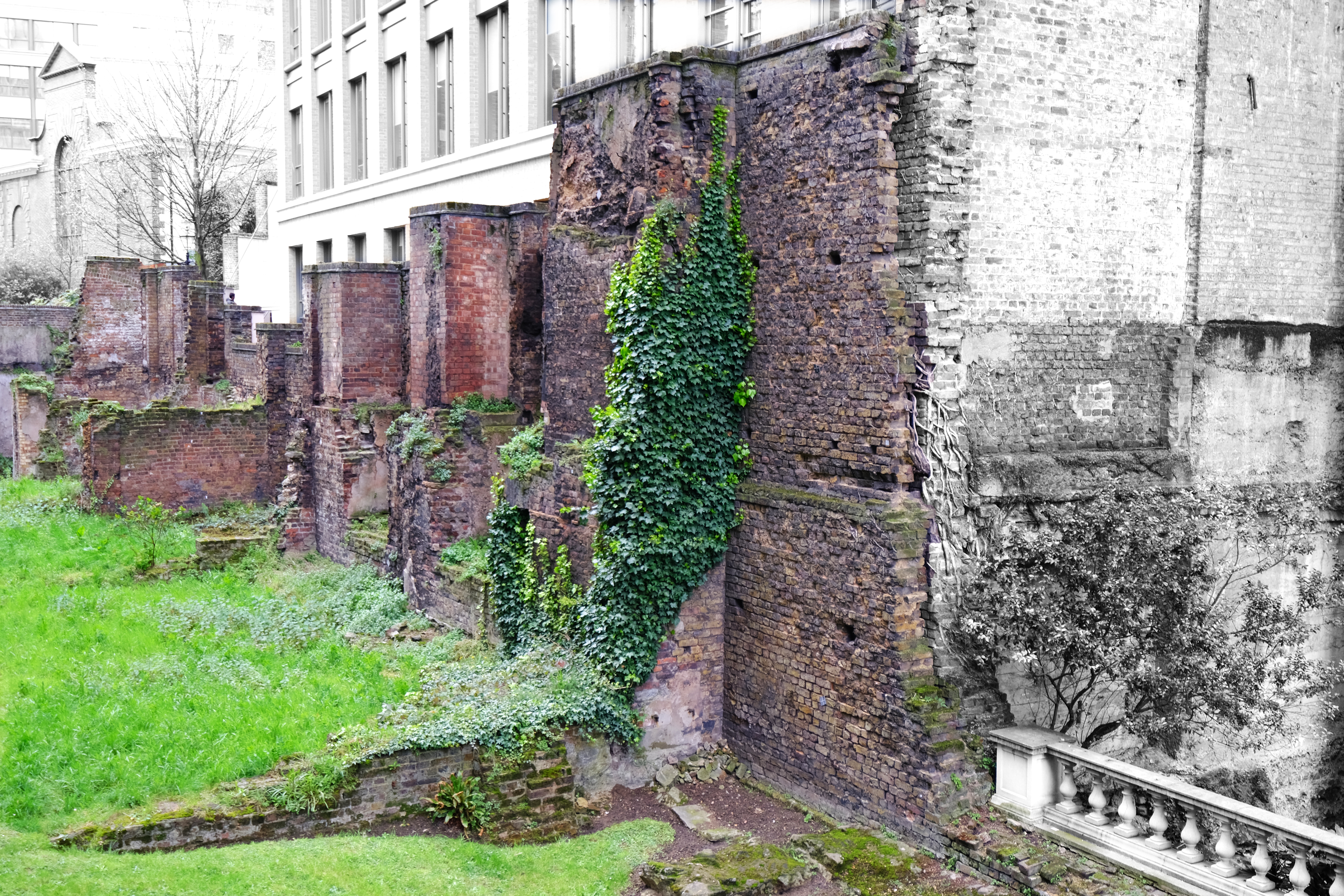
London was founded circa 48 A.D., a few years after the Roman Conquest in 43 A.D., and was originally called Londinium. Around 200 A.D., the Romans built a wall of stone to defend the city. After the Romans, during the Saxon period (the early fifth century A.D. to 1066), the wall fell into decay, but from the 12th to 17th centuries sections were repaired or rebuilt. As London expanded, the wall was no longer needed for defense and parts of it were demolished in the 18th century. By the 19th century most of it had disappeared. Only recently have several sections become visible again.
The London Wall Walk follows the line of the City Wall from the Tower of London to the Museum of London. It is 1 3/4 miles long and marked by 21 panels which can be followed in either direction. We visited several sections of the wall along this path and captured a few images.
The Cooper’s Row section of the City Wall survives to a height of 35 feet (black and white in this image). The lower section, at 14 1/2 feet, is Roman.
Noble Street Wall (color in this image, with the background black and white), near the Museum of London.
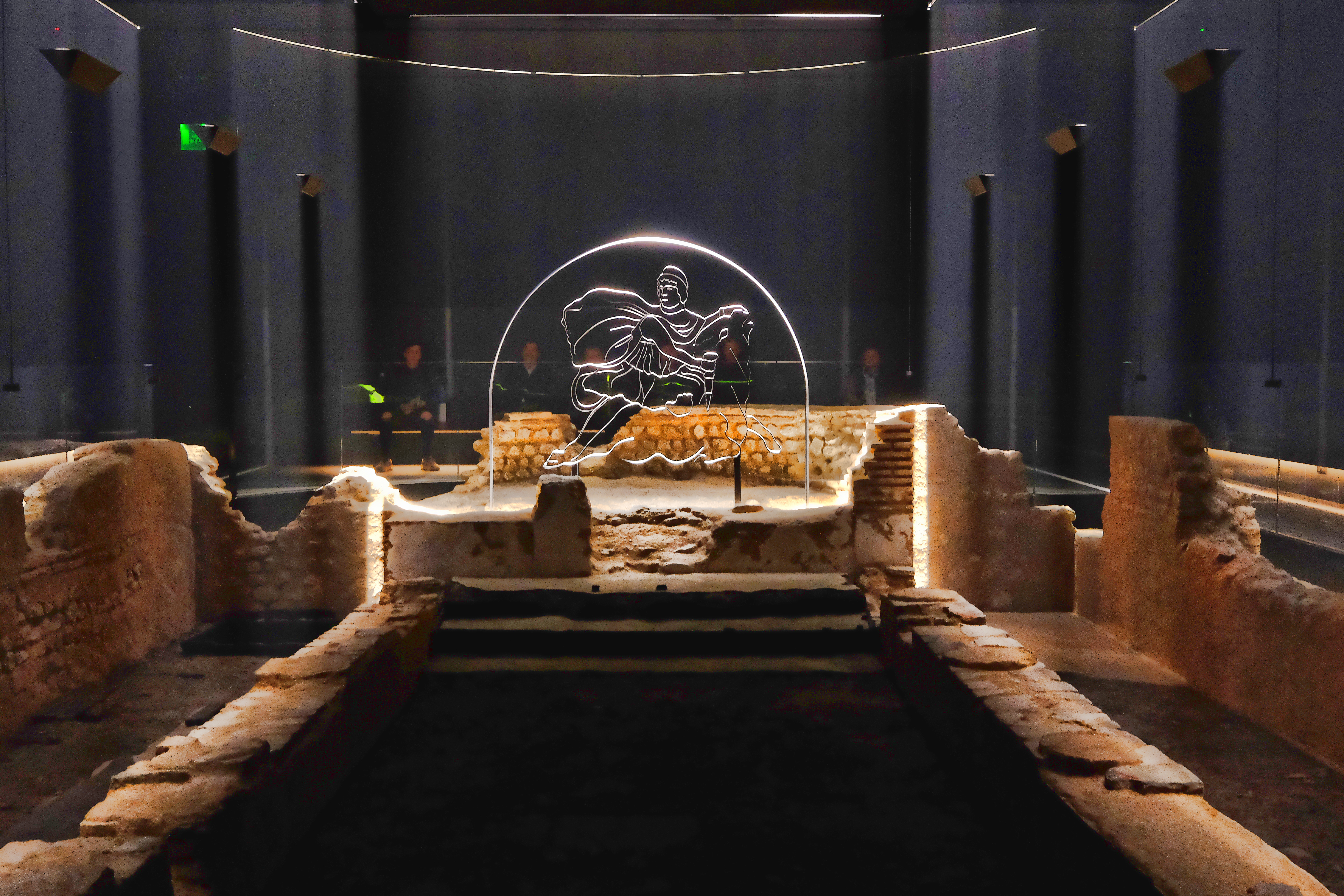
Some Romans were worshippers of the god Mithras. Theirs was a secret cult. The temples of Mithras were in underground caves and featured a relief of Mithras killing a bull. It was believed that from the death of the bull sprang new life. The idea of rebirth was central to the myth of the Mithraic Mysteries, as it is called.
Multi-media representation of the Temple of Mithras amid the ruins of the temple itself in the London Mithraeum Bloomberg SPACE.
The Temple of Mithras in the City of London was discovered in 1954 during excavations of areas of the city destroyed in the Blitz during World War II. Built of clay bricks and stone around 240 A.D., it was made to resemble the mythic cave where Mithras killed the bull and so was windowless and dark. Around 310-320 A.D., it may have been taken over by the followers of Bacchus and was abandoned in the 5th century as Londinium itself began to be abandoned.
Since 1954, the temple had been moved from its original site, but now the London Mithraeum Bloomberg SPACE has returned it to that location. Beneath Bloomberg’s European headquarters, the Mithraeum showcases the ancient temple and a selection of Roman artifacts found during excavations.
(Image above is Brazil Creek near the Council House site)
How slowly the scales fall from my eyes as I try to see into the past, the obscurity of the obvious sometimes clearing and other times going completely dark as I seek the truth in this landscape aged 200 years. Both extremes, along with the continuing emergence of questions likely to remain unanswered, are the result of my four visits to the site of Trahern’s Station.
Named for station keeper Judge James N. Trahern, the second station on the Butterfield Overland Mail’s Indian Territory itinerary was located seventeen miles southwest of Walker’s in the community now known as Latham, in LeFlore County. It was also called “Council House,” the namesake structure being the residence of Choctaw district chief Moshulatubbe.
Chief Moshulatubbe was one of the signers of the 1830 Treaty of Dancing Rabbit Creek and an influential tribal leader during the removal period. In the 1820 Treaty of Doak’s Stand, Choctaw leaders had ceded lands east of the Mississippi River to the United States in exchange for a thirteen-million acre tract in what would become southeastern Oklahoma. Only a few Choctaws migrated then, and not until the passage of the Indian Removal Act in 1830 did tribal leaders give up their remaining territory in Mississippi and agree to move west. By 1833 about eleven thousand Choctaws had arrived in Indian Territory where, mirroring their geographic divisions in the old country, they divided their lands into three districts, the Okla Falaya, or Red River, in the southwest (later renamed Apukshunnubbee); the Pushmataha, west of the Kiamichi; and the Moshulatubbe District in the north.
The treaty provided that a house was to be erected for the chief of each district in the Choctaws’ new domain. It is “more than likely,” according to Oklahoma historian Muriel Wright, that the Moshulatubbe Council House, sometimes dated to 1834, was the first of those built, since it was located nearest the Choctaw Agency in Skullyville. It is also believed, wrote Wright, that a session or two of the Choctaw General Council met there at some time, probably before the completion of the national council house near Tuskahoma later known as Nunih Waya, accounting for the “Council House” moniker.”
By the time the Conklings passed through in the 1930s, the Council House no longer stood, but they noted the “old executive building” was recalled as a “large well-built log structure.” In 1958, the Oklahoma Historical Society Committee described the Council House remains as “a few scattered foundation and chimney stones.”
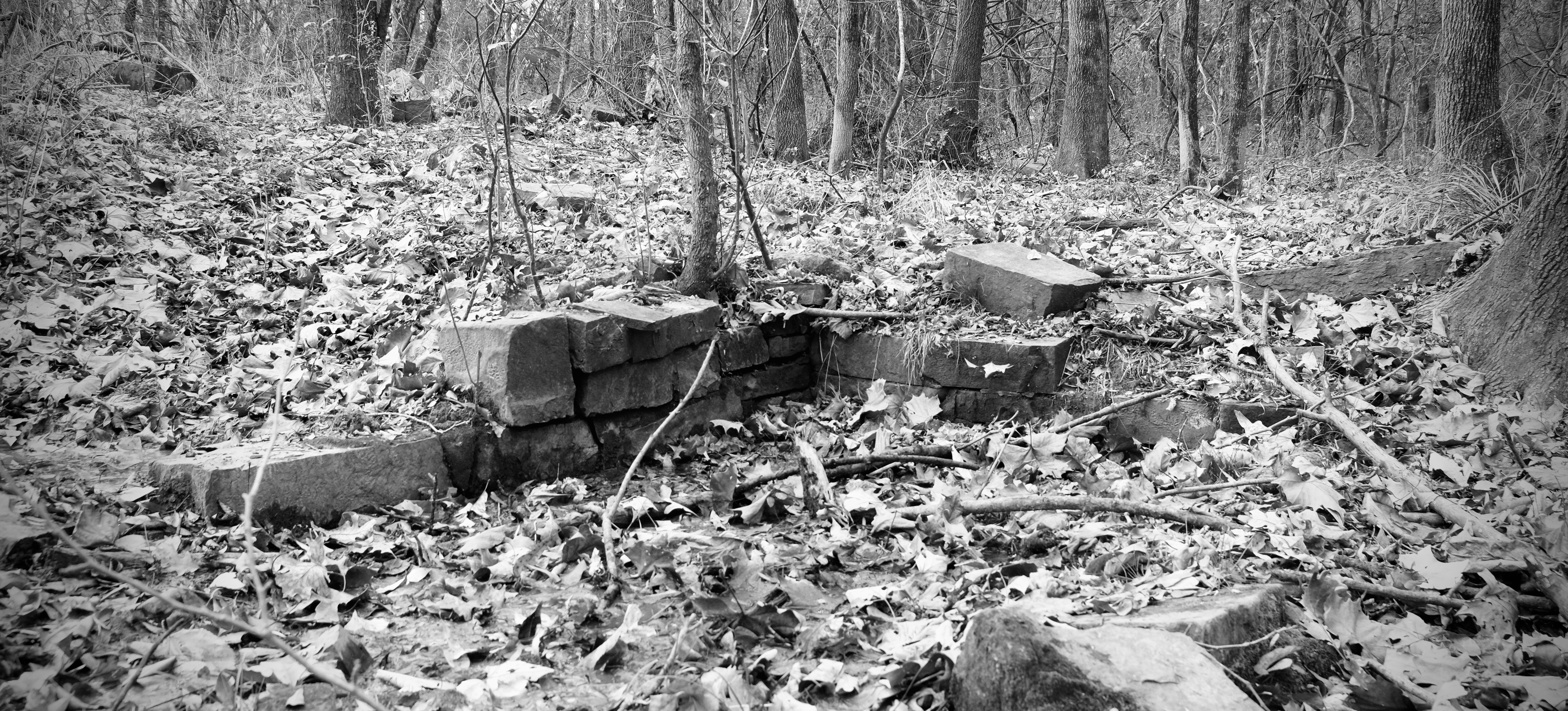
Sixty years later, I stand alone in the forest at the spring which served the Council House community. It was a “fine flowing spring of permanent water” when the Roscoe and Margaret Conkling, who wrote the definitive work on retracing the trail, observed Council House Spring. In 1958 it was “flowing copiously,” its walls covered with ferns, when the Oklahoma Historical Society’s committee came through, identifying station sites for placement of historical markers. Now in late November, clear water seeps through the fallen leaves of countless autumns in the spring’s shallow recess lined with cut stone. Down the bank in Brazil Creek, it mingles with run-off from other mountain springs and ethereal streams on a twisting journey northeast to the Poteau River. In 2018, it is more than a trickle but less than a flow. In May of the year, when the Committee reported its flow as copious, spring rains might even now make its volume more abundant.
The remaining walls of Council House Spring
My goal is to locate the ruins of the Council House and I am armed with a GPS unit and eyes much better trained on this, my fourth visit, than on my first. The spring is a landmark often used for orientation in the literature, and my starting point.
The Committee located the Council House about 100 feet from the spring, but did not comment in print on its orientation. A map hand-drawn by one of the Committee members and a draft of the Committee’s manuscript found in the Oklahoma Historical Society archives situate it to the northeast. Conkling places the Council House “approximately two hundred feet northeast of the present Latham store.” An Oklahoma Historic Sites Survey published in 1958 places the Council House about 400 yards southeast of the spring. Each of these reports contradicts the others.
A useful observation comes from the Committee report, quoting Everett Bledsoe, who lived in the home now standing abandoned on the north side of Latham Road, 370 feet south of the spring. Bledsoe came to the Latham Community in 1908 and was married to the widowed grandmother of Jonathan Watson, the current landowner. Bledsoe told the Committee that, when he was a boy, “the older settlers would align their sight upon the grave of Moshulatubbe by sighting a certain way through the windows and doors of the Council House.” This suggests a line-of-sight orientation between the Council House and the Moshulatubbe grave.
Chief Moshulatubbe died of smallpox in 1838 and was interred here in a burial mound south of Latham Road. The mound’s large size has been attributed to the belief that the chief’s horse was buried with him, reflecting a Choctaw practice which persisted into the nineteenth century and was intended to assure that the dead were buried with items — including horses, dogs, and guns — they would need in the next life
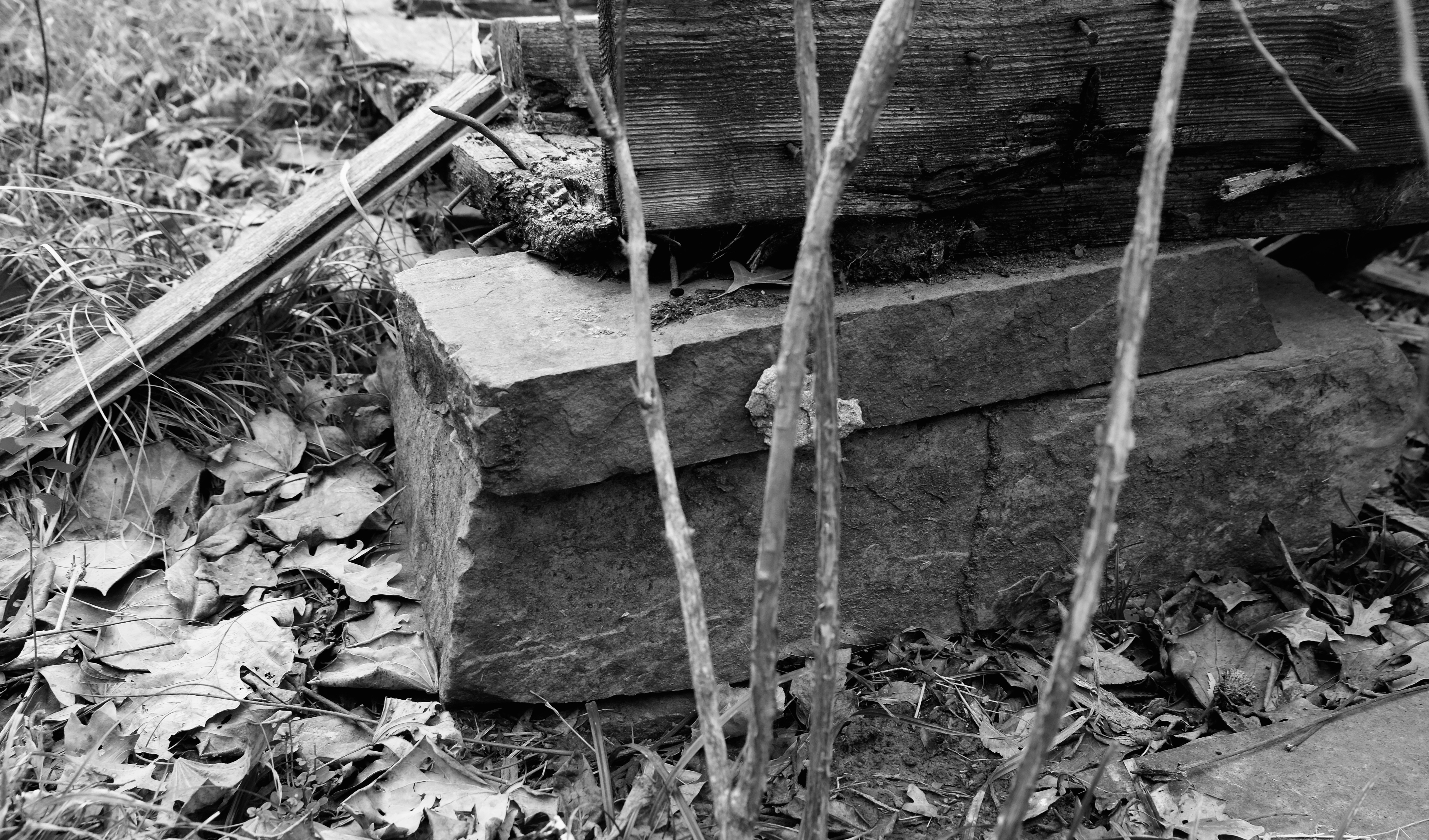
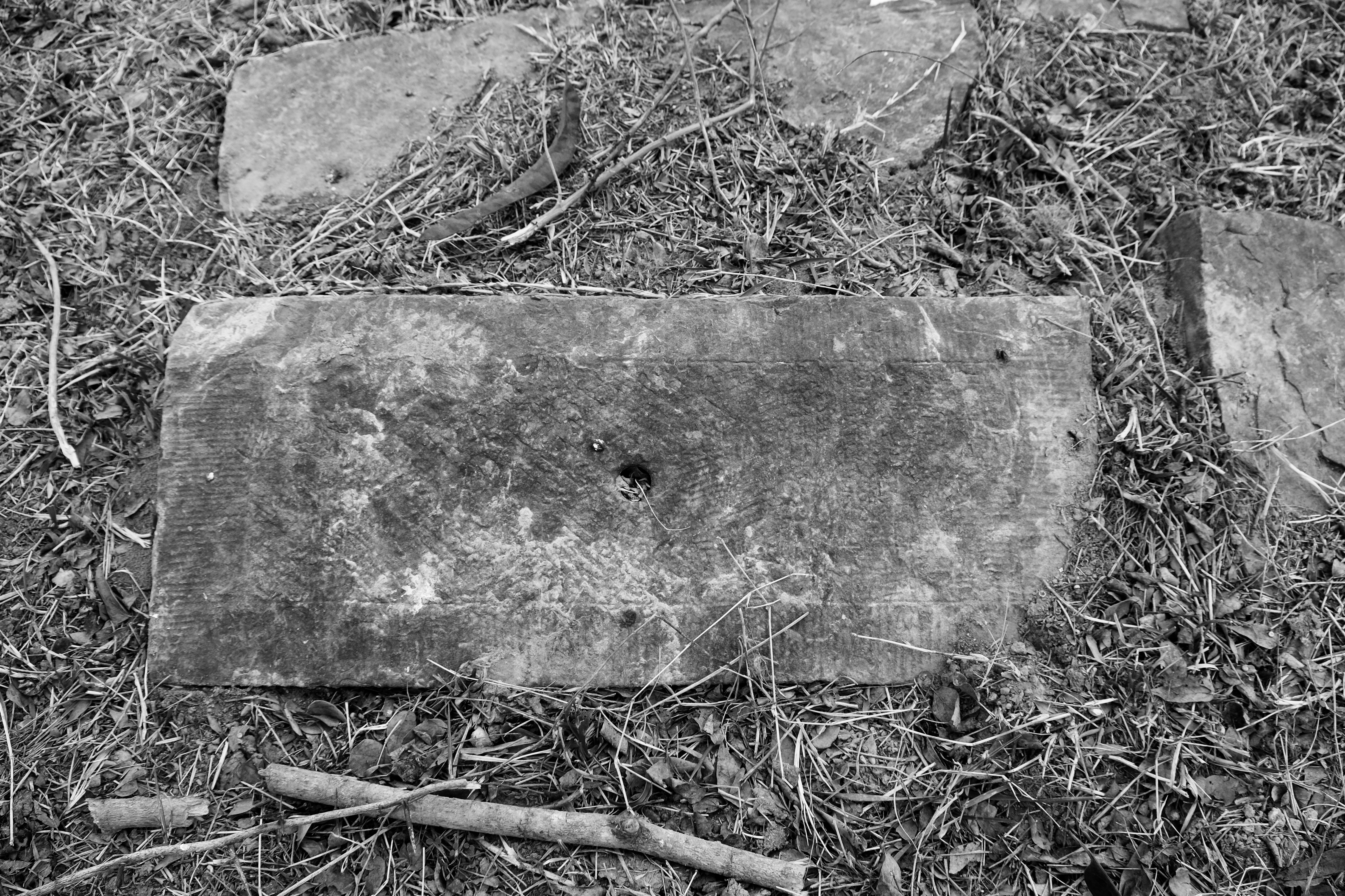
About 100 feet east of the spring is what looks like a dump. Modern detritus—55-gallon drums, a seat from a car, worn-out tires—congests and nearly conceals what on close examination is the foundation of a building perhaps 20 feet on its longest side. Large cut stones support the structure’s corners and support visible, but broken, floor joists. On a previous visit, I rejected this as a candidate for the Council House. It was too obvious, its upper layer too modern, the floor joists and nails certainly not of 1830s vintage. It isn’t what I expected to see.
A foundation stone at the possible site of the Council House
But in this jigsaw puzzle of an exploration, nothing else fits but that this be the Council House. It is located 100 feet from the spring — though east, not northeast. Perhaps the orientation did not make it into the published Oklahoma Historical Society Committee report because of its inaccuracy, while the 100-foot distance turns out to be fairly accurate.
It is nearly due north of Moshulatubbe’s grave at a distance of about 530 feet, making it a candidate for the sighting exercise described by Bledsoe. It is due north of the Latham Store, probably constructed after the days of the sightings, though at a distance of 430 feet, not the 200 feet northeast reported by Conkling. How the Oklahoma Historical Society arrived at a distance of 400 yards southeast of the spring for the Council House in their Historic Sites Survey is unclear and inconsistent with anything else. If this is the Council House site, another structure must have been built upon it, using the existing foundation stones, after its reported burning in 1932.
My conclusion about the Council House drawn as clearly as possible for now, my next goal is to walk what looks on Google Maps like a clear trace of the stagecoach road. Right direction, right location, and it appears to be a short section, easily trod. I strike out with iPad in hand and Google Maps open, trying to keep the blue dot that indicates my location centered on the pale line that looks like the trail. I run into brambles so thick as to make the path completely impassable and wonder why it appears so clear on the map, but struggle through and detour around the worst thickets, trying to hold to the trace as closely as possible, getting turned around and disoriented even with all my navigation equipment. I reach the north end of the trace and start back toward the county road, recording waypoints, finally emerging near the collapsed ruin of the Latham store. I turn back to look at the path I just struggled through, and there it is, a narrow marker about four feet high sticking out of the ground. It says, “Pipeline.”
So goes my quest for the truth. Where this pipeline was laid may indeed be the path of the stagecoach road, but I don’t feel as if I’ve gained anything but a jumble of scratches on my arms and legs from struggling through the briars. I’ve pushed up my shirt sleeves because it is a warm day, accounting for the bare arms, but the thin long pants I am wearing are worthless as protection. I decide to add heavy duty britches to my wardrobe for future excursions.
I mark GPS waypoints for the Latham Store and the Bledsoe home before crossing the road south to examine the Moshulatubbe mound and the site of the Trahern Station and cemetery.
On another winter day nearly two years before, my husband Bill and I walked these landmarks with the Watson family. Before visiting the spring, we explored the interior of the Bledsoe home. The building is slowly going away, its crumbling roof and missing windows admitting the forces of nature, wallpaper peeling to reveal newspapers layered on years ago as insulation. But its stone chimney holds fast, and a cellar, its depths surely unplumbed for some time except by snakes, appears as sound as ever.
On the opposite side of the road is the 1958 Oklahoma Historical Society marker, its bronze plaque in good condition but concrete base damaged at both upper corners. The Committee located this marker due north of the grave site of station keeper Trahern, a landmark no longer evident, as the gravestone has been moved.
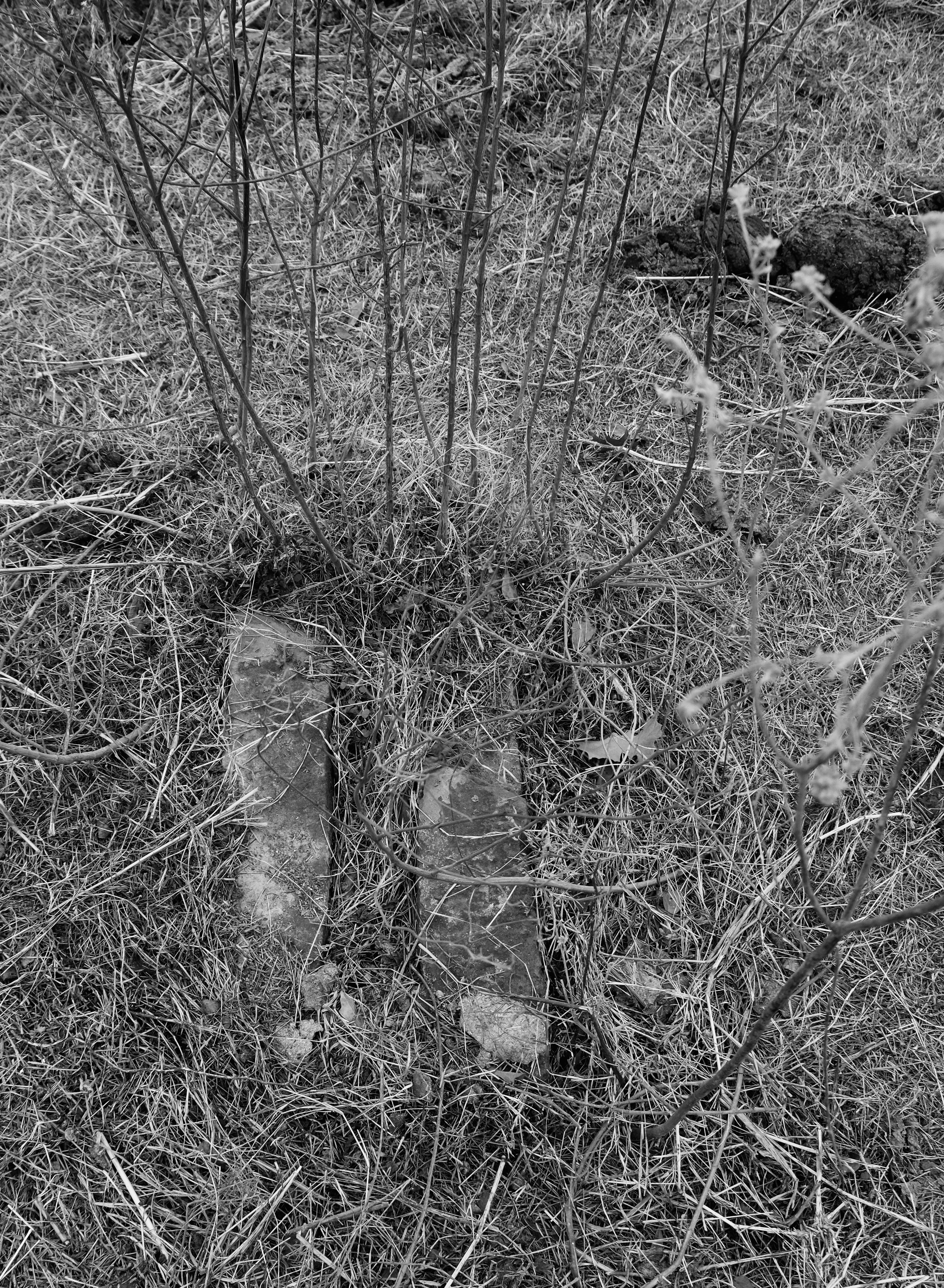
Along with the spring, I find the Moshulatubbe burial mound the only other consistently verifiable landmark. It is a large mound of earth easily distinguished from the flat land around it. The Committee reported it to be 19 feet from the right of way but now it is more than 100 feet away from the road, bordered on the south by two unimpressive bois d’arc trees, suggesting the road may have been relocated over the past 60 years, or that the 19 feet was simply an error, or perhaps their estimate of one of the dimensions of the mound, erroneously transcribed as the distance to the road. The mound measures perhaps 20 feet on a side. The Committee reported it was marked by a row of stones, but that in 1958 nothing remained of “the horizontal stone slab or other grave structure, just the large mound of earth and loose stones.” When I first saw the mound, I overlooked the fact that multiple stones, some cut, still remain on its surface, but on this fourth visit I really see them for the first time and begin to grasp their significance.
Cut stones on the Moshulatubbe burial mound (and a nearby cow pie)
This whole field was once a cemetery. It still is, I suppose, though the markers have been moved. According to Bledsoe, who died shortly after the Committee’s 1958 visit, a former owner had removed the gravestones and placed them in a large pile in order to cultivate the field. Now cattle graze here, and a gas well road cuts across on a southwest diagonal. On the southern edge of the Moshulatubbe mound in the vicinity of the trees are several large cut stones, one finely finished. The Committee’s diagram puts Trahern’s grave here, close to the trees, and the Trahern home and station nearby.
Cut stone near former site of Trahern grave
One of the markers still beneath the pin oak
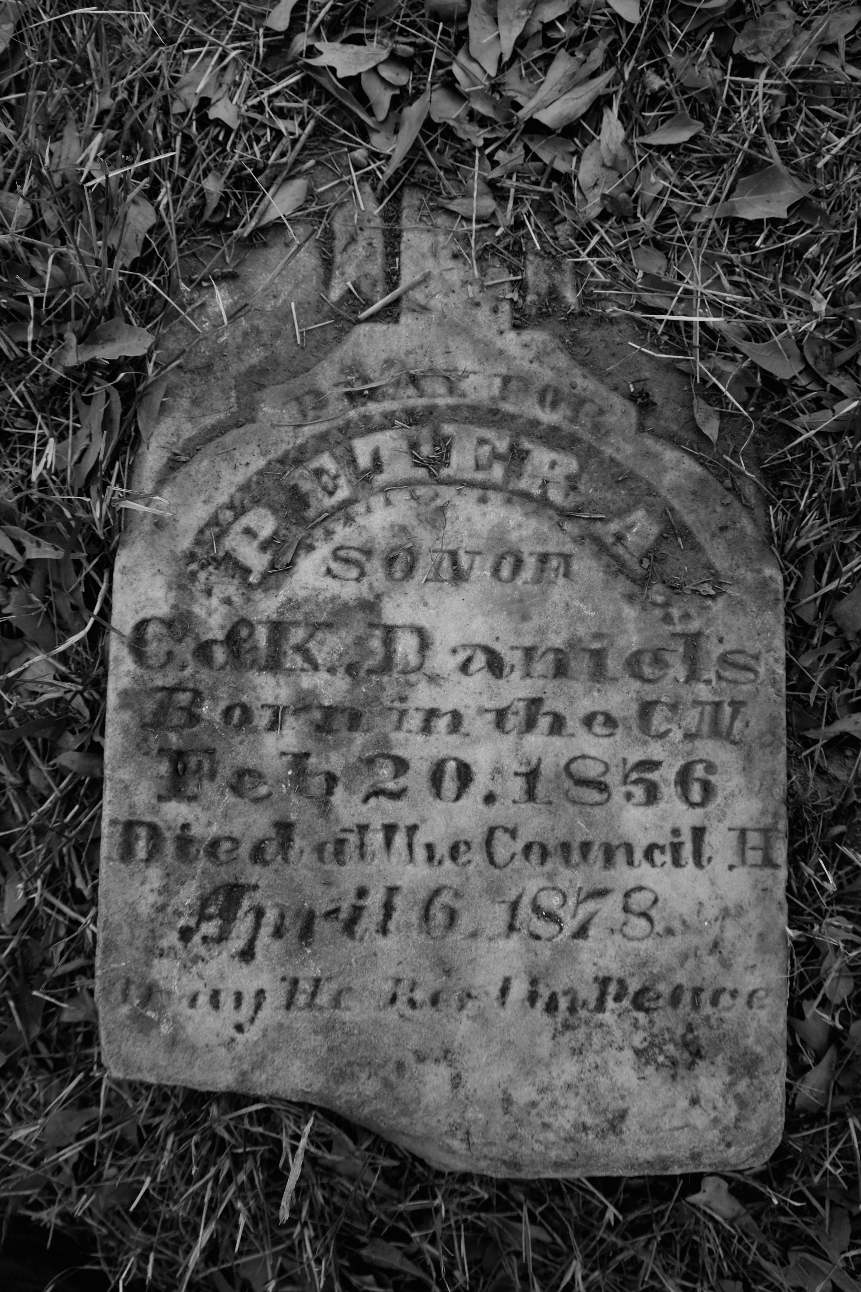
I climb over the fence to walk farther east, to a young pin oak where I first saw some of the gravestones that had been moved from their original locations. A few still remain, scattered, some dishonored by the natural processes of the cattle. Jonathan Watson has been retrieving and preserving these stones, and I find Judge Trahern’s marker and that of his wife cleaned up and stored at the Watson home, a quarter of a mile east.
Trahern was born in Mississippi in 1818, attended the Choctaw Academy in Kentucky, and served on the bench of the Supreme Court of the Choctaw Nation. After relocating to Indian Territory, he served as county judge of Skullyville County, Choctaw Nation. The Trahern family was long prominent in Choctaw Nation affairs and their descendants still lived in the region at the time the stagecoach station was nominated for listing on the National Register of Historic Properties in the early 1970s. Trahern died in 1883 at the age of 65.
Judge Trahern’s grave marker
In Waterman Ormsby’s account of his ride aboard the first Butterfield coach traveling west on the Overland Mail route, his only mention of Trahern’s Station is, “After leaving Gov. Walker’s the next station (sixteen miles distant) was reached in about two hours and a half.”
What mysteries remain at Trahern’s Station? A number of large cut stones sit just above the spring and their origin is unclear. Was Moshulatubbe really buried with his horse? Was the pipeline laid on the stagecoach trace? Have I correctly identified the Council House location? Unfortunately, the more time that passes, the more distant these answers become.
My favorite destinations often involve slot canyons. Click below for my article, “Slot Canyons Without the Crowds,” from OutdoorX4’s latest issue, with some recommendations for visiting slots that are both spectacular and somewhat off the beaten path. (Translate: Not Antelope Canyon)