
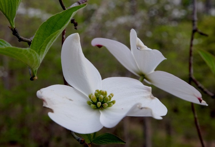
The dogwoods are in bloom; the redbuds are still flowering; and wildflowers are beginning to dot the landscape in violets and yellows as things green up in the Ozark Mountains of northwest Arkansas.
Bill and I spent the last couple of days with my parents, Jane and Jack Morgan, at their home on Beaver Lake near Garfield, then traveling to and around the Jasper area, near the Buffalo National River. Our primary goal for this trip was to hike to the Glory Hole Falls, and we decided to add a couple of other hikes while we were out.


Our first stop was Alum Cove Natural Bridge, a 130-foot long, 20-foot wide natural stone arch bridge (as the name says). There is a short trail from a picnic area to the top of the bridge and it’s an easy scramble down below for a better vantage point. It was getting late in the day when we visited so we didn’t explore more of the area, but the trail has other interesting features which sound worthwhile.
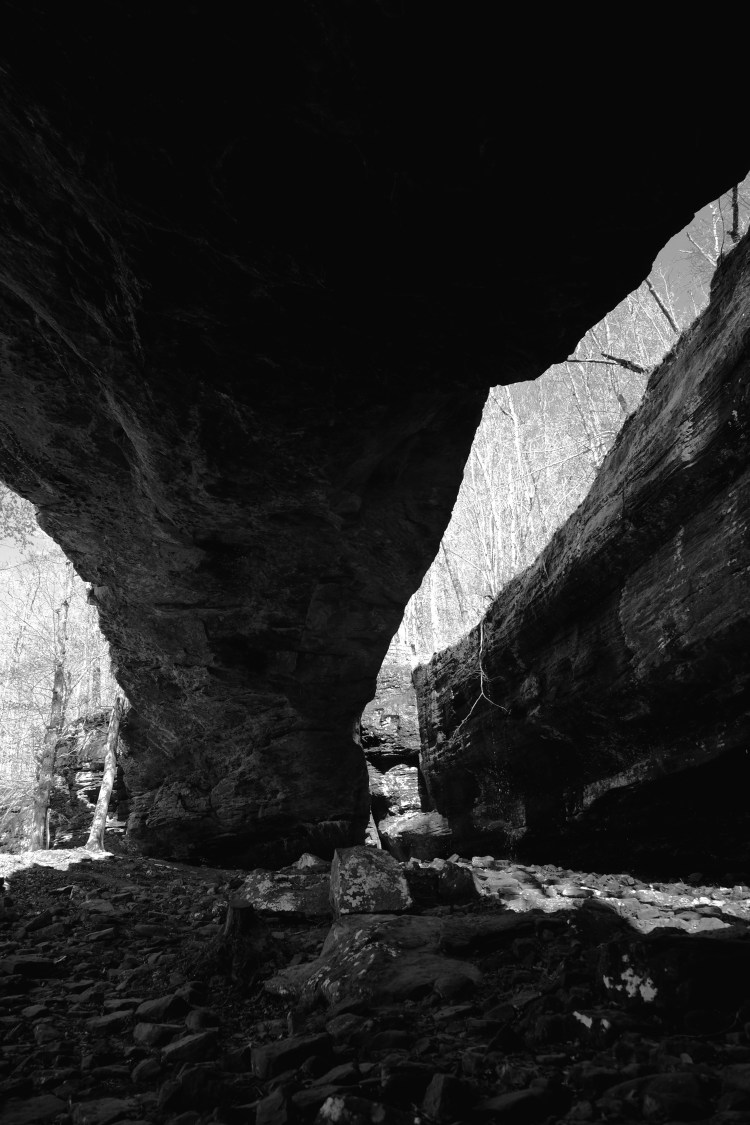
To reach this spot from Jasper, go south about 14.5 miles to Highway 16. Turn right on Highway 16, go about 1.1 miles to Country Road 28. Turn right and go approximately three miles to the turn-off, on your right.
For more information, go to: http://www.exploretheozarksonline.com/activities/parksnature/nationalforests/ozark/bigpiney/alumcove.html
We spent the night at the Cliff House Inn, which is south of Jasper on Highway 7 and has a spectacular view of “Arkansas’ Grand Canyon” of the Buffalo National River. http://www.cliffhouseinnar.com After checking in at the Cliff House, we drove in to Jasper for dinner and found some decent grub at the Blue Mountain Cafe and Bakery. We also picked up some peanut butter cookies and blueberry muffins for later.
Next morning it was French toast and bacon at the Cliff House Restaurant, pretty good food and they had the presence of mind to bring out the maple syrup warm. That sounds basic but it’s amazing how many restaurants miss that important detail.

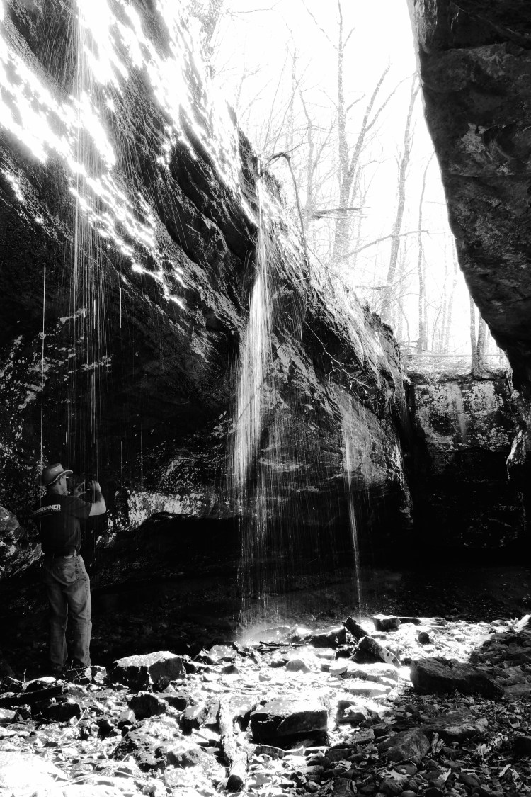
After breakfast we set out for the Glory Hole. We’ve been talking about doing this short hike (~2 miles round trip) for several years. It’s a remarkable sight, where Dismal Creek has eroded a circular hole in the bluff where the water pours through. The surrounding glade is lovely as well. A fellow hiker had the nerve to stand under the chilly water coming through the Glory Hole and amused us all. None of us offered to join him! The Glory Hole trail is off Highway 16, 2.2 miles west of Edwards Junction (the intersection of highways 21 and 16).


For more information, go to: http://www.buffaloriverchamber.com/attraction_glory_hole.html#ixzz45HvStZ5P
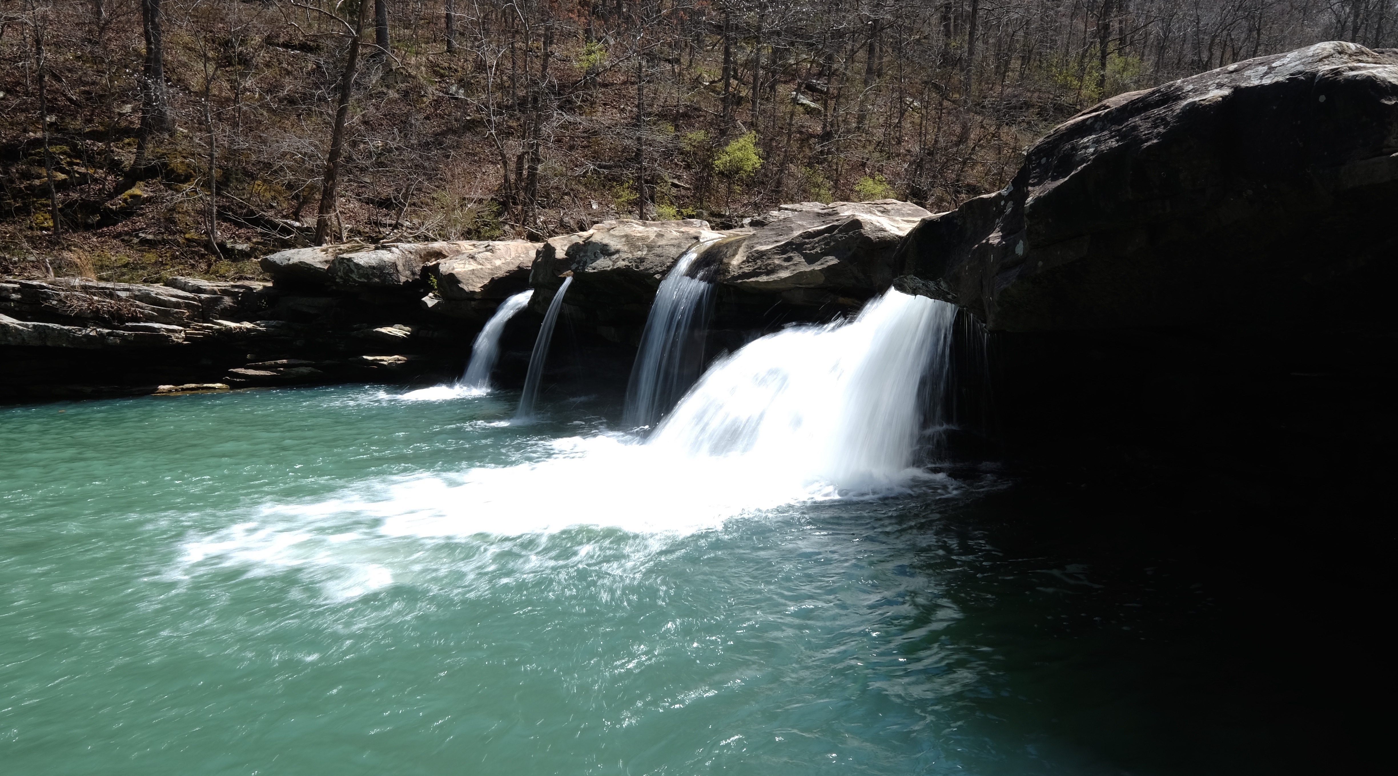
Our last hike of the trip was to Kings River Falls. This is an easy hike (~ 2 miles round trip) over level ground to a fairly significant waterfall. It is notable that it is the waterfall on the cover of Tim Ernst’s “Arkansas Hiking Trails” book (which served as our guide for all of this). We enjoyed this lovely finale to our hiking excursion; the weather was pleasant and we saw yellow violets and mayapples, and Bill got a nap. We also saw evidence of the long-ago existence of a grist mill at the site of the falls — carvings in the stone where mill foundations would have been secured.
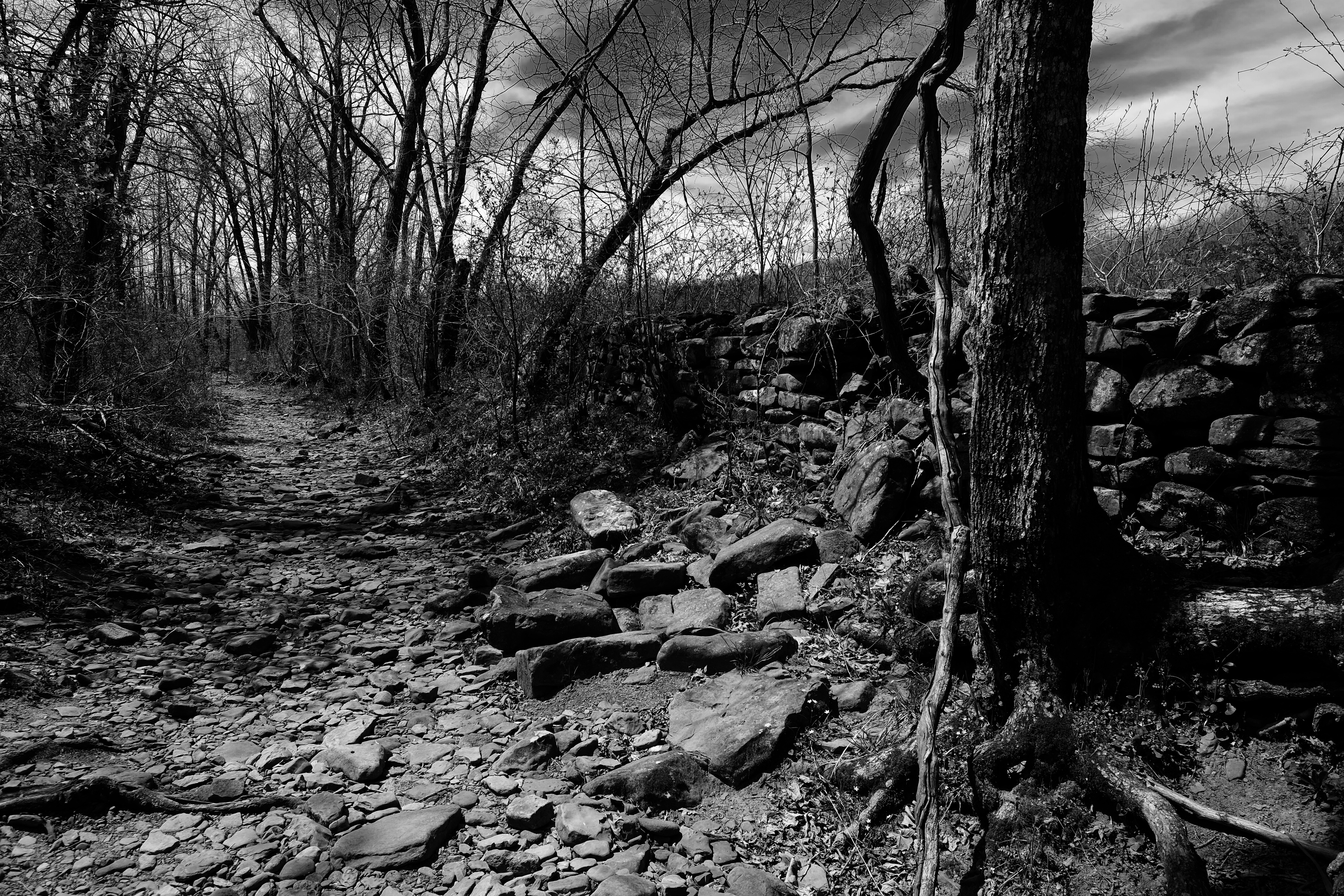


To get to Kings River Falls from the community of Boston on Highway 16 (between Fallsville and St. Paul), go north on County Road 3175 (dirt) for 2.1 miles; bear right as the road forks onto County Road 3415. Stay on this road for 2.3 miles until you come to a “T” intersection with County Road 3500. Turn left, and go across the creek and park at the natural area sign.
For more information, go to:
http://www.naturalheritage.com/natural-areas/kings-river-falls-natural-area
We returned to Beaver Lake satisfied with our short but fulfilling adventure. It’s amazing how much there is to see in Arkansas. The Natural State, indeed.

Enjoyed the trip! I’ve never stopped in at the Cliff House. I’ll tell them, “Susan sent me.” Sorry to see handprints below Glory Hole Falls. In the past I’ve noticed letters scratched into the rock. It’s a beautiful place. Just wish it were a little more difficult to hike to:)
Thanks! Yes, there were a ton of people going in and out at the Glory Hole. I was kind of surprised at the volume.