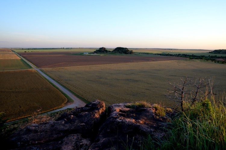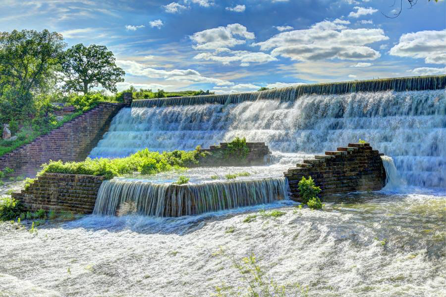
Above: Julie Monigold Roberds’ photo of the Lake Okmulgee Spillway
The sun, low in the November sky, illuminates the yellow leaves of an overhanging tree; I duck beneath it, hopping from boulder to boulder on the shore of Lake Okmulgee. The water sparkles with late afternoon reflections but I’m attracted more by the huge limestone slabs bordering the lake. They bear inscriptions, and I’m helping my friend Julie look for one carved by her husband Frank during their courtship, now more than 40 years ago.

We are disappointed in the effort and Julie wonders if she might have the location wrong, but we see many other young lovers’ dedications preserved in stone at this spot near Big Rock Shelter — some likely less successful than Julie and Frank’s — and I wonder how explorers of the future will interpret them. Broadly speaking, these are petroglyphs, and perhaps in another 500 years some archaeologist will draw fantastical conclusions about our culture from these stone carvings. This was a sacred place, they might say, a place where the ancients of the 20th and 21st Centuries traveled to inscribe symbols of devotion to their gods. This is not much of a stretch, given theories surrounding the rock art of the desert southwest. I wonder when it stops being graffiti and starts being history.
Yet the notion of this place as sacred has a kernel of truth. My trip here in my 60th year is not unlike a pilgrimage — a long journey not in distance traveled on this autumn weekend, but in years, in footsteps, in growing away, and back again. I’m here gathering with a few good friends to honor this place — this body of water and its surrounds — which holds great meaning for us.

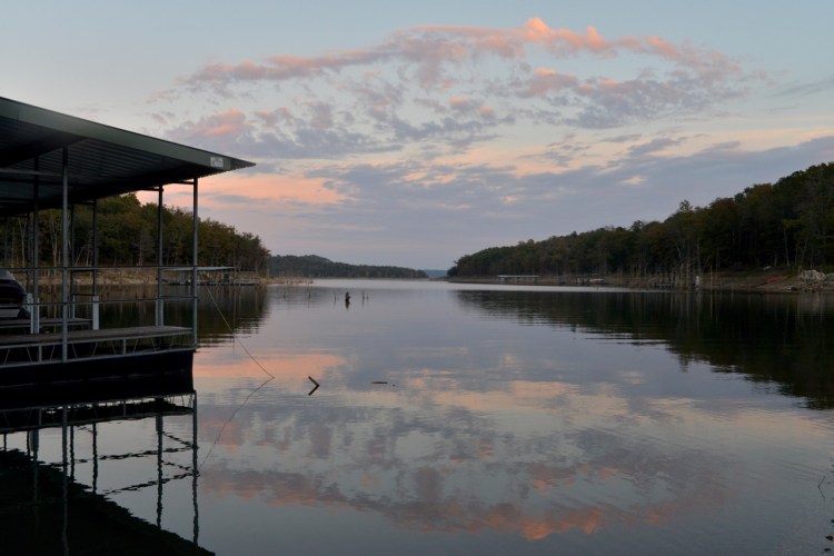
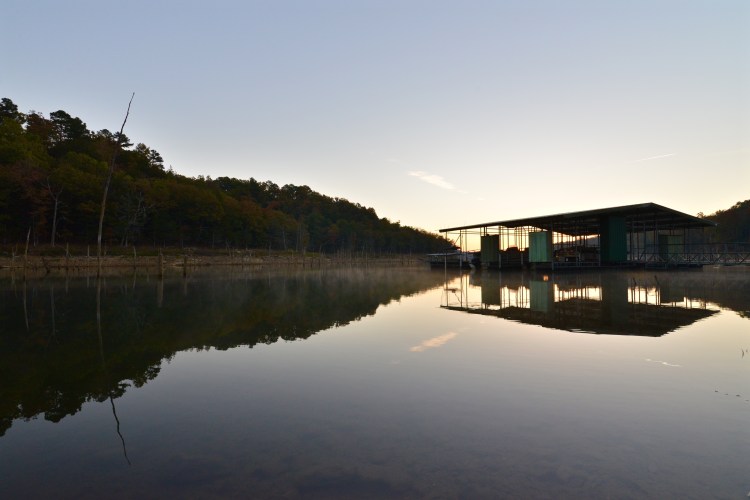
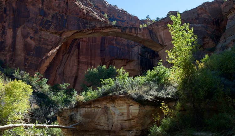
The lake itself came into being in 1928 with the damming of Salt Creek to improve the water supply for the City of Okmulgee and control flooding. But the original spillway was unable to contain the flood waters, which threatened the integrity of the earthen dam. After disastrous flooding between 1930 and 1935, the City of Okmulgee worked with WPA engineers and architects to reinforce the spillway portion of the dam, resulting in the 1939-1940 construction of the massive limestone cascade on the northeastern side of the lake along Highway 56. Now known simply as “The Spillway,” it gives a unique aesthetic to the park and was added to the National Register of Historic Places in 1999.
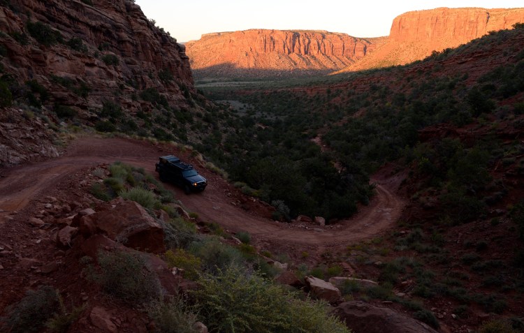
The 2016 transfer of the Lake Okmulgee property from the State of Oklahoma back to the City of Okmulgee triggered action on an idea my Okmulgee High School classmates and I had briefly flirted with during a reunion: Gather on a beautiful weekend for a hike at the lake, a beloved icon of our youth. For me, it was natural to suggest a hike. I’d rather hike than just about anything, and I’ve done it in the Himalayas, along the Mediterranean, atop the Great Wall of China, high in the Rockies and deep in the slot canyons of the Colorado Plateau. But never had I hiked at Lake Okmulgee.
Likewise, I’ve camped all over Oklahoma and the southwest, but never had I camped amid the Cross Timbers on the shore of Lake Okmulgee. (The largest existing contiguous tract of Ancient Cross Timbers is just north of the lake in the Okmulgee Wildlife Management Area.) In my youth the lake was a natural extension of my hometown, a place of picnicking, exploring, socializing, and romance, but the concept of a hiking trail was foreign to me then, and I knew nothing of camping.
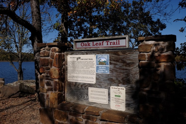
Since then, a trail has been constructed amid the post oak and blackjack — actually reconstructed and enhanced, as it incorporates landscaping and a path built by the young men of the Civilian Conservation Corps (CCC) in the 1930s. This, the Oak Leaf Nature Trail, is the trail I suggested to my classmates, and we scheduled a weekend in the middle of November, 2016.
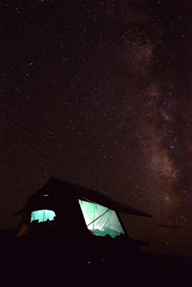
To several of my friends, November seemed a bit too late in the year for outdoor activity, especially when I brought up the idea of camping. Margaret Harlan-Hess graciously offered her lake bunkhouse as more conventional shelter, but I was determined to camp in the park anyway. It was about the integrity of the experience. And, in fact, late fall is the perfect time to be outdoors in Oklahoma. Ticks and chiggers and mosquitoes and poison ivy are less of an issue and the daytime temperatures are cool enough for comfortable physical exertion. It’s chilly at night, but over the years I’ve acquired the gear necessary to sleep comfortably in freezing temperatures and the skills to build a campfire.
Julie Monigold Roberds and I took the lead; we set the date and sent invitations to our “Okmulgee Lake Hike and Camp.” Our mission: to promote the lake as a desirable location for recreation, encouraging people to get outdoors and bringing awareness to the community that the park is a lovely place for hiking and camping.
Ultimately, even though we promoted it to the public, we ended up with only a handful of participants. But a special group of people comprised that handful. The newest of the relationships among these six women goes back to junior high, the oldest to the hospital nursery. These are truly lifelong friends: Julie, Debbie Yeager Cheney, Carla Mantooth Pilkington, Kay Rabbitt Brower, and Rebecca Abbott. That Julie is Director of Adult and Career Development at Green Country Technology Center and a member of the Okmulgee Main Street Board of Directors, and Kay is the Executive Director of the Okmulgee Chamber of Commerce, is not coincidental to our intention to promote the lake as a loosely related element of the “Okmulgee Rising” endeavor.
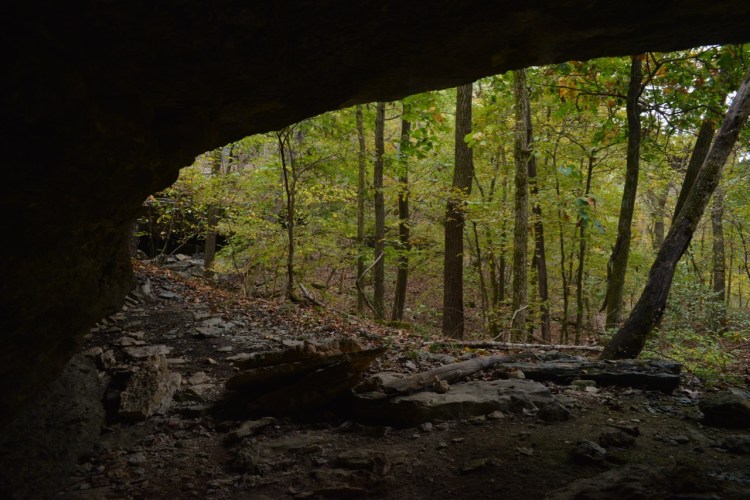
The designated Saturday in November arrives, and I drive over from my home in Norman — the “back way” to the lake through Okemah and along Highway 56 — and set up my tent in the Red Oak Campground at the camp site closest to Big Rock Shelter, which we have rented for the occasion. Big Rock is the largest intact structure of those built in the park in the 1930s under the Works Progress Administration (WPA), another New Deal program which provided work for local people during the Great Depression.

I am nearly finished pitching my tent when Debbie arrives, having driven up from Grapevine, Texas, bringing lunch for the group. The day is cool but sunny; by the time for our hike at 1 p.m., it should be perfect weather. Soon, Julie is here and the three of us break out lawn chairs and warm ourselves in the sun as we wait for the others. By one o’clock, Kay and Rebecca arrive and we walk from Big Rock Shelter to the Oak Leaf trailhead, just down the hill on the other side of the boat ramp.

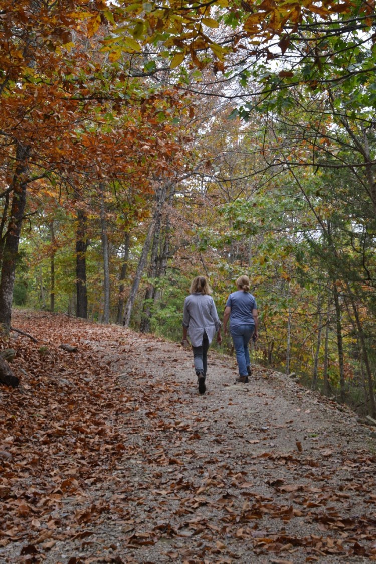
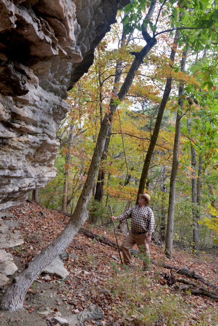
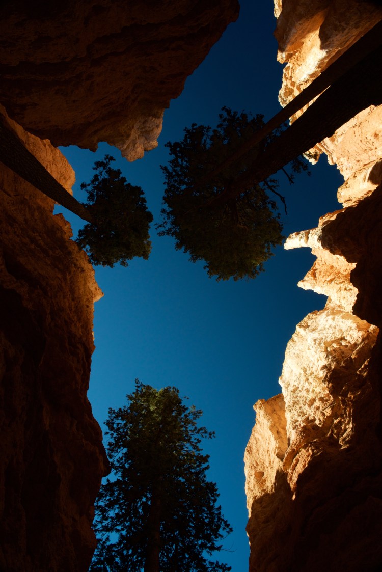
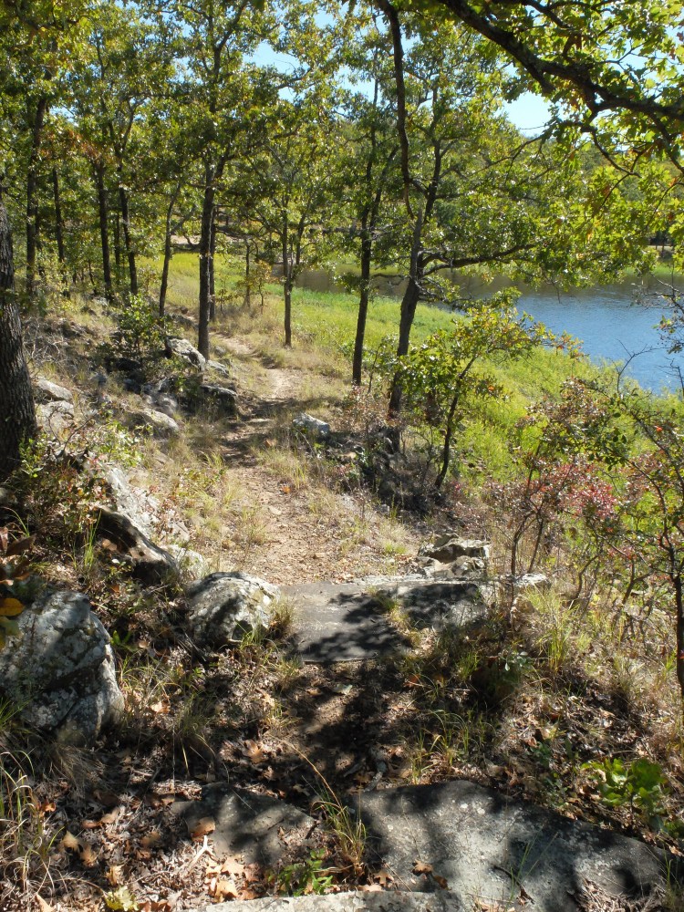
A few weeks earlier, I came over to pre-hike the trail, wanting to assure I wouldn’t lead the group off into something dangerous or difficult. Just under a mile and a half in length, the path follows the shoreline from the Red Oak Campground to a spot near Pin Oak Landing, or vice versa. Some spots are rocky and there is a bit of elevation change, but overall it is fine for beginning hikers who don’t get in a hurry. From the trailhead at Red Oak, there’s an option to take a flat, paved section for the first half-mile to the Black Jack area. Along that paved section, stone steps — probably of CCC origin — are located at intervals along the bluff, ascending to the lake’s best view, “The Scenic Overlook.”

So I know what I am getting these ladies into, although they don’t. Since my hope is to facilitate a wonderful experience they will want to repeat, I’m glad we have the paved section to start with and a glorious afternoon for hiking. We stroll along the path, noting the steep staircases, but I urge the group to refrain from climbing them now, knowing an easier way to get to the same spot awaits. No one protests.
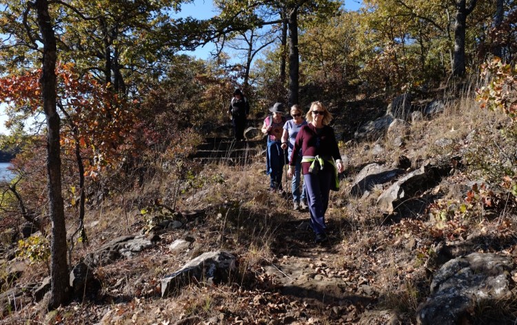
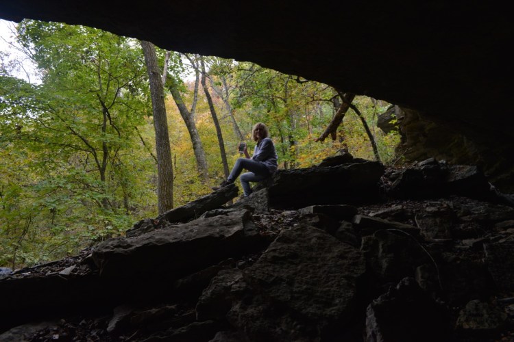
We emerge from the asphalt strip into the parking lot for the boat ramp near the Black Jack campground, where we walk along the road and pick up the trail on the north end of the area. There, the trail splits. Continue on the south side of the road and it takes you along the shore to Pin Oak Landing. Cross the road and climb the stone steps on the north side, and you can hike a loop trail, but it doesn’t have much to offer. We stay to the south, picking our way along the narrow, rocky trail. A picturesque bluff bids us take a break and there we explore a bit. Soon we reach trail’s end at “The Cliff House,” the midpoint of our out-and-back excursion.
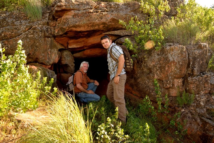
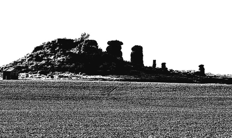
I wonder how many people know anything about The Cliff House these days. If you approach this spot from the main park road, you’ll see a sign warning you that it’s dangerous. It does indeed look rickety; large timbers prop up the high stone wall. The stone foundation appears quite solid, though, and I often see fishermen here when I visit, so I know I’m not the only one boldly testing the integrity of the structure.

At this spot in 1938 a boathouse and dock were built, and later it was converted into a nightclub and named “The Cliff House.” It was a popular nightspot until it burned after a lightning strike. In my imagination this is a place of romance on par with the Long Island party scenes in the 1954 movie, “Sabrina,” in which an orchestra plays “Isn’t It Romantic?” in the background and beautiful people sip champagne and float around a dance floor, doors thrown open to the sea breeze. If I could travel through time, The Cliff House is a place I would visit in its heyday. I might see my ancestors dancing the night away. Of course, the reality wouldn’t be as glamorous as a Hollywood movie, and perhaps not glamorous at all, but would be intriguing nonetheless.
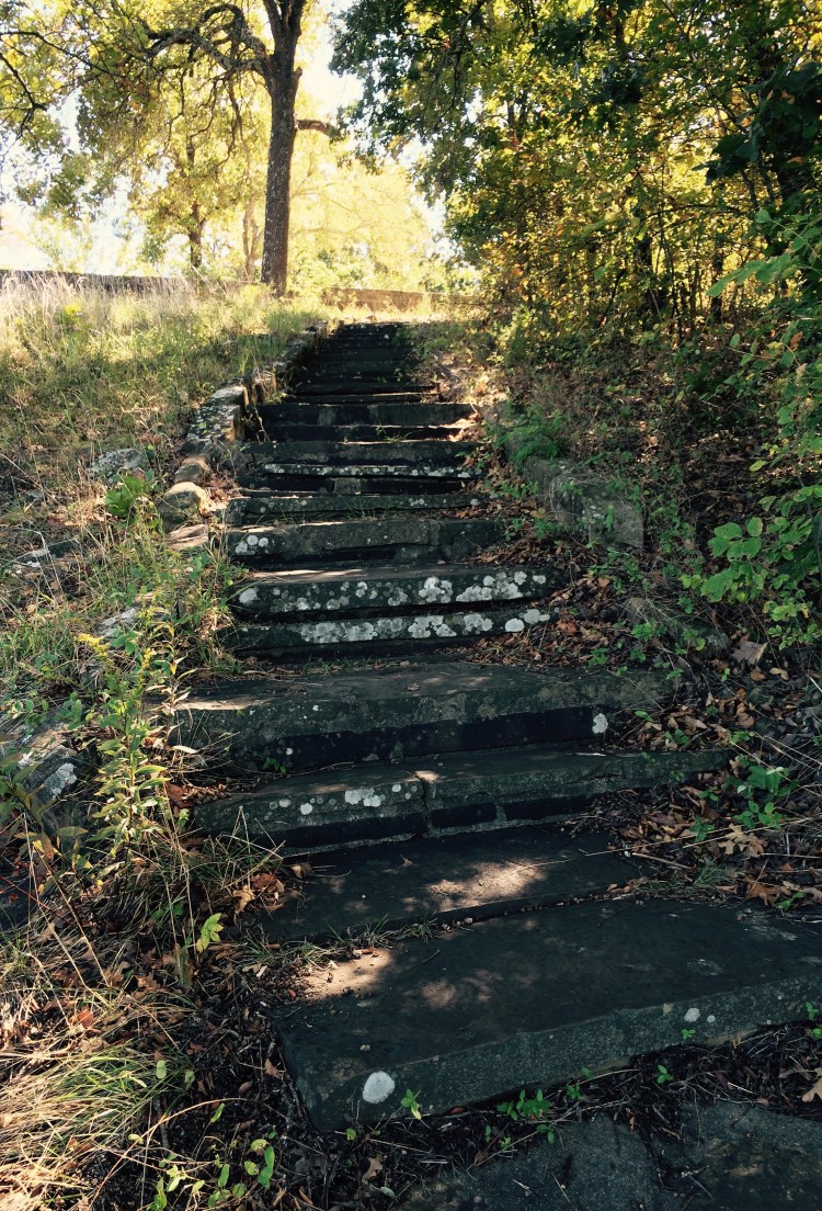
Back in the 21st Century, we pause in the ruins for a snack and a gulp of water, then begin our return trip. This time we take the unpaved route at the south end of the trail, which brings us to the Scenic Overlook. This high, western-facing slab of rock with a spectacular view of the lake is well inscribed by past visitors and perfect for a picnic or a stretch in the sun. And it’s a good place for a breather after the short climb. As natural as it looks, it was built by the CCC. But it’s one of those things that hasn’t changed in my lifetime and I love that about it. This spot, like many at the lake, feels like mine.

It’s all downhill from there, as they say, and we arrive back at the trailhead soon after. Our walk was not quite three miles and and no one broke an ankle or passed out, so I call it a success. It’s certainly a good start for our fledgling hiking group.
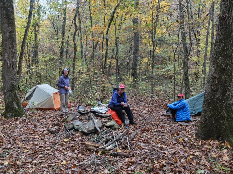
It’s only about 3:30 when we return but the daylight hours are short and the shadows are already getting long. Soon Carla arrives; a pharmacy owner, she has had to work most of the day but drove down from Sapulpa for a visit. It’s cooling off and we get a fire going in Big Rock Shelter’s massive fireplace, wondering aloud how many others have done the same in the past 80 years.

We spend the rest of the afternoon huddled around the fire in pleasant conversation, cooking hot dogs and s’mores over the open flame. At dark, Carla and Debbie have to leave and Julie and Kay adjourn for a night of relative comfort at the Hess cabin. Rebecca braves the cold to camp with me and we go down the road to my campsite.
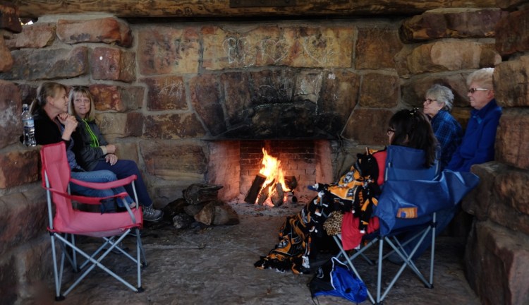

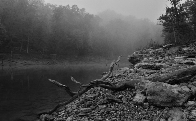
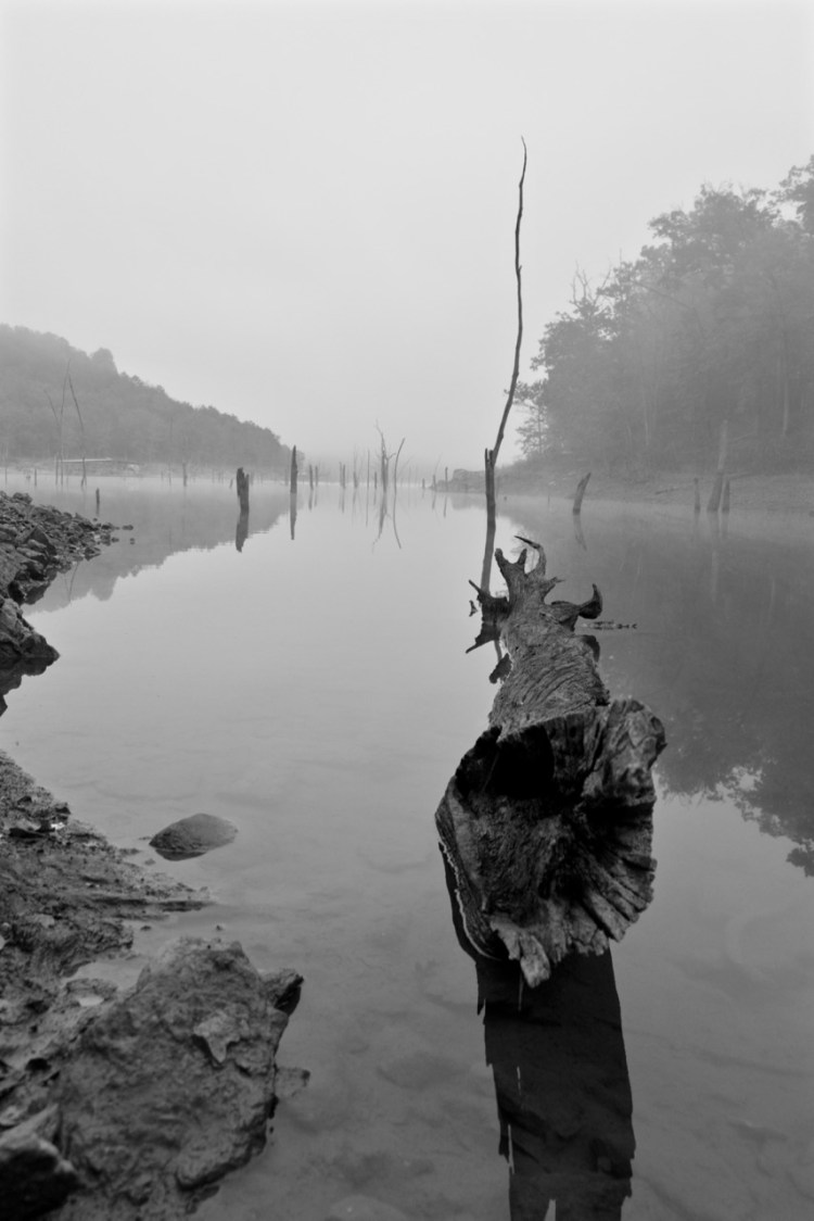
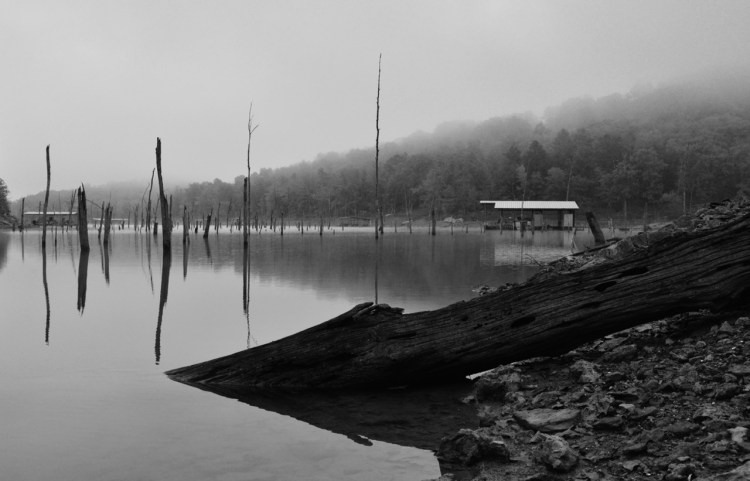
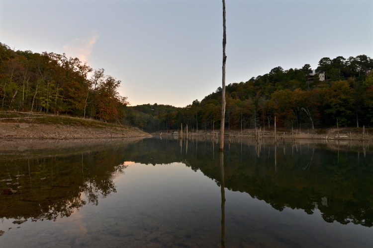
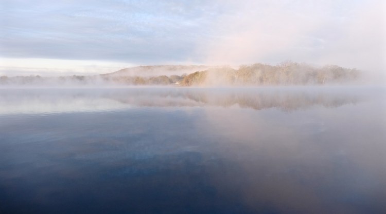
With another campfire going in the rock fire ring, we break out camp chairs and talk on into the night. Rebecca has decided to camp in the back of her car and finally I bid her good night. My sleeping bag beckons as I step away from the camp fire, but a fog has settled over the dark waters of the lake and I walk toward the shore, just a few feet away. I linger there for a moment, hoping that the fog still lurks over the waters when the sun comes up. Sometimes it’s all about the photo op, and a foggy sunrise is one of my favorite subjects.
I sleep warm and comfortably, and awaken — to my delight — to the hoped-for heavy fog. I hurry out of my tent and down to the lake, using another set of those CCC steps, carefully inching as close to the water as possible on rocks slick with moisture. Falling in is something I don’t care to do, especially with the heavy Nikon in my hands.

I pick my way along the water’s edge and try to be patient as the fog changes, thins here, lifts there. A mound of trees across the lake — amber in the sun’s early rays —mingles its color and shape with the white mist on the water. The sun gets higher in the sky, burning away the fog, and I finish with photos. I hear Rebecca getting around and text Julie to let her know we are making coffee. I’ve brought my JetBoil and a French Press for a civilized brew.

Julie and Kay return with the news that there was no heat in the bunkhouse but they kept warm under mounds of blankets. I start the campfire again and we linger over coffee for several more hours, reluctant to let go of the weekend. Eventually it’s time for everyone to go back to their usual lives, but we talk of the next time. I’m happy to hear my friends want to do this again.
As Julie and Kay are leaving, Rebecca tells me about another rock shelter just down the road. I’m intrigued and we decide to explore a bit more. At the south end of the campground we find a small shelter in a quiet cove. Of course the interior is spray painted with graffiti — modern pictographs? — but the structure is a treasure nonetheless. How could I not have known of it before? I am almost embarrassed, having thought I knew so much about the lake. From the shallows on the beach Rebecca picks out handfuls of crinoid fossils and hands them to me. I put them in my pocket, a gift for my granddaughter.

One thing we did not do on this weekend was visit the Spillway, but during my previous visit to scout the trail I took the time for that ritual. Atop the massive structure it is easy to feel worshipful. Even dry, it inspires awe, and after heavy rains the powerful and deafening 40-foot cascade is a wonder. I stepped across the huge stones along the 250-foot length of the spillway, remembering moments of youthful romance. My memories make this place something special indeed.
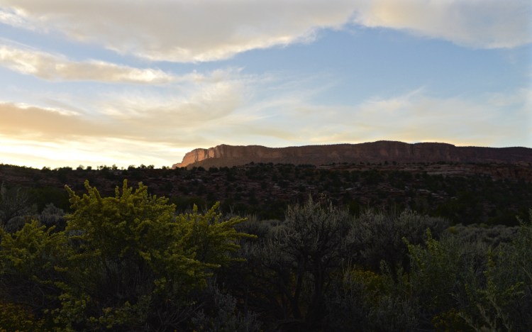
By noon that November Sunday, I am driving west toward my life in Norman, ready to be home but satisfied with my pilgrimage. Yes, for me and my friends there will be a next time in the sacred place we call Lake Okmulgee. And our hope is that, for others, there will soon be a first time.
Susan Penn Dragoo was born in Okmulgee and graduated from Okmulgee High School in 1975. She currently enjoys a freelance career in travel writing and landscape photography from her home in Norman. susandragoo.com
Resources:
http://www.travelok.com/listings/view.profile/id.5520
Click to access newdealparks.pdf
https://focus.nps.gov/GetAsset?assetID=63973fae-575b-4940-a144-3fe06965f6cf