LAND OF FIRE AND ICE

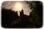
Iceland, a sparsely populated, volcanic island in the north Atlantic, is known as the “Land of Fire and Ice” for good reason. Volcanic activity is commonplace, revealed through recently deposited lava fields, steam erupting from underground hot springs through the moss-covered turf, and black pumice-covered trails in the countryside. The earth is volatile in this region. But more than 10% of Iceland’s land mass is covered by ice cap and glaciers, sometimes lying above volcanoes. It is a place of contrast, a land of harsh beauty and hardy people, and an outdoorsman’s paradise. I visited there in August 2015 to trek the Laugavegur trail with friends. My tale begins in Reykjavik, the nation’s capital and the world’s northernmost, where I met fellow Americans Joan Whitacre, Wes Scrivner, Mark and Laura Thompson, and Michele Williamson. Joan, Wes and Mark had hiked together before but the rest of us were just getting acquainted on this trip. We stayed at the Hotel Leifur Eiriksson, which was situated right across the street from Hallgrimskirkja, an iconic church which sits atop a hill in the center of the city and is visible from virtually anywhere in town. This made it easy to find our way back from any walking excursion, using the church steeple as our beacon.

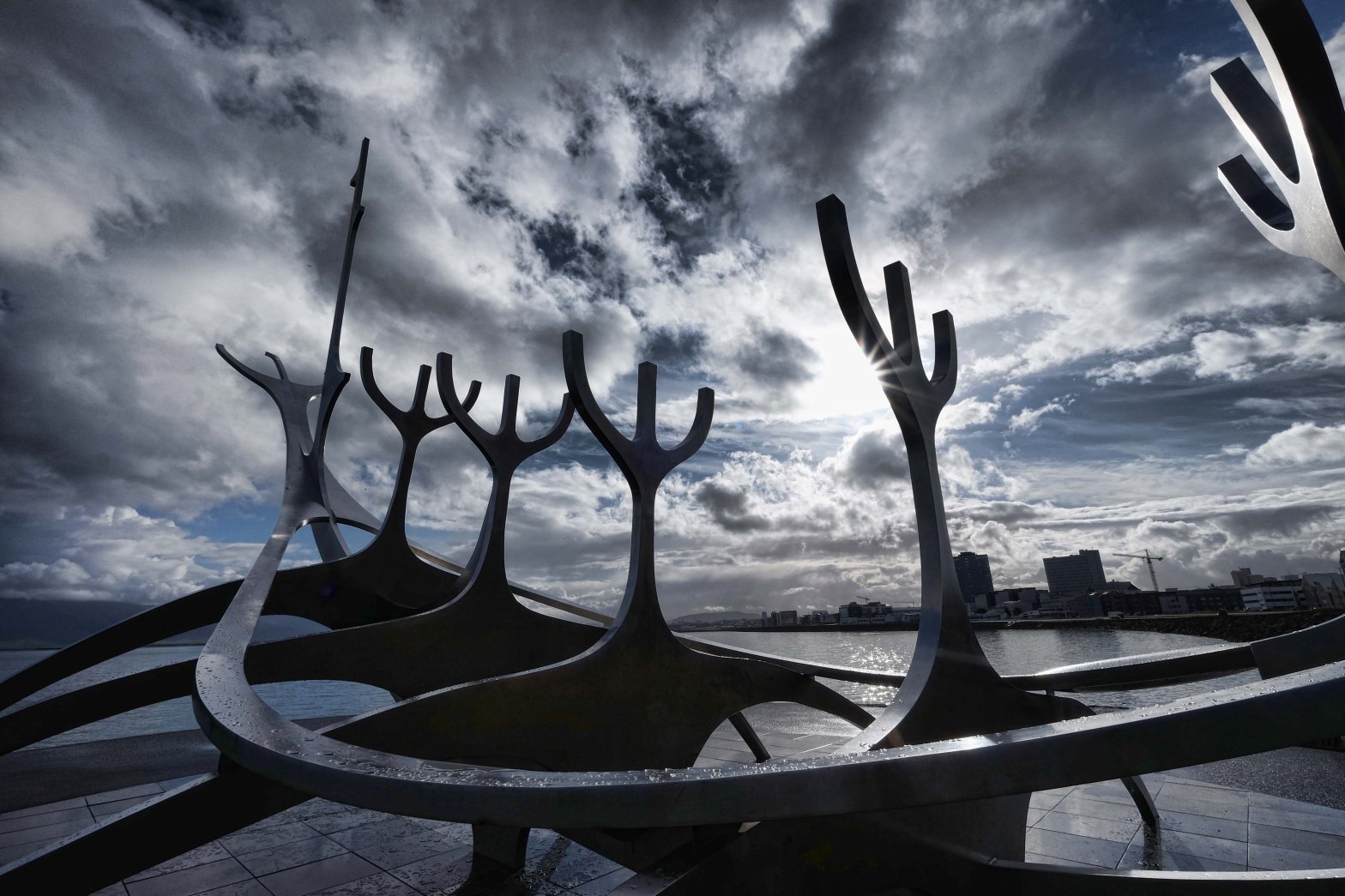
I was the first of our group to arrive in Reykjavik from the U.S. I dropped off my bags at the hotel and walked the city, starting at Hallgrimskirkja, and walking toward the sea along Frakkastigur, where I saw the famous Sun-Craft sculpture by Jon Gunnar Arnason. I enjoyed the scenery along side streets as I strolled, and when the rest of the group arrived (except for Michele, who arrived the next day) we went out walking again, going to a nearby cafe (Cafe Babalu), where we had coffee and my Idahoan friends ran into a fellow Idahoan running the shop. Small world. That evening we walked to dinner and the group finally settled on Prikio, the oldest coffeehouse in Reykjavik, where we ate hamburgers and talked about what better place we might find the next evening. Joan and I also walked to the city’s opera house, Harpa, a spectacular mixture of art and architecture.

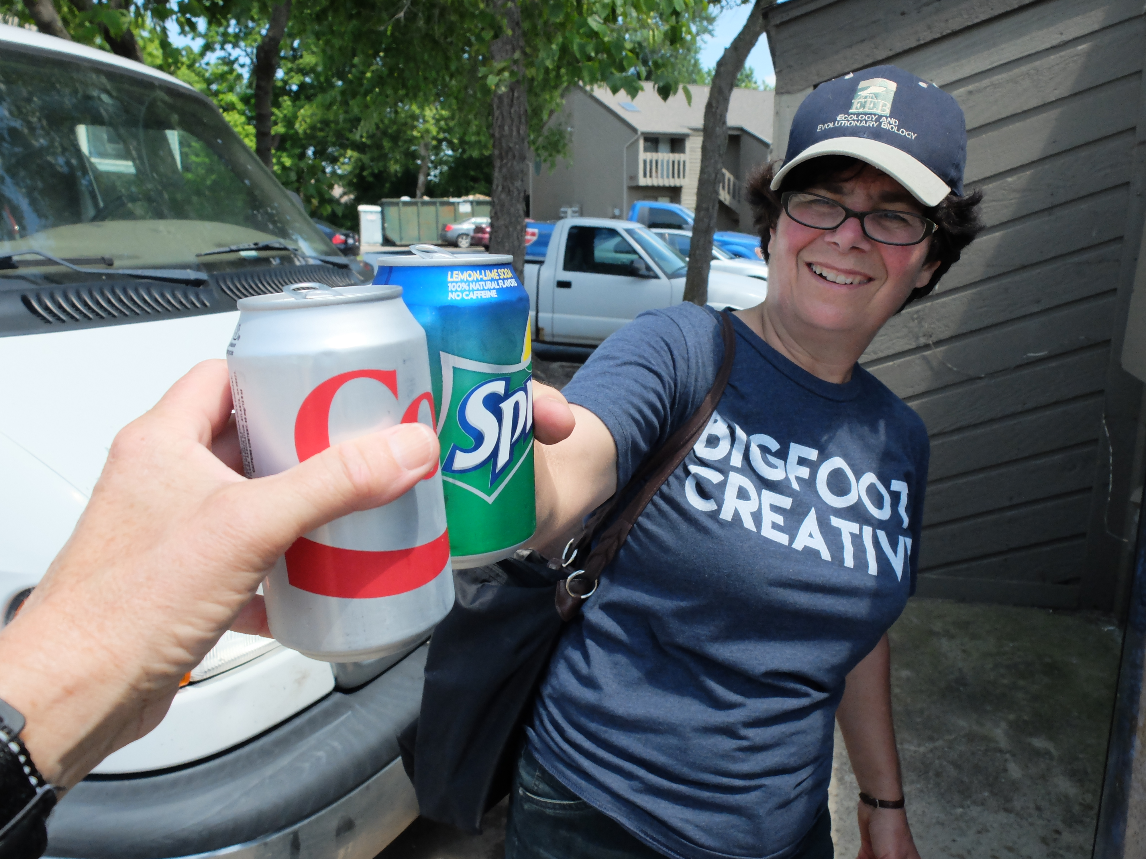
The following day we had more time to explore and we walked for hours. Michele arrived from Arizona, and she and Joan and I ate local food for breakfast at Cafe Loki, visited the Settlement Exhibition, walked around lake Tjornin, and returned to Harpa with Laura after dinner. I don’t recall the name of the place we ate dinner that night but I had an excellent seafood soup and felt a bit more as if I were actually enjoying Icelandic food. See the gallery below for photos from Reykjavik, and more narrative and photos about our hike following that.

REYKJAVIK GALLERY

(Click on images to scroll)

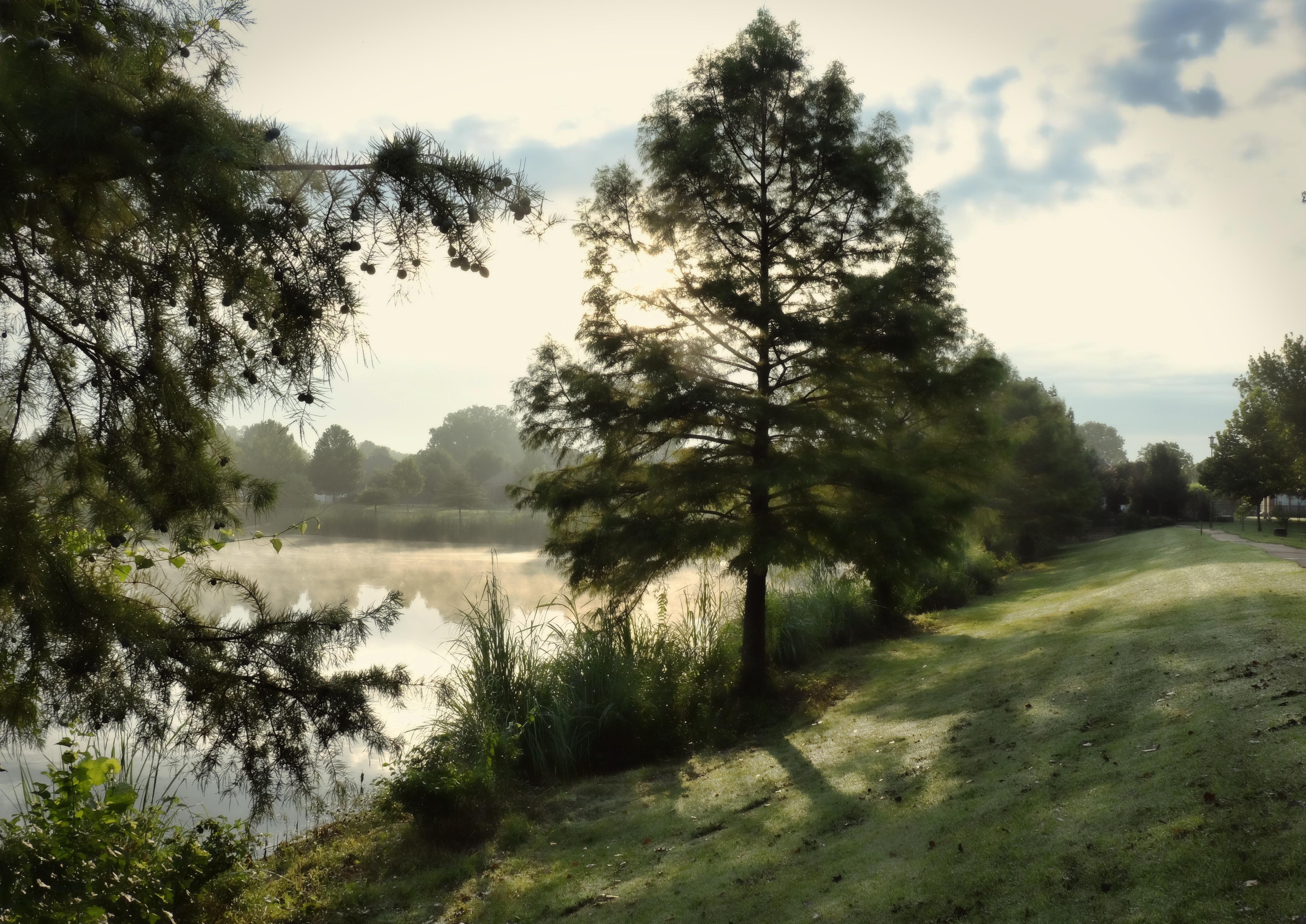
Our trek began on August 17, a Monday. A shuttle bus picked us up at our hotel and took us to the bus station where we boarded a larger vehicle to take us to Landmannalaugar, the starting point for our hike of the Laugavegur trail, the most popular hiking trail in the Icelandic wilderness. The trek from Landmannalaugar, located in south central Iceland, to Thorsmork is 55 kilometers in length and usually completed in four days. Ours was an assisted trek with Trek Iceland, which meant they would carry the bulk of our gear and we would need only a daypack as we hiked. They also provided a guide, our meals, and accommodations in the “huts” located along the trail.

Here’s a map and good summary of the technical details of the trek: Laugavegur Trek

Here are my journal entries from the trek:

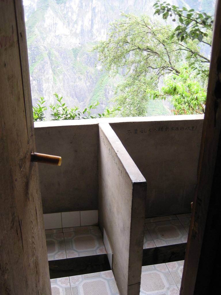
Day 1, 8/17/15: 6.99 miles from Landmannalaugar to first hut. Didn’t start until after 2 p.m. ~1,500 feet of ascent. Nice weather, no rain this afternoon. Lots of snow, didn’t expect it. Very hard walking. Steam coming from the earth. We walked by the hot spring Storrihver. Lava field littered with obsidian rock (Laugahraun). At the hut (Hrafntinnusker, one of the most remote huts in Iceland), tent campers outside (their tents hadn’t yet arrived). so glad to be inside in the warm hut. We are upstairs in a loft room with mattresses on the floor. Dining room also on top floor. Another room downstairs with bunk beds. Salmon pasta and salad for diner. Outside to the bathroom — snowing.

Day 2, 8/18/15: White out conditions! “No one’s leaving without GPS,” per the Hut Warden. We left about 10 a.m. – long walk in snow and sleet. Very wet and cold. High winds, steep climbs, along the Reykjafjoll mountains, descending into the Jokultungur area. Two river crossings – cold! 18.5 km today — farther than originally planned, not sure why. Hut – Hvanngil – farther than Alftavatn (meaning Swan Lake), which we passed by. Room with spaces for 20, which means 10 double bunks. I am sharing with Michele. So crowded! Toilets a fair walk from the hut. Good to be warm and dry! Had some cell service so could send messages home. Camera getting wet. iPhone getting wet, too. Hands cold. Black Diamond mittens great. Scenes at the hut — young woman being comforted by young man in the mud room, probably the conditions are not what she expected. Tent campers waiting on delayed tents? Washing dishes — Joan in charge. Having to do other groups’ dishes. Was able to send Sophia a postcard from 1st hut. Breakfast was oatmeal and oranges. We made sandwiches to take with us. Heavy bread, cheese, meat, peanut butter, jam, cucumbers, tomatoes. Our guide, Einar, all by himself in this job. A lot for one guide — he has to cook, too.

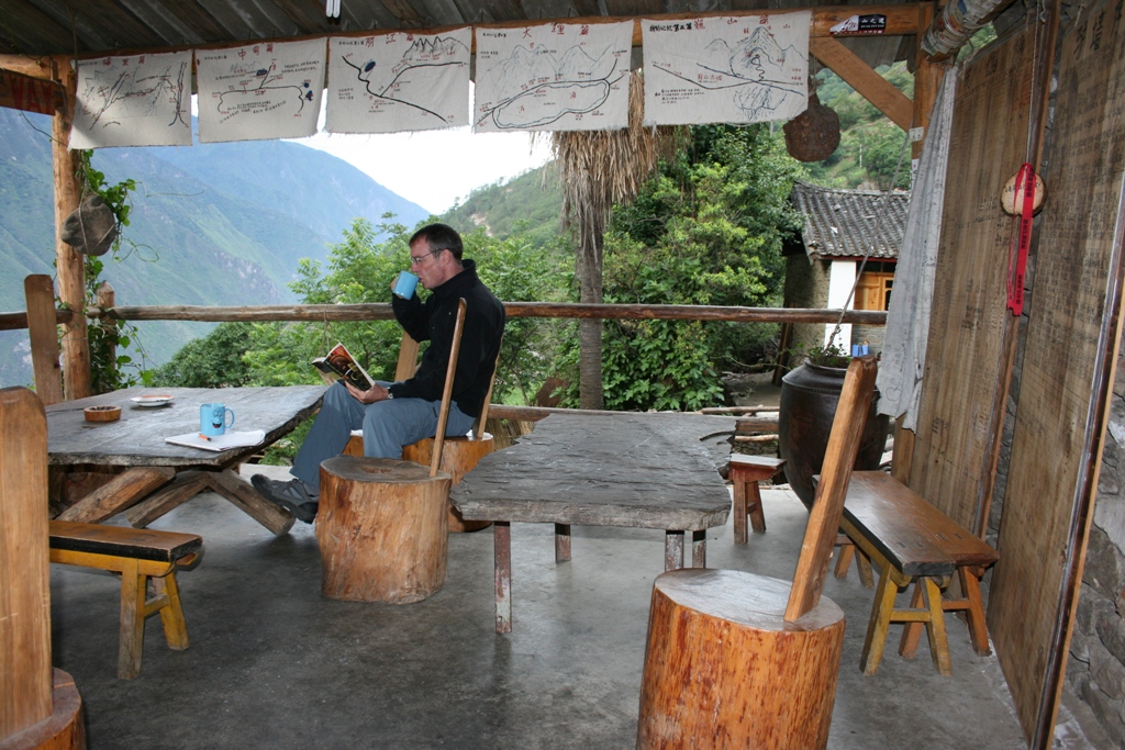
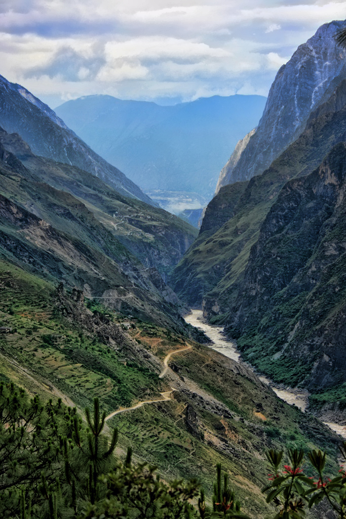
Day 3, 8/19/15: Didn’t sleep much last night. Got on the trail about 10:15. River crossing (only one today) very quickly after departure. Oatmeal for breakfast again – good. A “TWO SANDWICH” day — not as bad as yesterday — a “THREE SANDWICH” day. Good weather today. No rain, little wind, quite a bit of sun. Gorgeous scenery, through the black glacial desert of Maelifellssandur. Took a side trip to look at Markarfljotsgljufur, canyons almost 200 meters deep carved out by the glacial river Markarfljot, before getting to hut at Emstrur/Botnar. Double bunks again, sharing with Michele. Nicer hut. WCs and showers closer to hut. Three separate huts, 20 persons each. Got a shower — first shower since got on the trail. Got a lot of photos today. Had a little cell service. 16.8k today. Pretty flat. Amazing dessert — Einar’s signature dish. Cookie crumbs on bottom — over chocolate sauce (dark chocolate and coconut milk), then half canned pear, topped with mashed bananas and milk and more chocolate sauce. Great spaghetti and meat sauce and salad for dinner. Food great! Tomorrow breakfast at 8 a.m., departure 9:30, expect 15km. “One water crossing tomorrow,” said Einar. “Is it big?” “You’ve done bigger.” More rain forecast for tomorrow, but who knows. Helen, 74, from Melbourne, Australia. Retired from preparing teachers to teach English as a second language. She really struggled yesterday with the rough conditions and steep climbs. She told Joan that she was proud of herself for the first time in her life. Inspiring.

Day 4, 8/20/15: Finished Laugavegurinn today. 15 kilometers (~55km total mileage for the trek). Not too hard. Good weather. One river crossing. Einar: “Looks like it will be a FOUR SANDWICH day.” He was just kidding, it was only a TWO SANDWICH day. Walked within a few kilometers of the Myrdalsjokull glacier. Arrived at Thorsmork, a green valley beneath the glaciers Eyjafjallajokull and Myrdalsjokull. Birch “forest,” very small trees. But smelled of earth and vegetation like nothing else on this hike. Lush and green. Hut nice. Have my own bunk, hooray! Amazing dinner, Icelandic cod. To bed early for 8 a.m. breakfast and prep for hike. Got wine at shop here. Michele bought. Got a shower too!

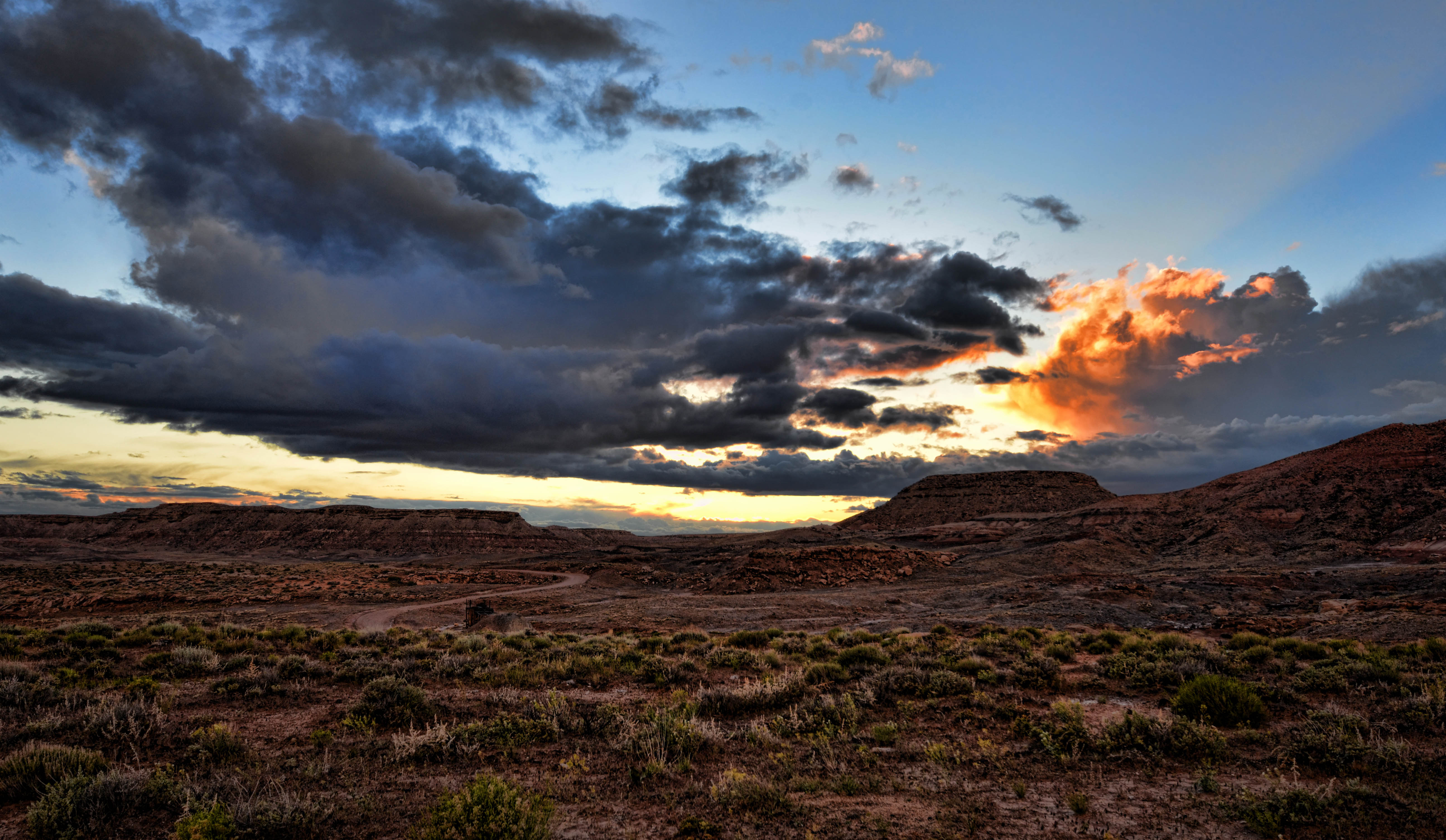
Day 5, 8/21/15: Didn’t sleep last night either. Too hot, lots of snoring. Will open a window tonight. Left at 9:30 a.m. to do Fimmvorduhals hike, heading for the mountain pass between the glaciers Eyjafjallajokull and Myrdalsjokull to craters formed in 2010, Magni and Modi (the sons of Thor). Expected to be 20k round trip and elevation gain of 850 meters. It was a spectacular hike! Back a little after 5 and I bought wine to contribute. Enjoyed drinking wine on the patio with hiking friends. Weather very nice. Started raining and we came in. Dinner was grilled Icelandic lamb, potatoes, a dessert made of peanut butter, chopped up chocolate, strawberries and Skyr, served over cookie crumbs and nuts. It’s late and I’m tired, should be helping clean up but am done. Knees hurting from climb. Will rest awhile then go brush teeth and visit the toilet once more. Tomorrow 8 a.m. breakfast, load bags, do day hike, then catch bus to Reykjavik. Ready to get home!

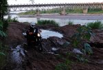
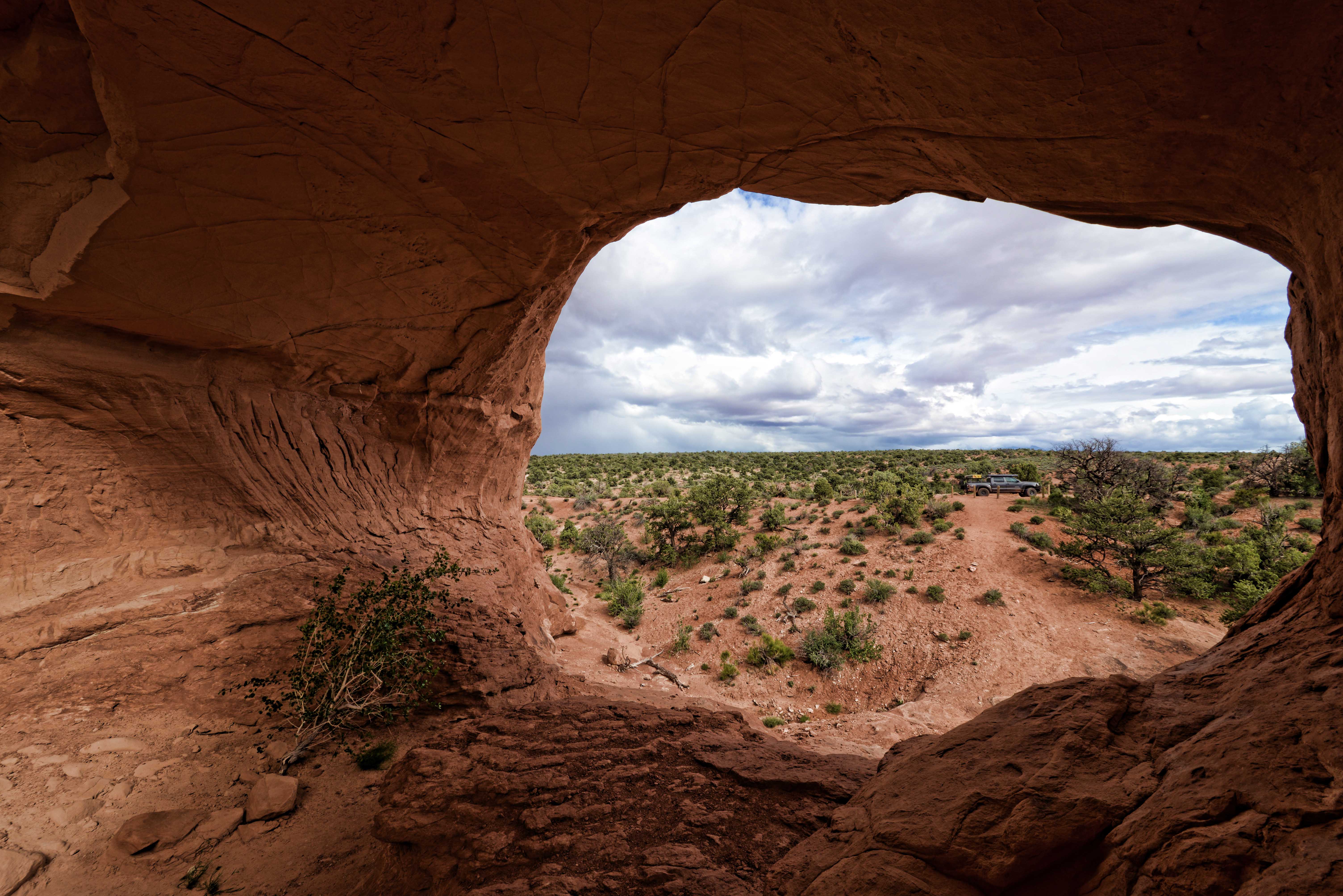
Day 6, 8/22/15: Last climb in Iceland. We hiked to Valahnukur and then to Husadalur for coffee. Watched buses crossing the river at Thorsmork — impressive. Hiked to cave.  On the bus for Reykjavik – 3 to 4 hour ride. Multiple water crossings in the bus, would require specially equipped 4WD vehicle. Transfer from one bus to another, about midway. Ate dinner at bus station with Joan, Mark and Laura. Bus to airport hotel. Quiet night, good sleep. Homeward bound.

LAUGAVEGUR TREK GALLERY

FIMMVORDUHALS HIKE AND THORSMORK GALLERY

On the Bus to Shangri-La

Bus Station
The bus station at Lijiang

(A story from our 2007 visit to China)

“Is this bus going to Qiaotuo?”
“Shangri-La,” says one of the seated passengers.
Confused, we get off and return to the terminal to ask the gate agent.
“Is this the bus to Qiaotuo?” Mark points through the glass to the bus sitting outside.
“Yes. Qiaotuo.”
“They said Shangri-La.”
“Yes. After Qiaotuo.”
We return to the bus and take our seats. We are departing from Lijiang, located in the northwest tip of China’s Yunnan Province. Our destination is a small town farther northwest. The final destination of this bus, however, is indeed the town of Zhong Dian, now known — renamed by the Chinese government to encourage tourism — as “Shangri-La.”
We are, in fact, on the bus to Shangri-La.
If you’re not familiar with the mythical kingdom of Shangri-La, check out this trailer for the 1937 Frank Capra film, “Lost Horizon,” based on the novel by James Hilton:

Lost Horizon 1937 Trailer

Hilton’s characters did not, of course, ride a Greyhound to their Himalayan paradise. They were kidnapped by air. Not that it matters. Nor is this bus a Greyhound. We have ourselves stumbled onto this connection to Shangri-La, and I am delighted by the unexpected juxtaposition.
It is tempting to travel beyond Qiaotuo, just so we can tell the folks back home that we actually went to Shangri-La. We might even get away with the subterfuge in some cases. But Qiaotuo is the getting–off point for our goal — a hike in the foothills of the Himalaya of the Tiger Leaping Gorge, a canyon on the Yangtze River (known locally as Golden Sands or Jinsha River), one of the world’s deepest river gorges.
With my husband, Bill, and 15-year-old son, Johnny, I am in China to visit my older son, Mark, who is studying in Dali, and to have some adventures. We are succeeding on both counts.
(Mark’s future wife, Jessica, and two of her schoolmates accompanied us for part of the trip as well.)

Jessica, Mark and Johnny taking a break in the shade of a watchtower along the Great Wall

During our first 10 days here we hiked a seven-mile stretch of the Great Wall, from Jinshanling to Simatai, in June’s 100-degree heat. We braved the thick, dirty air of Beijing to traverse the Forbidden City until we found Starbuck’s (It’s there although no external sign is allowed, although I hear it has since been closed) and drank a Frappucino right in the middle of the former Chinese imperial palace. We paid a sobering visit to Tian An Men Square and tried to behave as if it were a tourist attraction. We even ate real Peking Duck.

From the watchtower
View of the Great Wall from one of its watchtowers
Starbuck's Forbidden City
Frappucinos in the Forbidden City

Then, we took a night train to Shanghai. I repeat . . . a night train to Shanghai. There, cooled by the river breeze, we recovered from the culture shock of Beijing, staying in a charming 19th century European hotel and jogging on “The Bund,” the city’s famous street-now-promenade along the banks of the Huang Pu river.

Astor House at night
The Astor House Hotel, Shanghai

We looked up an old haunt of writer and fellow Oklahoman Louis L’Amour’s from his days in Shanghai in the 1920’s. The address is still there, near the river front and away from Shanghai’s tourist areas, but not the Café Olympic (“First Class Restaurant and Cabaret” according to a card found in L’Amour’s scrapbook). It is now called the “Lady’s Club Bar” and I suspect it is much the same sort of “establishment.” We saw a side of Shanghai far different from the popular (and incredibly crowded) tourist sites of Nanjing Road and Yu Yuan Garden, exploring back streets and alleys where the “real people” live.
After three pleasant days in Shanghai, we flew to Kunming, capital of the Yunnan Province in southern China. Because of its year-round temperate weather, Kunming is often referred to as the “City of Eternal Spring.” We rode a bus four hours through the mountains to Dali City, where Mark studies Chinese at the Dali Medical College. After a couple of days acclimating and getting to know Dali, we boarded a bus for another four-hour ride to Lijiang.
“Leave the driving to us” takes on a whole new meaning in the mountain roads of south central China and requires a whole different level of intestinal fortitude than cruising along the interstates of the U.S. Traffic flow in China is what I can only characterize as “fluid.” Where in the U.S. we are governed by things like lanes, traffic signals, speed limits (well, to some degree), “getting there first” seems to be the only governance in China. This means a whole new level of trust. And lots of honking.
Once on the bus from Lijiang to Qiaotuo (and of course Shangri-La), we are grateful to be on the last leg of the convoluted trip to Tiger Leaping Gorge. On the roadside, workers cultivate rice, corn and potatoes, and young women tote their one child in papoose-like arrangements. The bus stops frequently to pick up other passengers, put water on the brakes, change drivers, and for no apparent reason.
At Qiaotuo, finally off the bus, we walk to the trailhead at 6,000 feet elevation and set off with about a dozen other hikers. Three Chinese with two horses offer their services, but none of the hikers succumb to the temptation to ride rather than walk. They follow along anyway.

TLG Trailhead
Bill, me, Johnny and Mark at the Tiger Leaping Gorge trailhead
Horse Followers
Horsemen on the Tiger Leaping Gorge trail

The trail runs high on the north side of the nine-mile gorge, which is shaded by the Jade Dragon Snow Mountain and Haba Snow Mountain, both about 18,000 feet in height. Our route snakes through terraced farmland and along precipitous cliffs as the Jinsha rushes far below. We hike uphill for an hour and a half, thankful for mild temperatures and intermittent light rain.
“Chew gently at first, the rice has stones,” cautions a fair-haired young woman sitting at a table on the terrace of the Naxi Family Guest House, where we stop for lunch. She and her male companion are Israeli and she is right. We sit at the table next to them and learn the next part of the hike is the most difficult. Right again.

IMG_0492
A long trudge uphill

After lunch we continue toward the summit and I wish for my trekking poles, which stayed at home because we carried on all our baggage and trekking poles don’t go over well with the TSA. In spite of the load and the lack of poles, we conquer the infamous “28 Bends” switchbacks handily as we approach the 8,759-foot summit. A local man offers a view at the top for a few kwai but we decline, later to learn it would have been well worth the small investment. After the summit, the hike is an easy downhill but it is another couple of hours before we reach our stopping place for the night.
The terrain and the views become increasingly beautiful — shady forest, spectacular drop-offs. Remarkably, we are now alone on the trail, although power lines mar the concept of wilderness. Our horsemen friends had followed along unobtrusively for some distance, but gave up just below the summit. There are three “English” (other white people) behind us and we have decided to stay a good distance ahead so we can have first dibs on beds at the Halfway House. As it turns out, we beat them but just barely, hiking a little over 11 miles in six and a half hours.

Halfway House
The Halfway Guest House

The Halfway Guest House clings to the steep hillside, a cluster of stone buildings with worn tile roofs. A sign advertises “Constant Hot Showers and Clean Toilets,” the latter being the most appealing at this point in our trip (See The Art of the Squatty Potty). We enter through heavy wooden doors and descend a brick staircase lined with bougainvillea, hydrangea and geranium. Here it is quiet, pristine, and nearly empty, as much a contrast to Beijing as if we had actually passed through the gateway to Shangri-La.

Johnny Entry Halfway House
Johnny at the entry to the Halfway House

We pass a comfortable night in clean beds, enjoying the chill in the air at this elevation — just under 8,000 feet. The views (even from the toilet) — overlooking Tiger Leaping Gorge and directly across to Jade Dragon Snow Mountain — add to our enchantment with the lodge.

Cleanest WC and Best View
Cleanest Toilet in China . . . and Best View!

In the morning we linger on the terrace over stout mugs of coffee (a luxury in China) as the sun rises over jagged peaks. A breakfast of banana pancakes completes the pleasant experience and we set off from this oasis to finish our hike, now only a brief walk down the mountainside for a ride back to Qiaotuo.

Bill enjoys coffee on the terrace at the Halfway House

Perhaps this modern-day Shangri-La thing is more than Chinese tourist propaganda? Here on Tiger Leaping Gorge, you may actually experience a slice of such paradise. In fact, some believe that Hilton was inspired to create Shangri-La in part by the writings of Joseph Rock, a botanist whose adventures here in the Yunnan Province and in Tibet were documented in National Geographic Magazine from 1922 to 1935. Whether or not it’s true, it’s easy to believe on the terrace of the Halfway House, watching the sun rise.

For more on this subject, here’s a fascinating YouTube video by a writer who went looking for Shangri-La in 2018: https://youtu.be/1t_XqAduOk0

Gateway to ShangriLa
Tiger Leaping Gorge — Gateway to Shangri-La?

Learn more:
http://ngm.nationalgeographic.com/print/2009/05/parallel-rivers/jenkins-text

http://whc.unesco.org/en/list/1083

Summer Sunrise

We spent the Fourth of July weekend at Beaver Lake, and were blessed with a photogenic sunrise on the cove.

Boat dock silhouetted against the sunrise
Boat dock silhouetted against a July sunrise on Beaver Lake, Northwest Arkansas
Beaver-Lake-Sunrise-Mist-NW-Arkansas
Mist in a cove of Beaver Lake at sunrise in Northwest Arkansas
Beaver-Lake-Sunrise-NW-Arkansas
Spectacular reflections during a summer sunrise at Beaver Lake in Northwest Arkansas

Mud and Sand

North of Moab

DSCF1184

Traveling on the Utah Backcountry Discovery Route from Moab, we first circled east and north around Castle Valley and made a stop at the historic Taylor Ranch, where Bill had stopped for water during his trip on Kokopelli’s Trail a few years ago. (See his story, Beemers and Black Diamonds, from the Winter 2014 issue of Overland Journal here OJ WTR14 Beemers Black Diamonds)

We were blessed to get to visit with Mr. and Mrs. Taylor, fifth generation ranchers whose ancestors walked over with Brigham Young.

Soon we were back on the trail, driving west along Onion Creek. A few weeks later, this road would be washed out by heavy rains but it was still intact when we drove through.

DSC_7992
Onion Creek Road

Traveling west we soon came upon a sign for “La Boca Arch” and we took a side trip to find it. It was fun seeing a spectacular formation like this without fighting the crowds at Arches National Park.

DSC_8021_edit
View of our truck through La Boca Arch
DSCF1250
Bill’s photo of me at La Boca Arch

This was mining country and there are many remnants of that industry. A couple of shacks made of railroad ties indicated the area’s history of human occupation.

DSCF1224 DSCF1230
We found a nice camping spot on Yellowcat Mine Road — not particularly lovely to look at in the day time but providing plenty of spectacular views at sunset and sunrise.

DSCF1260
Scene from our camp after an evening downpour
DSC_8050
Sunset from our camp near a uranium mine
DSCF1285
Our truck at sunrise

The next morning we headed off into the Book Cliffs and toward Green River. More of Utah awaits!

DSCF1324
A steep climb in the Book Cliffs
DSCF1344
Spring wildflowers west of Green River

View of the Wichitas

DSCF2140_SM

I had a nice view of the Wichitas from the front porch of Krehbielhaus when I visited earlier this week. This location is a lovely two-bedroom house and a wonderful getaway spot on the northwestern edge of the Wichita Mountains in southwestern Oklahoma. It’s owned and has been meticulously restored by our friends Chris and Claire Johnson. A great base camp for hiking in the Wichitas! Book it at: https://www.airbnb.com/rooms/5929246

No Trail? No Problem!

Debby hikes in the stone-lined channel of Imhoff Creek

Debby Kaspari (https://drawingthemotmot.wordpress.com/) and I are off on another adventure! Our first collaboration resulted in “In History’s Footsteps,” (Nuttall) published in the March/April issue of Oklahoma Today magazine. In “Follow the Rivers” we are focused on the blessings of Oklahoma’s natural rivers, in stark contrast to concretized streams like the Los Angeles River. Illuminating the reasons we should appreciate these water resources is part of our goal.

Last weekend, we decided to trace one of Norman’s creeks from its source to its confluence with the Canadian River. It was an eight-mile adventure (involving lots of detours and backtracking) on foot, starting just northeast of Andrews Park, where we found Imhoff Creek’s “headwaters” in the back yard of a residence surrounded by riparian vegetation (cottonwoods, willows and catalpa, oh my). The trickle of water soon became a concrete-bottomed, stone-lined drainage ditch of WPA vintage and ran through Andrews Park, skirted downtown Norman, flowed through Lions Park, and spread out into a wide concrete drainage south of Boyd. We were able to walk either along or in the channel of the creek until we were confronted with creekside fences and dense growth in the stream south of Lindsey. We turned back, detoured to Berry Road, and walked to Imhoff Road, then went through a neighborhood and along Highway 9 to rejoin the course of the creek. It was an adventure going through a large culvert under Highway 9 and scrambling back up the embankment to walk along the shoulder of the highway to The Trails golf course. There we were able to follow the creek south as it bordered the golf course and, eventually, we made our way to the river.

It was fascinating to watch nature determinedly push through the stone and concrete as we moved south along the course of the creek. Where there was any water pooled, we began to see tiny fish. By the time we reached the Imhoff Road bridge over the creek, it was quite wild, although littered with the flotsam of human existence in the form of litter. What might be the benefits of returning this creek to a more natural state? We will be considering that question as we get deeper into “Follow the Rivers.”

DSCF4358
Debby in a culvert in Andrews Park
DSCF4382
We took a break for provisions at The Earth deli.
DSCF4393
South of Lindsey we found this area where a permeable surface was allowing habitat to emerge. Debby was joyous!
DSCF4407
We stumbled upon the civilized luxury of a functioning Coke machine and enjoyed ice cold beverages near the Trails.
DSCF4409
A close-up view of a Swallowtail was one of the benefits of our journey.