
“Girls, it’s 5:35!”
“Thank God,” I think as I hear Mary’s words.
Nights are long on the trail in late October. The sun sets early and there we are in camp, 13 hours of darkness ahead. Even a camp fire provides amusement for only so long. The four of us have been together all day so there’s not much left to talk about. We try to stretch the evening to 8 o’clock but eventually we give up and retire to our tents. By the light of my head lamp, I review the trail guide for the day’s hike and read what tomorrow will bring. Then I look at photos on my camera’s small screen. I’m trying to preserve battery life on my iPhone so I use it sparingly; still, I read a few pages of a book on my Kindle app. That gets me up to about 8:15, when I give up and try to settle into my sleeping bag. Sleep is slow to come and when it does, it’s interrupted by the howls of coyotes close to camp or a chain of hoot owls sending late-night messages. Then I start over, not daring to look at my watch for fear it will only be 11 p.m.
I can’t wait for that wake-up call.
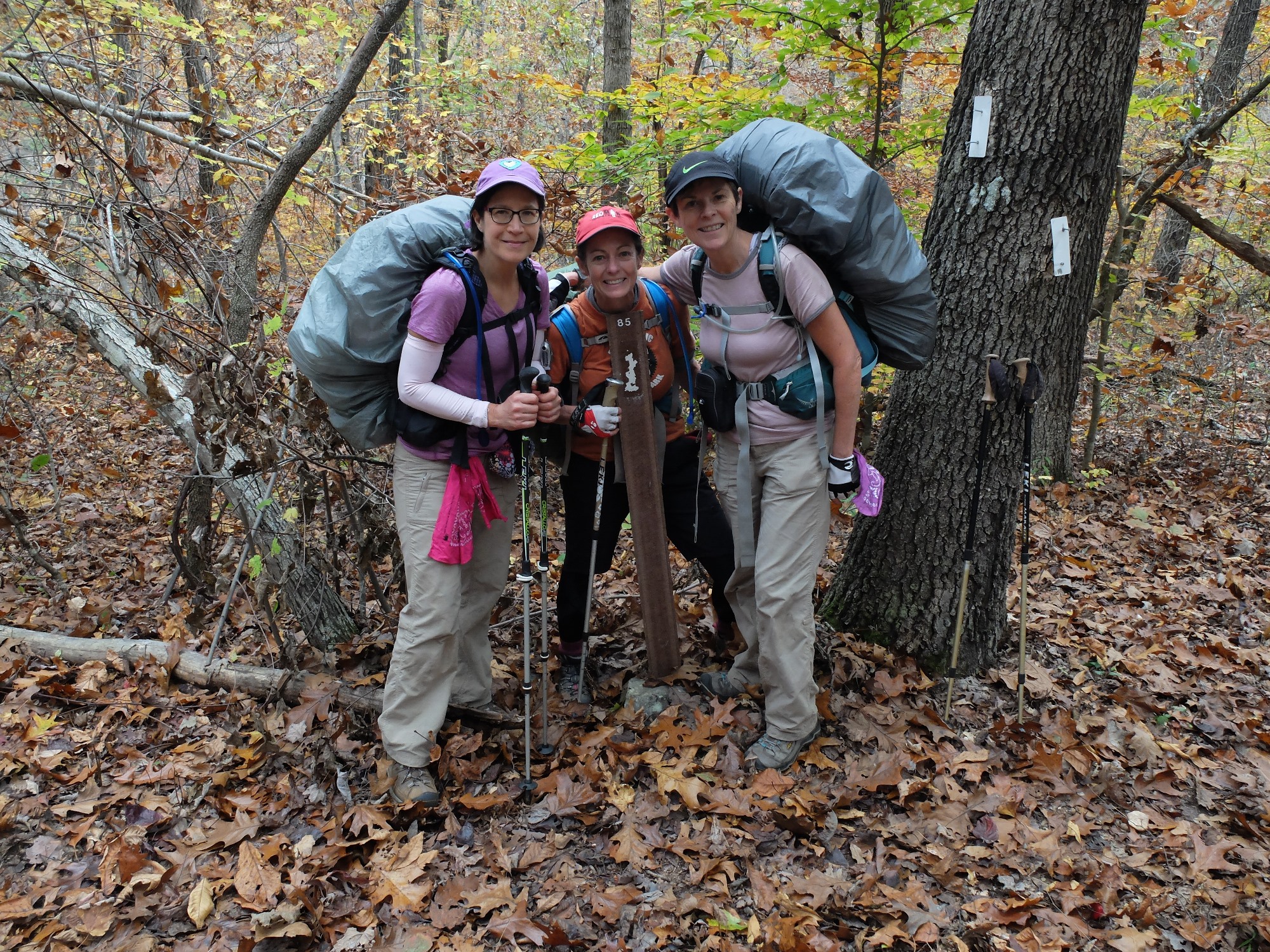
With Mary McDaniel, Janet Hamlin and Pam Frank, I am hiking the western half of the Ozark Highlands Trail (OHT), in northwest Arkansas. Eighty-five miles in seven days is our goal and we have scheduled the trip for late October to enjoy good weather and peak fall foliage. The full length of the trail is 165 miles (an update from the Ozark Highlands Trail Association says it is 197 miles and growing) starting at Lake Fort Smith State Park and running northeast to the Buffalo National River. Our end point for this hike will be the Ozone Trailhead, mile 85.7, the approximate midpoint of the trail.
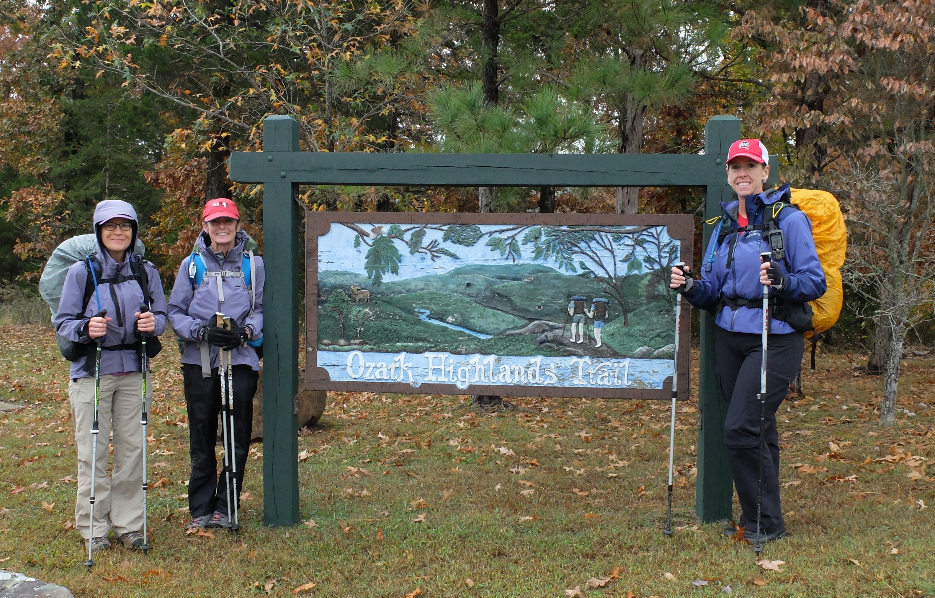
Originally, I proposed to my hiking buddies, now dubbed “The Lost Girls,” (see http://www.trailgroove.com/issue24.html?autoflip=39 for how that came about and https://susandragoo.com/2015/04/24/seventy-per-cent/ for more adventures) that we through-hike the entire OHT but cooler heads (and work schedules) prevailed. We decided to take a week to hike the western half in 2015 and save the rest for the following year.
We set out on October 23 from Oklahoma City, heading east on I-40. First stop, Ozone Trailhead, to leave one of our vehicles at the end. After lunch at the Ozone Burger Barn (burgers good/proprietor grumpy) we leave my Subaru Outback a few miles north of Ozone in the trailhead parking area off Highway 21. The four of us pile into Pam’s Honda Element to return to Fort Smith, and ultimately the trailhead, by way of four water caches. The past few months have been dry in this part of Arkansas and water sources are unreliable east of White Rock Mountain. We spend the day driving dirt roads to trail crossings and stashing 16 gallons of water (one per person per cache). Then we camp at the Hampton Inn in Fort Smith. Nothing like a good night’s sleep before a big adventure.
The morning of October 24 dawns cool and drizzly and we don rain gear for our 10:30 a.m. departure from Lake Fort Smith’s Visitor Center. We begin the hike with a prayer, a habit we will continue each day of our trip.
In addition to our camping gear and water, we each carry seven days’ worth of food, making our packs much heavier than normal. Thankfully, we have a short day today, just over eight miles to Jack Creek, actually a short distance beyond milepost nine. Because of some trail re-routing, the actual distances are about a mile less than what the mileposts currently read. So, somewhere along this first stretch of trail, we actually gain a “bonus mile.” Kind of like Daylight Savings Time, I suppose. The mileposts are one of the notable things about the OHT. On the Ouachita Trail, mileposts are missing more often than they are present. On the OHT, they are virtually always there. And the blazes — metallic with reflective white paint — are easy to see and ever present.
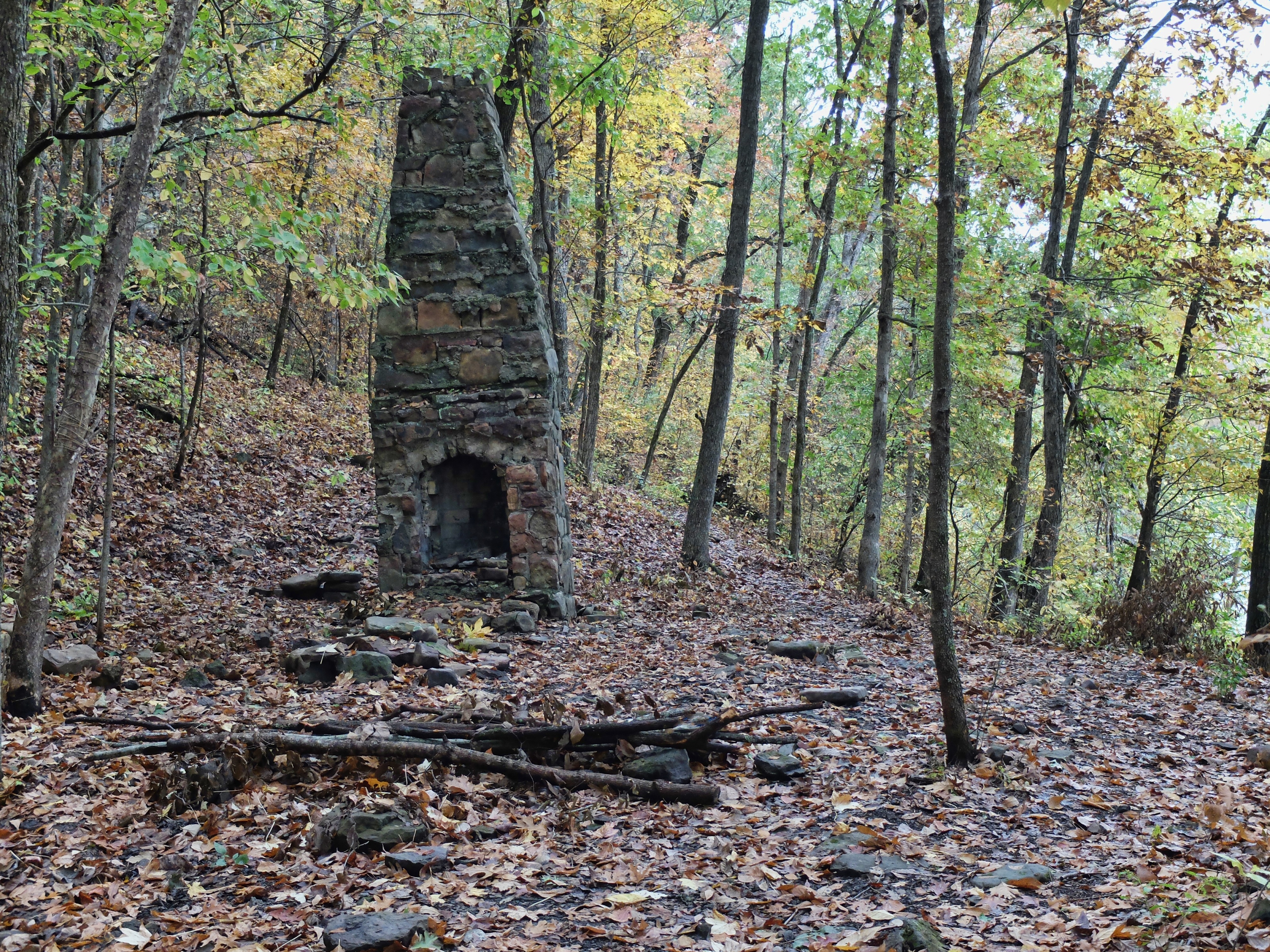
We pass several old home sites on the shore of Lake Fort Smith and cross a bone-dry Frog Bayou Creek on the lake’s north end, arriving at Jack Creek in plenty of time to set up our tents and filter water. There’s been a lot of bear spoor along the trail and we take the usual precautions, hanging the bear bag.
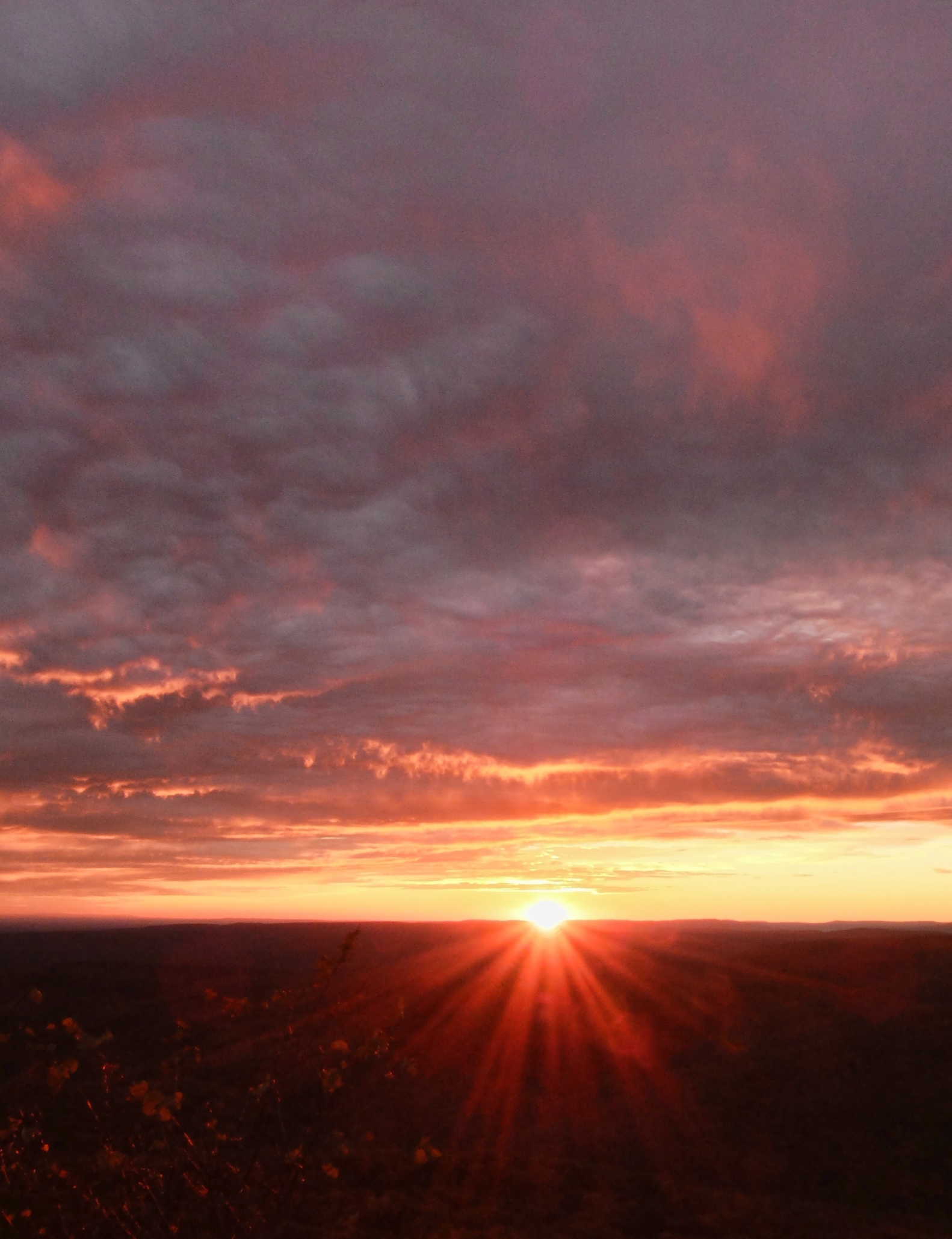
The next morning we get an earlier start, although we are hiking about the same distance we did on the first day. Our destination is White Rock Mountain, a spot known for its spectacular sunsets. There’s a lodge there, cabins and campsites, running water and who knows what other luxuries. I called for reservations in the lodge or cabins many weeks ago and was told they are full, but things could change. As we hike we fantasize about what awaits there. Maybe someone cancelled and a cabin is available! Perhaps there is food — something cooked in a pot on a stove, not rehydrated with water from a JetBoil!
It’s a hard climb to the top of White Rock and it’s disappointing to learn there are no vacancies in the lodge or cabins, but it’s okay. We have our choice of camp sites and the campground has a toilet, a water faucet, and picnic tables. Luxury is in the eye of the beholder. Best of all, there is ice cream. At the cottage of the congenial caretaker, we find a freezer full of frozen goodies and a case of cold soda pop and candy bars. I buy an ice cream bar and savor every sweet bite.
Firewood is available here too, at 10 sticks for $5. But the caretaker tells me where to find some scraps and says we can have those for free. We retrieve enough for a nice camp fire and haul those to our camp site, then eat dinner before heading to the pavilion to watch the sunset.

Our timing is perfect. Low golden rays set the mountainsides on fire, making the greens, reds, and yellows pop. On the verge of disappearing, the sun outlines the distant ridges and once it sinks below the horizon, lights the ragged pink edges of the gathering clouds. It’s a feast for the senses and worth the climb. But the wind is freshening atop the mountain and we head back to our camp site for a fire and the warmth of our sleeping bags.
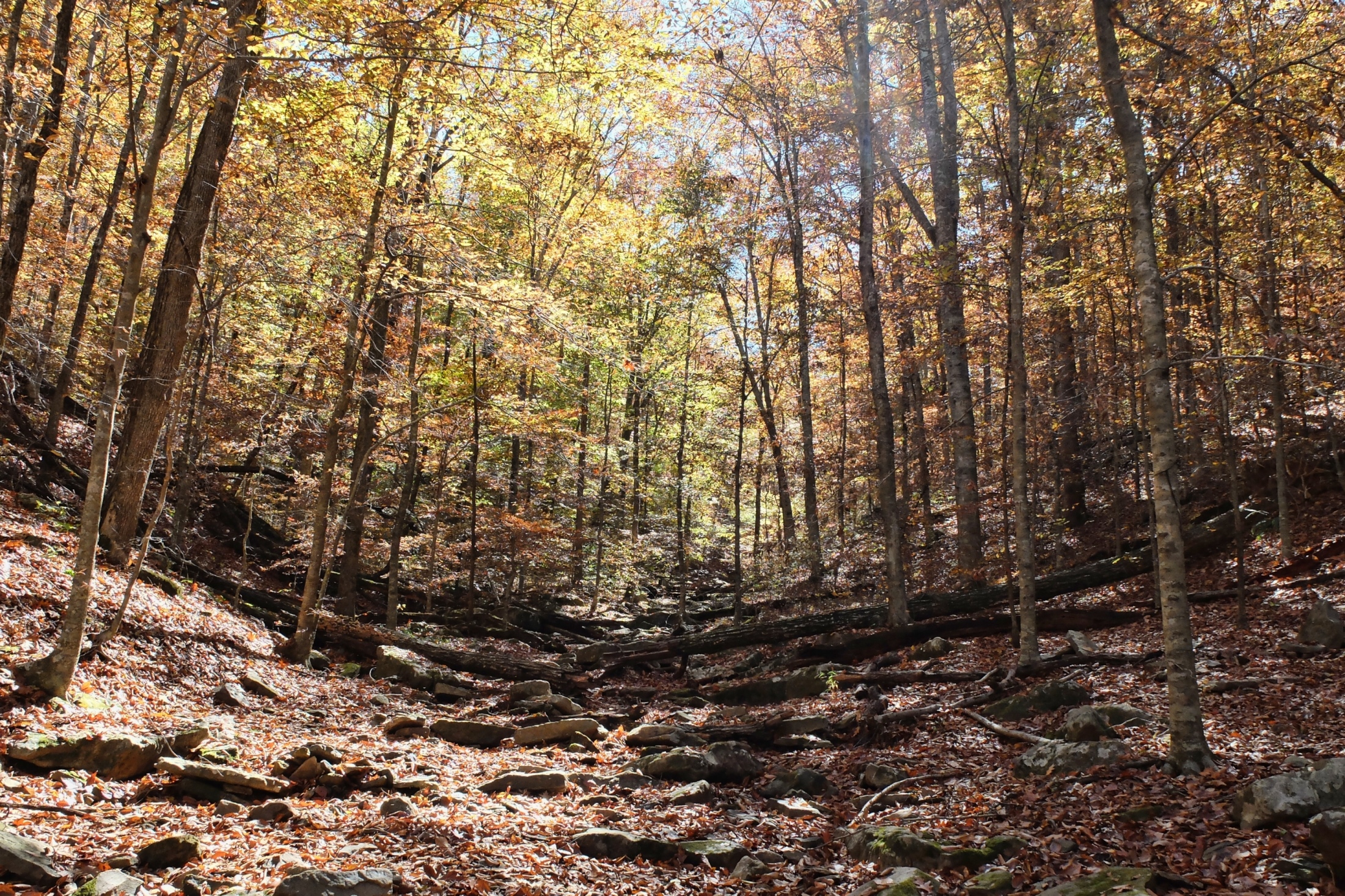
Day Three brings longer miles and two long, steep climbs made more difficult by the warmth of the day. We also encounter a great deal of deadfall, requiring us to go over, under or around the huge trees killed by the red oak bore. Three miles of hiking on an abandoned railroad bed provides straight and level relief. It is part of the Combs to Cass spur of a railroad that ran from Fayetteville to St. Paul in the early 1900s.

We make it the 13.5 miles to Fanes Creek, where we pick up our first cache and camp. That night around the camp fire, a persistent frog joins us. He is determined to listen as Mary reads from the trail guide, recapping our day and describing what we can expect tomorrow. The frog hops closer and closer to Mary; it seems he likes the sound of her voice. He is unfazed when she shrieks when he hops a bit too close. Of course, we are the invaders and this is his home turf. Still, rather quickly we go to our tents and zip them up securely. None of us wants a frog joining us in our sleeping bag.
The next day brings our biggest challenge so far. It is Day Four and our schedule calls for a walk of 15.9 miles to Herrods Creek. It is raining as we get on the trail at daylight. Our first climb, to the top of Whiting Mountain, is long but not too hard. Soon we approach the Highway 23 trailhead and on a narrow, loose stretch of trail Mary, leading at the time, slips and falls. She ends up tail over tea kettle on the steep slope below the trail and my first thought is that we’re fortunate to be so close to the highway. Thank God, she is unhurt and we continue. Skipping the climb up to the Rock House, we cross Highway 23 and enter the Pleasant Hill Ranger District, marking the beginning of one of the OHT’s more scenic sections. The next climb takes us to the summit of Hare Mountain, the highest point on the OHT at about 2,380 feet, and the midpoint of our hike. It’s all downhill from here! Well, not quite.
After we descend Hare Mountain we pick up our water cache. This one is not at our camp site and we’ll have to carry it for three miles. A gallon of water weighs 8.3 pounds and that’s a lot of weight to add to a backpack. It’s a downhill walk to our camp at Herrods Creek but that doesn’t make it easy. Steep, rocky downhills with a heavy pack lead to sore feet. What a relief to reach our camp site after this long day of hiking. We’ve had a light rain all day and are tired and wet. No camp fire tonight, we cook dinner and listen to Mary read from a seated position in her tent. That girl was ready to get off her feet!
Day Five is shorter, just 12.5 miles to our camp site at mile 60. It’s not raining when we start out, but my tent and boots have not dried out from the day before. Plastic bags over my socks are the solution for the moment, and I hope my boots dry out as I walk. But they don’t. At least not today.
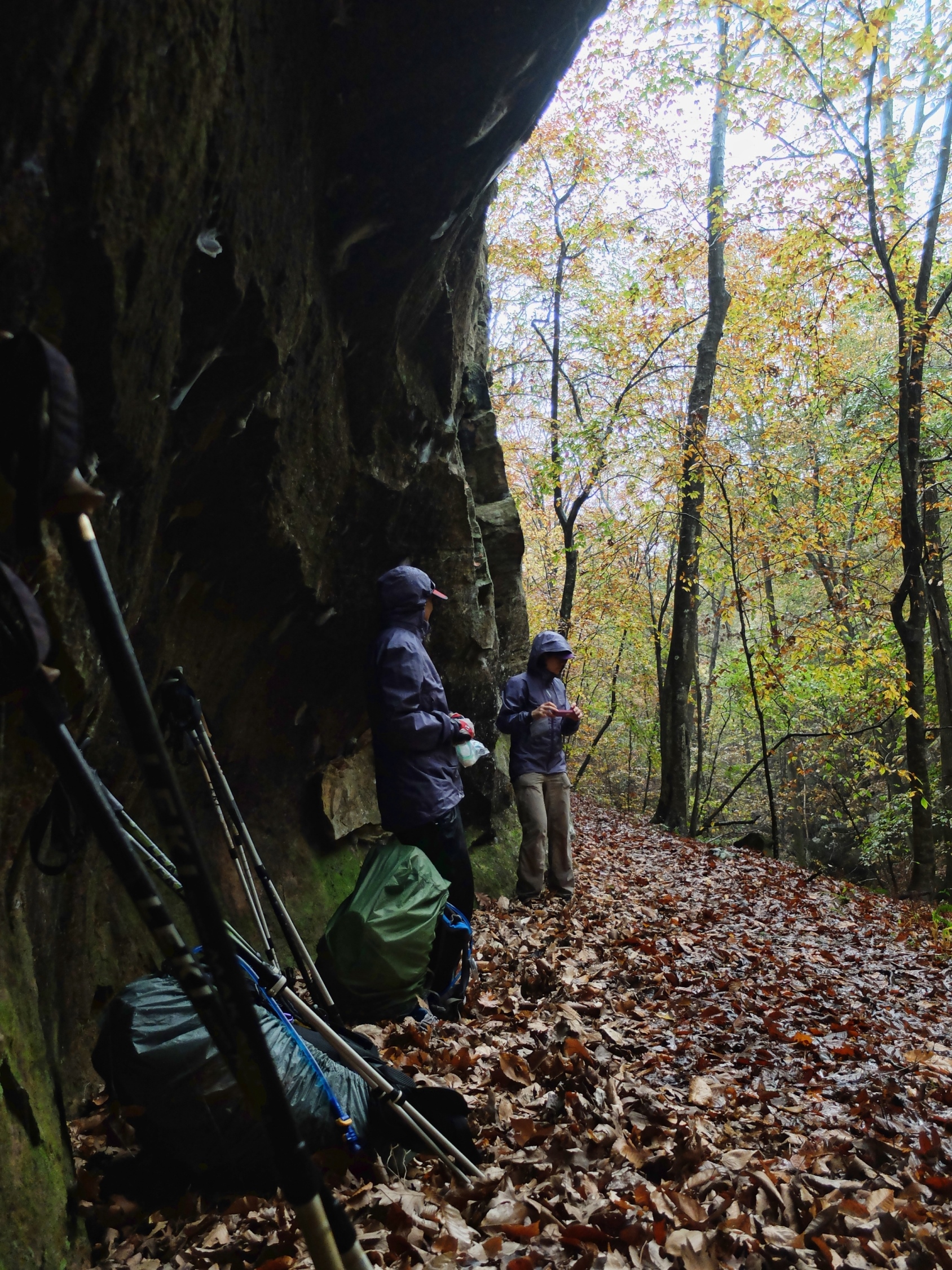
This part of the trail takes us from one beautiful hollow to the next, places where spectacular waterfalls would stop us in our tracks — if only there were water. And in one of those beautiful places — a ravine filled with large beech trees called the Marinoni Scenic Area, a thunderstorm strikes. We take refuge under a bluff until it calms.
When we reach our cache at the Lick Branch Trailhead we find that someone has opened one of our gallons. We hope that they really needed a drink and decide to split the other three gallons among us. This means less weight to carry and no one minds that. As it turns out, three gallons is also plenty of water for the four of us.
Tonight our camp is in a ravine on the side of Wolf Ridge. Our camp site is small and not very level but we get through the night. Next morning, we walk less than a tenth of a mile before we find a large, level camp site with four, count ’em, four stone recliners. These Flintstones-like seats around the fire ring are a hallmark of the plentiful camp sites along the OHT and are actually quite comfortable.
It’s a foggy morning but soon it burns off at our high elevation and we see the fog hanging in the valleys below. Soon we’re hiking in the sunshine and cool temperatures and today, Day Six, we have mostly level trail. It is another day of long miles. At first, we had planned to hike 17.7 miles but it became apparent it would be near-impossible for our troupe with the short daylight hours. We decrease the day’s hike by two miles and add that on to our last day. We come across five other hikers on the trail as we walk and we realize it is indeed a perfect day to get out for a hike. Two of the hikers are a couple of girls who have run out of water. We leave them our 4th gallon at the Arbaugh Road Trailhead and fill up our reservoirs with the remaining three. By this time, we are all carrying several empty gallon jugs attached to our backpacks by whatever means possible. It makes for bulky and comical backpacks, to be sure. Our last night of camping is at the second crossing of Lewis Prong Creek and the night is cold. Our coldest night so far.
Day Seven . . . today we will finish! We are on the trail a little earlier than usual, admiring the pink clouds hanging in the pale sky as we start. We have some up and down climbing but by this time our packs are lighter and our spirits are buoyant. It’s a 10-mile day but that seems like nothing. At one of our snack breaks, a solo hiker comes along. He approaches Pam and says, “I see you’re wearing purple. Is this yours?” He holds out a purple bandana which I had lost on the trail the day before. It had special meaning for me and I was sad to have lost it. Getting it back was a happy thing! The hiker’s name is Mike Wilson and he is a State Park Superintendent at Arkansas’ DeGray Lake State Park. We have a good visit with him and he tells us he is hiking the entire trail in nine days.

We reach the end of the trail at the Ozone Trailhead at 2:30 p.m. There, to my relief, is my Subaru and, it starts. As I drive toward the highway, it feels strange to experience movement without effort. We’ve hiked more than 85 miles under our own power, carrying all of our food, and are thankful at the end for each other, for God’s provision of guidance and shelter, for freedom from injuries (although we each fell at least once but none as spectacularly as Mary), and good health.
The realization came, on this last day or two of hiking, that we couldn’t have hiked the miles we did in a week’s time if we’d had water crossings to deal with. So the drought was a blessing in that respect. But the beauty we had to rush through made me think — do we really want to through-hike the eastern half? Or can we section hike it and schedule fewer miles per day — do it when there is plenty of water so we can see the waterfalls? We’ve passed this test of endurance — sore feet on long mileage days; heavy backpacks; eating the same oatmeal and peanut butter and rehydrated rice and beans every day; having no shower for a week; trying to sleep cold and on a slope; being unnerved by coyotes howling nearby. We know we can keep putting one foot in front of the other for many miles. Next time, we might just take it a little slower. Maybe.
More Photos:


For more information on the Ozark Highlands Trail, see Ozark Highlands Trail Association and Tim Ernst’s Ozark Highlands Trail Guide

Wow this looks absolutely amazing! It seems like it would be a good first trail to try out hiking/camping along. I’ve always thought of doing part of the Appalachian Trail, but I think I would try out this trail first if I ever get the chance to! Your photos are also really great!
Thanks!
Nice write up Susan. I have been following the hiking adventures of you four. Sounds like a lot of fun. It it wasn’t for the fact, one needs to carry ones gear… I would like to come along. But carrying my gear is not ever going to happen. Guess, I will stick to bicycle touring… and let my bike be my mule. 😉
Moni
Excellent trip report and photos!
Thank you!
Great adventure story! I loved the pictures and descriptions. You write in a way that makes the reader feel they are participating–even if from a cozy office chair looking at gorgeous photos on an iMac. Thanks for this story!